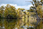
Alluvial City is an Isleño fishing community in St. Bernard Parish, Louisiana, United States. The community is located on the western bank of Bayou la...
4 KB (159 words) - 04:52, 3 May 2024
North Louisiana), and the alluvial along the coast (the Central Louisiana, Acadiana, Florida Parishes, and Greater New Orleans regions). The alluvial region...
250 KB (22,579 words) - 17:19, 13 August 2024
incorporated city in Louisiana. It was approved in a ballot initiative on October 12, 2019. Upon incorporation, it became the fifth largest city in Louisiana and...
62 KB (6,586 words) - 21:31, 6 August 2024
the city of New Orleans and comprises the Chandeleur Islands and Chandeleur Sound in the east. St. Bernard was the fastest growing parish in Louisiana from...
32 KB (2,885 words) - 06:23, 30 July 2024
Lake Pontchartrain (redirect from North Shore, Louisiana)
(/ˈpɒntʃətreɪn/ PON-chə-trayn) is an estuary located in southeastern Louisiana in the United States. It covers an area of 630 square miles (1,600 km2)...
33 KB (3,617 words) - 20:22, 3 August 2024
territory and the introduction of the name Louisiana, the first settlements in the southernmost portion of Louisiana (New France) were developed at present-day...
18 KB (2,026 words) - 05:48, 28 July 2024
Bayou (redirect from Louisiana bayou)
Orleans, Louisiana. The term may also be associated with the homelands of certain Choctaw tribal groups. Houston has the nickname "Bayou City". Anthropogenic...
17 KB (1,793 words) - 00:06, 27 July 2024
dictionary. Vatican may refer to: Vatican City, an independent city-state in Rome, Italy Ager Vaticanus, an alluvial plain in Rome Vatican, an unincorporated...
939 bytes (142 words) - 04:26, 8 July 2024
state of Louisiana. At the 2020 census, the population was 42,477. The parish seat is Edgard, an unincorporated area, and the largest city is LaPlace...
39 KB (3,748 words) - 22:27, 4 July 2024
(French: Islingues) are a Spanish ethnic group living in the state of Louisiana in the United States, consisting of people primarily from the Canary Islands...
41 KB (4,857 words) - 14:25, 4 August 2024
Concordia) is a parish that borders the Mississippi River in eastern central Louisiana. As of the 2020 census, the population was 18,687. The parish seat is...
35 KB (2,162 words) - 06:36, 8 June 2024
land area in Louisiana. The primary groundwater resources of Natchitoches Parish, from near surface to deepest, include the Red River alluvial, upland terrace...
43 KB (2,511 words) - 22:41, 3 July 2024
particularly affecting the alluvial basin surrounding the mouth of the Mississippi River. In the last century, coastal Louisiana has lost an estimated 4...
32 KB (3,956 words) - 20:41, 13 June 2024
data related to Outline of Louisiana at OpenStreetMap Ecoregions Ecoregions of Louisiana Ecoregions of the Mississippi Alluvial Plain Geology links Geology...
16 KB (1,153 words) - 12:12, 30 October 2023
Arkansas (section Cities and towns)
borders Missouri to the north, Tennessee and Mississippi to the east, Louisiana to the south, Texas to the southwest, and Oklahoma to the west. Its name...
147 KB (13,344 words) - 18:41, 4 August 2024
Oroville, California (redirect from Ophir City)
is situated at the meeting place of three provinces: the Central Valley alluvial plain to the west, the crystalline Sierra Nevada to the SE and the volcanic...
47 KB (4,395 words) - 12:22, 17 August 2024
Mississippi Alluvial Valley - North (MAVN) with 128,736 acres, and the Mississippi Alluvial Valley - South (MAVS) with 257,999 acres. Louisiana Wildlife...
18 KB (716 words) - 01:07, 8 July 2024
Red River Valley Southeast Minnesota Twin Cities Metro Regions of Mississippi include: Mississippi Alluvial Plain Mississippi Delta Mississippi Gulf Coast...
54 KB (3,957 words) - 19:08, 28 June 2024
Missouri (section Cities and towns)
to Lower Louisiana for trade. Grain production in the Illinois Country was critical to the survival of Lower Louisiana and especially the city of New Orleans...
153 KB (14,004 words) - 06:36, 18 August 2024
Osceola, Arkansas (category Cities in Mississippi County, Arkansas)
Mississippi Alluvial Plain, which is a flat area consisting of rich, fertile sediment deposits from the Mississippi River between Louisiana and Illinois...
27 KB (2,787 words) - 16:39, 21 April 2024
encompassing about 4,415,000 acres (17,870 km2), or, almost 7,000 square miles of alluvial floodplain. Originally covered in hardwood forest across the bottomlands...
47 KB (5,388 words) - 19:40, 11 August 2024
Grassy Lake Wildlife Management Area (category Wildlife management areas of Louisiana)
Geological Survey: Chemical Character of the Water in the Red River Alluvial Aquifer, Louisiana Archived 2017-04-27 at the Wayback Machine- Retrieved 2018-09-12...
8 KB (663 words) - 06:10, 27 July 2024
Marion, Arkansas (category Cities in Crittenden County, Arkansas)
Holocene Meander Belts (east Marion) ecoregions within the larger Mississippi Alluvial Plain. The Northern Backswamps are a network of low-lying overflow areas...
23 KB (2,237 words) - 06:29, 28 July 2024
Louisiana Highway 46 (LA 46) is a state highway in Louisiana that serves Orleans and St. Bernard Parishes. It runs in a west to east direction for a total...
6 KB (417 words) - 01:56, 16 February 2024
Arkansas Delta (section Principal cities)
part of the Mississippi embayment, itself part of the Mississippi River Alluvial Plain. The flat plain is bisected by Crowley's Ridge, a narrow band of...
25 KB (2,838 words) - 03:13, 26 February 2024
DeWitt, Arkansas (category Cities in Arkansas County, Arkansas)
Mississippi Alluvial Plain, which is a flat area consisting of rich, fertile sediment deposits from the Mississippi River between Louisiana and Illinois...
17 KB (1,581 words) - 20:43, 28 April 2024
Mississippi Valley Loess Plains (ecoregion) (category Regions of Louisiana)
border of the Mississippi Alluvial Plain, from the Ohio River in western Kentucky, through Tennessee and Mississippi, to Louisiana. A separate unit that includes...
17 KB (1,693 words) - 23:20, 17 June 2024
Des Arc, Arkansas (category Cities in Arkansas)
Mississippi Alluvial Plain, which is a flat area consisting of rich, fertile sediment deposits from the Mississippi River between Louisiana and Illinois...
22 KB (1,626 words) - 20:49, 11 May 2024
is a geological formation that rises 250 to 550 feet (170 m) above the alluvial plain of the Mississippi embayment in a 150-mile (240 km) line from southeastern...
12 KB (1,235 words) - 03:43, 8 November 2023
Edward Livingston (category Democratic-Republican Party members of the United States House of Representatives from Louisiana)
of the Louisiana Civil Code of 1825, a civil code based largely on the Napoleonic Code. Livingston represented both New York and then Louisiana in Congress...
27 KB (2,645 words) - 02:28, 24 July 2024


