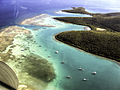
Ancón de Sardinas ('Sardinas Bight') is a bight in the Pacific Ocean, located on the border between Colombia, which is to the north (Nariño Department)...
2 KB (172 words) - 20:30, 25 August 2023

to west (from the Güepí River to the mouth of the Mataje River in Ancón de Sardinas Bay in the Pacific Ocean). It is about 28% of what was once the border...
3 KB (285 words) - 14:30, 7 March 2024
the municipal head and about 36.6 kilometers from the Ancón de Sardinas. "Ubicación geográfica de Colombia". TodaColombia.com. Retrieved 16 April 2017...
952 bytes (91 words) - 05:41, 3 July 2024
river flows into the bay of Ancón de Sardinas, point where the maritime border between Colombia and Ecuador begins. "Geografía de Colombia". Turismo Colombia...
2 KB (108 words) - 17:27, 2 April 2020
1.583°N 79.000°W / 1.583; -79.000 (Pacific Ocean) Pacific Ocean Ancón de Sardinas Bay 1°14′N 79°0′W / 1.233°N 79.000°W / 1.233; -79.000 (Ecuador)...
9 KB (100 words) - 18:43, 16 September 2022
Culebra, Puerto Rico (redirect from Isla De Culebra, Puerto Rico)
abandonment of the island. The location identified by Márquez on Playa Sardinas became the town of Dewey. A new church was built with materials taken from...
54 KB (5,048 words) - 17:43, 30 June 2024

Carlos Mesa (redirect from Carlos Diego de Mesa Gisbert)
21 mi) strip of land along the Chile–Peru border. As per the Treaty of Ancón, any cession of land formerly belonging to Peru necessitates Peruvian approval...
214 KB (20,100 words) - 06:47, 27 June 2024
reserved for the states of Aguascalientes, Guanajuato, Hidalgo, Jalisco, Estado de México, Michoacán, Nuevo León, Querétaro, San Luis Potosí, Tamaulipas, Veracruz...
63 KB (61 words) - 18:42, 31 May 2024