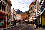
State Route 80 (SR 80) is a 120.20-mile (193.44-kilometre) long, roughly arc-shaped highway lying in southeastern Arizona. Starting in downtown Benson...
15 KB (1,571 words) - 00:36, 5 August 2024
US 80 was a particularly long highway, reaching a length of almost 500 miles (800 km) within the state of Arizona alone for most of the route's existence...
112 KB (12,565 words) - 05:02, 28 August 2024
State Route 79 (SR 79), also known as the Pinal Pioneer Parkway, is a 58.40 mi (93.99 km) long state highway in the U.S. state of Arizona. It serves as...
19 KB (1,921 words) - 00:36, 5 August 2024
State Route 85 (SR 85) is a 128.86-mile-long (207.38 km) state highway in the U.S. state of Arizona. The highway runs from the United States–Mexico border...
20 KB (1,704 words) - 07:40, 19 August 2024
U.S. Route 80 or U.S. Highway 80 (US 80) is a major east–west United States Numbered Highway in the Southern United States, much of which was once part...
70 KB (8,196 words) - 07:52, 5 November 2024
State Route 89A (SR 89A) is an 83.85-mile (134.94 km) state highway that runs from Prescott north to Flagstaff in the U.S. state of Arizona. The highway...
28 KB (2,141 words) - 20:37, 19 August 2024
State Route 77 (SR 77) is a 253.93-mile (408.66-kilometre) long state highway in Arizona that traverses much of the state's length, stretching from its...
23 KB (1,922 words) - 21:54, 4 August 2024
state of Arizona's State Routes are usually abbreviated as SR. The Arizona State Highway system was introduced on September 9, 1927, by the State Highway...
50 KB (1,442 words) - 23:47, 19 July 2024
Signage at an intersection with State Route 64 in Valle, Arizona 40 miles (64 km) northwest of Flagstaff indicates that the route starts at SR 64, which is...
16 KB (1,574 words) - 22:55, 30 May 2024
Arizona State Route 101 (SR 101) or Loop 101 is a semi-beltway looping around the Phoenix Metropolitan Area in central Arizona, United States. It connects...
25 KB (1,727 words) - 16:30, 25 July 2024
State Route 90 (SR 90) is a highway in Cochise County, Arizona that runs from the I-10 junction at Benson to a junction with State Route 80 between Bisbee...
8 KB (701 words) - 01:31, 8 September 2023
Arizona State Route 93, abbreviated SR 93, was a state highway in Arizona that existed from 1946 to 1991. The route was co-signed with other highways...
26 KB (2,185 words) - 00:36, 5 August 2024
State Route 87 (SR 87) is a 272.66-mile (438.80 km) north–south highway that travels from I-10 near Picacho northward to State Route 264 near Second Mesa...
12 KB (736 words) - 02:06, 2 August 2024
longest numbered highway. The highway begins at State Route 80 near Douglas and crosses over the Utah state line near Mexican Water in the Navajo Nation...
47 KB (4,555 words) - 10:02, 25 October 2024
entire route is in Maricopa County. Roads and freeways in metropolitan Phoenix Arizona State Route 24 Arizona State Route 202 Arizona State Route 303 "MAJOR...
13 KB (1,053 words) - 22:37, 4 August 2024
Arizona State Route 202 (SR 202) or Loop 202 (202L) is a semi-beltway circling the eastern and southern areas of the Phoenix metropolitan area in central...
45 KB (3,323 words) - 16:31, 25 July 2024
State Route 88 is a long state highway in the U.S. state of Arizona. It runs from U.S. Route 60 (US 60) in Apache Junction through desert terrain to SR...
14 KB (1,145 words) - 09:13, 13 October 2024
State Route 69 (SR 69) is a highway that serves as the main road to Prescott, Arizona, from Interstate 17. The highway mainly consists of four-lanes (two...
7 KB (581 words) - 02:39, 8 November 2023
State Route 92 (SR 92) is a state highway in the U.S. state of Arizona. Running roughly in an L-shaped pattern, SR 92 begins at SR 90 in Sierra Vista and...
8 KB (697 words) - 00:42, 21 August 2024
the Colorado River into Arizona and met up with mainline US 80 again in Yuma. Prior to 1957, this was the mainline route of US 80. The Ocean to Ocean Bridge...
25 KB (2,387 words) - 01:35, 5 August 2024
State Route 82 (SR 82) is an east–west state highway in southern Arizona. The western terminus of Route 82 is located at its junction with Business Loop...
7 KB (429 words) - 15:20, 21 March 2024
summary of the former state routes in Arizona, including mileage tables and maps. Between the establishment of Arizona's numbered state highway system in...
93 KB (8,932 words) - 22:00, 4 August 2024
in Cochise County, Arizona at a signaled intersection with Arizona State Route 80 (SR 80) and Historic U.S. Route 80 (Historic US 80) near Douglas. The...
27 KB (3,065 words) - 07:59, 5 November 2024
State Route 86 (or SR 86) is a state highway in southern Arizona that stretches from its junction with State Route 85 in Why east to its junction at 16th...
7 KB (550 words) - 14:27, 8 January 2024
State Route 30 (formerly State Route 801), also known as the I-10 Reliever, is a planned state highway in the southwest parts of Phoenix, Arizona and nearby...
17 KB (1,567 words) - 01:38, 5 August 2024
Interstate 8 (redirect from Arizona State Route 8)
by U.S. Route 80 (US 80) across California and part of Arizona, and Arizona State Route 84 (SR 84) between Gila Bend and Casa Grande. The US 80 freeway...
113 KB (12,102 words) - 03:54, 14 October 2024
planned ones in northwestern Pinal County. It is the lowest-numbered state route in Arizona. The first mile from Loop 202 to Ellsworth Road opened on May 4...
18 KB (1,662 words) - 06:35, 7 June 2024
the school system, and other civic activities.[citation needed] Arizona State Route 80 runs through the city, leading northwest 23 miles (37 km) to Tombstone...
39 KB (3,584 words) - 12:23, 22 August 2024
In the U.S. state of Arizona, Interstate 10 (I‑10), the major east–west Interstate Highway in the United States Sun Belt, runs east from California, enters...
61 KB (4,286 words) - 01:47, 17 October 2024
U.S. Route 80 (US 80) was a U.S. highway in California that continued east across the country to Georgia. The western terminus of US 80 was in San Diego...
48 KB (5,823 words) - 01:08, 26 October 2024


