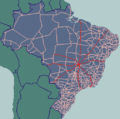
BR-060 is a federal highway of Brazil. The 1329 kilometre road connects Brasília to Bela Vista, on the Paraguayan border. It is also designated as part...
7 KB (469 words) - 04:29, 21 September 2023
Brazilian Highway System (redirect from Br 101)
Belém-Brasília Highway follows the BR-060, the BR-153 and the BR-226 highways, which are completely paved in this stretch. The BR-010 passes through the Federal...
37 KB (3,807 words) - 11:47, 4 April 2024
Jataí by BR 364. Highway connections from Goiânia are made by BR-060 / Abadia de Goiás / Guapó / Indiara / Acreúna / Rio Verde / Jataí / GO-050 / BR-364....
8 KB (813 words) - 18:40, 20 August 2024
Stretch concurrent with BR-060 in Goiânia. Urban segment of BR-153 in Goiânia. BR-153 in Minas Gerais Precarious stretch of BR-153 in the rural area of...
4 KB (300 words) - 14:26, 3 April 2024
applies to BR-226 between Porto Franco and Wanderlândia, BR-153 thence to and from Anápolis, and BR-060 thence to and from Brasília. In each case, the route...
3 KB (428 words) - 02:16, 1 December 2022
the original route of the Belém–Brasília Highway follows the BR-060, the BR-153 and the BR-226 highways, which are completely paved in this stretch. The...
4 KB (440 words) - 05:13, 10 March 2023
East: Cidade Ocidental West: Novo Gama It is served by highways BR-040, BR-060, BR-020 BR-251, and DF-290. The distance to the state capital of Goiânia...
6 KB (515 words) - 17:06, 3 July 2024
Brasília-Goiânia highway (BR 060), which has now become a four-lane motorway. It is also the starting point for the famous Belém-Brasília highway (BR 153). Distances...
18 KB (1,825 words) - 00:01, 9 August 2024
major federal highways cross the municipality: BR-060, which links Brasília to the state of Acre, and BR-452, which links Rio Verde to Itumbiara, Goiás...
12 KB (995 words) - 17:23, 3 July 2024
Brasília, via a four-lane tolled highway (BR-060) and to São Paulo via another four-lane tolled highway (BR-153). The state of Goiás maintains the main...
52 KB (5,063 words) - 17:06, 22 August 2024
Mato Grosso do Sul (redirect from BR-MS)
crossing the entire state. Other important highways in the state are BR-262, BR-060 and BR-267. As it is a state that only became more populated in the 1970s...
29 KB (2,650 words) - 00:14, 9 August 2024
BR-364 is an inter-state highway in Brazil connecting the southeast state of São Paulo to the western state of Acre. The highway was opened in the 1960s...
35 KB (3,879 words) - 04:35, 21 September 2023
is 120 kilometres (75 miles) from the Paraguayan border) to the south. BR-060 links Campo Grande to the state of Goiás and the national capital city of...
27 KB (2,040 words) - 20:43, 19 August 2024
88 km. Highway connections with Brasília, Anápolis and Goiânia are made by BR-060 (also called in the Brasília-Anápolis stretch as Belém–Brasília Highway)...
6 KB (415 words) - 13:30, 25 July 2023
Taguatinga, Federal District (category CS1 Brazilian Portuguese-language sources (pt-br))
There is another important industrial area near BR-060. The region known as "Sector H Norte", near BR-070, concentrates a large variety of workshops and...
15 KB (1,234 words) - 11:17, 2 August 2024
Guapó is approximately 37 kilometers southwest of Goiânia and is on the BR-060 highway (Goiânia to Rio Verde). The lands where Guapó is located today once...
5 KB (330 words) - 05:59, 9 August 2024
is 408 kilometers from the state capital, Goiânia, and is connected by BR-060 / Abadia de Goiás / Guapó / Indiara / Acreúna / Rio Verde / GO-174 / GO-422...
6 KB (470 words) - 13:17, 24 August 2021
Transport in Brazil (category CS1 Brazilian Portuguese-language sources (pt-br))
595 mi) in 2018. The two most important highways in the country are BR-101 and BR-116. Although Brazil has the largest duplicated road network in Latin...
31 KB (2,674 words) - 11:54, 2 June 2024
List of federal highways in Brazil (category CS1 Brazilian Portuguese-language sources (pt-br))
in 1973. Brazilian federal road names are composed of the ISO 3166 code "BR", a dash and three numbers. State highways in the country are classified as...
22 KB (675 words) - 16:25, 16 January 2024
The distance to Goiânia is 27 km. and highway connections are made by BR-060. Neighboring municipalities are: north and east: Trindade northwest: Goiânia...
5 KB (279 words) - 18:54, 15 July 2024
Arniqueira (category CS1 Brazilian Portuguese-language sources (pt-br))
Riacho Fundo and Taguatinga. The region has access to federal highways BR-060, located to the south of the region, DF-001 to the west, and DF-079 to the...
13 KB (1,240 words) - 15:11, 5 February 2024
capital, Goiânia, on BR-060, (Brasília-Acre) which links Goiânia with Rio Verde. The distance to Goiânia is 153 kilometers via BR-060 / Guapó / Indiara....
6 KB (539 words) - 21:17, 26 August 2022
The Rodovia Presidente Dutra, (BR-116 – or SP-060 in the state of São Paulo), colloquially known as Via Dutra is a federal highway which runs through the...
7 KB (495 words) - 04:48, 4 April 2024
highway connections are made by BR-060 / Abadia de Goiás / Guapó / Indiara / Acreúna / Rio Verde / Jataí / GO-184 / BR-060 / Estreito. The region around Serranópolis...
7 KB (543 words) - 01:16, 23 June 2022
British Rail Class 122 (redirect from BR Class 122)
Railways Past and Present. Vol. 17. Past & Present Publishing. ISBN 1-85895-060-0. "Bubble Car 55009 makes preservation debut after 20 years out of action"...
12 KB (582 words) - 06:13, 10 August 2024
Goiânia and is connected by highways BR-153 and BR-060, leaving from São Paulo, and from Goiânia, by highways Br-060 and BR-164 and GO-206 and GO-302. Connections...
6 KB (456 words) - 18:27, 20 February 2022
capital of Goiânia is 316 km (196 mi). away. Highway connections are made by BR-060 / Abadia de Goiás / Guapó / Indiara / Acreúna / Santo Antônio da Barra /...
12 KB (1,032 words) - 04:29, 31 January 2024
The BR-101 (also called Translitorânea (transcoastal), officially named Rodovia Governador Mário Covas. and nicknamed Briói in some regions) is a longitudinal...
11 KB (994 words) - 23:57, 24 January 2024
connections from Goiânia are made by taking BR-153 / Anápolis / Alexânia / BR-060 / Planaltina / Formosa / BR-020 / Simolândia / GO-236. The population...
10 KB (1,026 words) - 07:32, 27 September 2023


