de Carrillo Puerto. Bokobá is a term in the Yucatec Maya language, which means "splashing water". Prior to the conquest, Bokobá was located within the...
5 KB (203 words) - 05:57, 2 May 2023
[permanent dead link] "Municipios de Yucatán » Bokobá" (in Spanish). Retrieved 2 June 2015. "Mexico In Figures: Bokobá, Yucatán". INEGI (in Spanish and English)...
7 KB (288 words) - 23:56, 23 February 2024
Baca 6,195 5,701 +8.7% 108.5 41.9 57.1/km2 (147.9/sq mi) July 24, 1867 Bokobá Bokobá 2,167 2,053 +5.6% 71.7 27.7 30.2/km2 (78.3/sq mi) July 24, 1867 Buctzotz...
38 KB (605 words) - 16:02, 5 January 2025
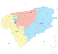
north-central part of the state. It comprises 48 municipalities: Acanceh, Baca, Bokobá, Buctzotz, Cacalchén, Cansahcab, Cenotillo, Chicxulub Pueblo, Conkal, Cuzamá...
18 KB (1,064 words) - 19:56, 5 January 2025
Suma and Teya, to the south: Izamal, to the east: Tepakán and to the west: Bokobá. The distances from the municipal seat to nearby cities are as follows:...
18 KB (1,537 words) - 03:23, 26 March 2024


