Blackburn Broxburn Bucks Burn Burnside Braid Burn Dighty Burn Burn Dale, East Donegal Burnfoot, Inishowen Burn of Elsick Burn of Pheppie Burn of Muchalls Bannockburn...
3 KB (227 words) - 09:27, 16 August 2024
brands Burn (landform), type of watercourses so named in Scotland, England, and New Zealand Burn, Combustion Burn, slang for a type of insult Burn, an orbital...
7 KB (774 words) - 22:28, 3 April 2024
Bourne (stream) (category Fluvial landforms)
spelling is an etymological precursor to the Middle English bourne/burn. Cf. Burn (landform), in common use in Scotland and North East England especially,...
2 KB (291 words) - 09:59, 19 August 2023
windows are still clearly in evidence. Today, roughly 45 acres, the Park Burn (landform) and several 250 year old sycamore trees remain of what was once the...
3 KB (352 words) - 16:59, 7 August 2024
Erosion (redirect from Erosional landform)
"Local-Scale geomorphology – process systems and landforms". Introducing Geomorphology: A Guide to Landforms and Processes. Dunedin Academic Press, 2012,...
61 KB (6,889 words) - 14:30, 21 November 2024
cottages for staff such as gardeners. A burn is a large stream or small river. For more information, see Burn (landform). In 1543, Cullen Old Church was elevated...
33 KB (3,647 words) - 13:41, 17 March 2024
The Burn o’ Vat is a mountain stream in Deeside, Scotland, rising on Culblean Hill and flowing into Loch Kinord. The Vat, a pothole of glacial origin,...
5 KB (558 words) - 09:29, 22 September 2024
on Mercury is an itemization of mountains, valleys, craters and other landform features of the planet Mercury. Different types of features are named after...
11 KB (182 words) - 12:11, 18 May 2024
Las Vegas Valley (redirect from Las Vegas Valley (landform))
County, Nevada. The Valley is largely defined by the Las Vegas Valley landform, a 600 sq mi (1,600 km2) basin area surrounded by mountains to the north...
79 KB (7,677 words) - 04:40, 17 November 2024
Cheyenne Mountain (redirect from Cheyenne Mountain (Colorado landform))
a scheduled stop on the stage route to Cripple Creek, was torn down or burned down by 1934. It was next used beginning 1910 by the Girl Scouts of America...
38 KB (4,069 words) - 02:17, 14 September 2024
streamsPages displaying short descriptions of redirect targets Glossary of landforms Lists of bodies of water Port – Maritime facility where ships may dock...
31 KB (1,083 words) - 19:36, 4 November 2024
the west and north of the regional district, respectively. The dominant landform is the Nechako Plateau. Neighbouring regional districts are the Kitimat-Stikine...
16 KB (588 words) - 08:27, 11 August 2024
List of rivers of England (category Lists of landforms of England)
Lisles Burn (L) Elsdon Burn (L) Durtrees Burn (L) Silis Burn (L) Blakehope Burn (R) Cottonshope Burn (L) Hareshaw Burn (L) Chirdon Burn (R) Tarset Burn (L)...
87 KB (10,761 words) - 19:28, 15 October 2024
List of lakes of New Zealand (category Lists of landforms of New Zealand)
175°13′33″E / 37.77056°S 175.22583°E / -37.77056; 175.22583 Kopuatai Burn Pools Hauraki District 0.02 km2 Peat lakes on Kopuatai Peat Dome. Watershed...
165 KB (1,030 words) - 11:00, 13 October 2024
Stream (redirect from Fluvial landforms of streams)
England for ephemeral rivers. When permanent, they are chalk streams. Brook. Burn is used in Scotland and North East England. Gill or ghyll is seen in the...
50 KB (5,693 words) - 22:33, 15 November 2024
monogenetic volcanoes of these fields are the most common subaerial volcanic landform. Many monogenetic volcanoes are cinder cones, often with lava flows, such...
5 KB (577 words) - 19:36, 4 July 2024
Meikle Carewe Hill is a landform in Aberdeenshire, Scotland within the Mounth Range of the Grampian Mountains. (Grid Reference NO 921 828) The peak elevation...
3 KB (343 words) - 16:43, 11 April 2022
List of rivers of Scotland (category Lists of landforms of Scotland)
coastal catchments Burn of Boyndie Burn of Boyne Burn of Durn Burn of Fordyce Cullen Burn Burn of Deskford Glen Burn Burn of Buckie Burn of Tynet Spey catchment...
42 KB (4,537 words) - 16:25, 4 September 2024
peak 1. A pointed or protruding top or other vertical projection on a landform, e.g. a mountain, especially implying the highest point or elevational...
196 KB (18,440 words) - 12:39, 9 November 2024
Makapuʻu Point (category Landforms of Oahu)
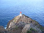
single 1000 watt 120 volt alternating current lamp. Should the first lamp burn out, a tangent lamp will automatically rotate into place. The light house...
2 KB (245 words) - 18:46, 10 April 2024
Megray Hill is a low-lying coastal mountainous landform in Aberdeenshire, Scotland within the Mounth Range of the Grampian Mountains. The peak elevation...
3 KB (401 words) - 14:15, 8 April 2022
Bridal Veil Falls (Otago-Route Burn) Bridal Veil as seen from the road to the Routeburn Track. Location Queenstown-Lakes District, New Zealand Coordinates...
2 KB (143 words) - 02:53, 4 June 2024
De Gaulle and His Troops (category Landforms of San Juan County, Utah)
it does appear on USGS topographic maps. Some rock climbers call this landform "North Tower." The first ascent of the summit was made on June 11, 1974...
7 KB (616 words) - 04:30, 2 September 2024
114.1736194°E / 22.2877528; 114.1736194 Victoria Harbour is a natural landform harbour in Hong Kong separating Hong Kong Island in the south from the...
18 KB (1,912 words) - 23:42, 30 October 2024
Fairy Pools (category Landforms of the Isle of Skye)
Coire na Creiche ("corrie of the spoils"), on the Allt Coir' a' Mhadaidh ("burn of the corrie of the wolf/dog"), at the foot of the Cuillin mountains. The...
5 KB (449 words) - 22:52, 11 November 2024
Te Ana-au Caves (category Landforms of Fiordland)
swirling) in reference to the water running through it. The water, Tunnel Burn, is the outflow of Lake Orbell. Lawson Burrows and his business partner Wilson...
3 KB (362 words) - 21:50, 22 July 2024
Vieira, Gonçalo; Luís, Zêzere José; Mora, Carla (2018). Landscapes and Landforms of Portugal. Springer International Publishing. ISBN 978-3-319-03640-3...
233 KB (20,306 words) - 17:44, 20 November 2024
Reef knoll (category Landforms)
A reef knoll is a landform that comprises an immense pile of calcareous material that had previously accumulated on an ancient sea floor. Reef knolls are...
5 KB (512 words) - 18:40, 8 August 2023
anchors its largest metropolitan area. Tennessee has diverse terrain and landforms, and from east to west, contains a mix of cultural features characteristic...
249 KB (22,473 words) - 11:09, 17 November 2024
terraces of the hill slopes and the very small alluvial plain of the flat landform created by the deposition of sediment near river areas because of this...
3 KB (227 words) - 02:52, 11 November 2024


