28 routes assigned to the "A" zone of the California Route Marker Program, which designates county routes in California. The "A" zone includes county highways...
44 KB (2,149 words) - 07:31, 30 August 2024
21 routes assigned to the "G" zone of the California Route Marker Program, which designates county routes in California. The "G" zone includes county highways...
82 KB (6,527 words) - 17:52, 3 September 2024
34 routes assigned to the "S" zone of the California Route Marker Program, which designates county routes in California. The "S" zone includes county highways...
106 KB (6,481 words) - 22:27, 11 November 2024
45 routes assigned to the "J" zone of the California Route Marker Program, which designates county routes in California. The "J" zone includes county highways...
119 KB (4,980 words) - 19:32, 17 November 2024
21 routes assigned to the "E" zone of the California Route Marker Program, which designates county routes in California. The "E" zone includes county highways...
47 KB (2,796 words) - 08:13, 18 November 2024
9 routes assigned to the "N" zone of the California Route Marker Program, which designates county routes in California. The "N" zone includes county highways...
22 KB (1,206 words) - 01:57, 21 October 2024
County routes in the U.S. state of California are controlled and maintained by the respective counties in which they are located. However, they are generally...
50 KB (444 words) - 03:54, 5 October 2024
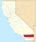
In the California Route Marker Program, which designates county routes in California, only two highways exist in the "R" zone, which encompasses Riverside...
5 KB (332 words) - 10:16, 17 August 2024
State Route 1 (SR 1) is a major north–south state highway that runs along most of the Pacific coastline of the U.S. state of California. At 656 miles...
137 KB (9,304 words) - 17:03, 2 November 2024
Pass; see California county routes in zone S S3, a British term for a road with a Suicide lane. Stagecoach Gold bus route S3, a bus route in Oxfordshire...
6 KB (941 words) - 22:00, 13 August 2024
highways, in a system where roads are graded A, B and sometimes lower categories roads in a particular area or zone designated A This is a list of road...
3 KB (108 words) - 11:45, 14 December 2022
Large portions are now California State Route 99 (SR 99), Oregon's Routes 99, 99W, and 99E, and Washington's SR 99. The highway in Washington connected...
22 KB (2,232 words) - 17:37, 25 October 2024
both Route 7 and Route 710. The California Streets and Highways Code defines Route 710 as follows: 622. Route 710 is from Route 1 to Route 210 in Pasadena...
42 KB (3,311 words) - 05:17, 17 November 2024
Southern California, United States. As of the 2020 census, the population was 3,186,989, making it the third-most-populous county in California, the sixth-most-populous...
213 KB (16,656 words) - 00:39, 18 November 2024
98°W / 33.73; -115.98 Riverside County is a county located in the southern portion of the U.S. state of California. As of the 2020 census, the population...
136 KB (5,688 words) - 15:37, 18 November 2024
Alameda County (/ˌæləˈmiːdə/ AL-ə-MEE-də) is a county located in the U.S. state of California. As of the 2020 census, the population was 1,682,353, making...
92 KB (5,017 words) - 17:11, 6 November 2024
Santa Clara County, officially the County of Santa Clara, is the sixth-most populous county in the U.S. state of California, with a population of 1,936...
109 KB (6,281 words) - 23:47, 11 November 2024
Contra Costa County (/ˌkɒntrə ˈkɒstə/ ; Contra Costa, Spanish for 'Opposite Coast') is a county located in the U.S. state of California, in the East Bay...
138 KB (8,665 words) - 20:29, 10 November 2024
Sveadal is a private summer resort in an unincorporated area of Llagas-Uvas in Santa Clara County, California. The Swedish American cultural heritage and...
5 KB (246 words) - 04:41, 3 June 2024
San Mateo County (/ˌsæn məˈteɪ.oʊ/ SAN mə-TAY-oh), officially the County of San Mateo, is a county in the U.S. state of California. As of the 2020 census...
113 KB (5,948 words) - 23:47, 11 October 2024
State Route 13 (SR 13) is a state highway in the U.S. state of California. It runs entirely in Alameda County, connecting Interstate 580 in Oakland to...
12 KB (1,265 words) - 17:15, 2 June 2024
Kern County is a county located in the U.S. state of California. As of the 2020 census, the population was 909,235. Its county seat is Bakersfield. Kern...
121 KB (6,558 words) - 01:34, 13 October 2024
Interstate 15 (redirect from Interstate 15 (California–Montana))
near the Mexican border in San Diego County and stretches north to Alberta, Canada, passing through the states of California, Nevada, Arizona, Utah, Idaho...
28 KB (2,710 words) - 15:17, 26 October 2024
Yolo County (/ˈjoʊloʊ/ ; Wintun: Yo-loy), officially the County of Yolo, is a county located in the northern portion of the U.S. state of California. Yolo...
52 KB (2,300 words) - 15:52, 8 November 2024
primarily in the Central Time Zone, but northwestern Culberson County, including Guadalupe Mountains National Park, is in the Mountain Time Zone, making...
26 KB (2,153 words) - 01:23, 10 November 2024
Humboldt County (/ˈhʌmboʊlt/ ) is a county located in the U.S. state of California. As of the 2020 census, the population was 136,463. The county seat is...
135 KB (7,756 words) - 16:14, 9 November 2024
Mono County (/ˈmoʊnoʊ/ MOH-noh) is a county located in the east central portion of the U.S. state of California. As of the 2020 census, the population...
49 KB (2,035 words) - 17:10, 9 November 2024
Ventura County (/vɛnˈtʊərə/ ) is a county located in the southern part of the U.S. state of California. As of the 2020 census, the population was 843,843...
139 KB (10,514 words) - 01:05, 14 November 2024
S. Route 95 (US 95) is a major north–south United States Highway in the western United States. It travels through the states of Arizona, California, Nevada...
23 KB (2,408 words) - 22:29, 4 August 2024
Reef State Marine Conservation Area Marin County is considered in the California Floristic Province, a zone of extremely high biodiversity and endemism...
93 KB (5,607 words) - 22:29, 16 November 2024


