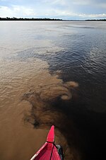
The Canutama Extractive Reserve (Portuguese: Reserva Extrativista Canutama) is an extractive reserve in the state of Amazonas, Brazil. The Canutama Extractive...
5 KB (419 words) - 00:37, 5 September 2024
right to traditional extractive practices, such as hunting, fishing and harvesting wild plants. In the broad sense, an extractive reserve is an area of land...
19 KB (491 words) - 21:04, 6 September 2024
2008. It also contains the 197,986 hectares (489,230 acres) Canutama Extractive Reserve, created in 2009. It contains 2% of the 881,704 hectares (2,178...
4 KB (257 words) - 20:31, 19 August 2024
The reserve is largely surrounded by indigenous territories. The Canutama Extractive Reserve is downstream from the Médio Purus Extractive Reserve. The...
6 KB (581 words) - 03:27, 29 February 2024
Médio Purus Extractive Reserve, created in 2008. Below this it runs through the 197,986 hectares (489,230 acres) Canutama Extractive Reserve along the stretch...
14 KB (923 words) - 18:28, 20 April 2024
Nova Ação. It adjoins the Canutama Extractive Reserve to the south. The vegetation is 100% dense rainforest. The Canutama State Forest was created by...
4 KB (372 words) - 14:40, 8 January 2024
Madeira, Igapó-Açu, and Matupiri sustainable development reserves, Canutama Extractive Reserve, Canutama State Forest, Tapauá State Forest, and Matupiri State...
5 KB (433 words) - 03:20, 29 February 2024
Madeira, Igapó-Açu and Matupiri sustainable development reserves, Canutama Extractive Reserve, Canutama State Forest, Tapauá State Forest and Matupiri State...
5 KB (451 words) - 03:38, 21 October 2024
Madeira, Igapó-Açu and Matupiri sustainable development reserves, Canutama Extractive Reserve, Canutama State Forest, Tapauá State Forest and Matupiri State...
8 KB (864 words) - 03:37, 29 February 2024
Madeira, Igapó-Açu and Matupiri sustainable development reserves, Canutama Extractive Reserve, Canutama State Forest, Tapauá State Forest and Matupiri State...
25 KB (2,860 words) - 04:12, 26 September 2024
Madeira, Igapó-Açu and Matupiri sustainable development reserves, Canutama Extractive Reserve, Canutama State Forest, Tapauá State Forest and Matupiri State...
4 KB (357 words) - 14:51, 8 January 2024
Uacari Extractive reserves covered by ARPA as of 2016 were: Alto Tarauacá Arapixi Arióca Pruanã Auati-Paraná Baixo Juruá Barreiro das Antas Canutama Catuá-Ipixuna...
15 KB (986 words) - 13:07, 12 December 2023
hectares (537,420 acres) Catuá-Ipixuna Extractive Reserve, established in 2003 as the first extractive reserve in the state of Amazonas. de Magalhães...
11 KB (673 words) - 10:05, 24 October 2024
contains 58.76% of the 427,004 hectares (1,055,150 acres) Rio Gregório Extractive Reserve. IBGE 2020 IBGE - "Archived copy". Archived from the original on 2007-01-09...
3 KB (77 words) - 20:27, 19 August 2024
contains 41.22% of the 427,004 hectares (1,055,150 acres) Rio Gregório Extractive Reserve. The climate is equatorial (Af, according to the Köppen climate classification)...
16 KB (1,225 words) - 16:09, 19 August 2024
contains 62% of the 187,982 hectares (464,510 acres) Baixo Juruá Extractive Reserve, created in 2001. The municipality contains about 12% of the Tefé...
3 KB (109 words) - 20:28, 19 August 2024
743 hectares (461,450 acres). It covers parts of the municipalities of Canutama and Humaitá in the state of Amazonas and Porto Velho in the state of Rondônia...
7 KB (632 words) - 06:29, 30 August 2023
hectares (537,420 acres) Catuá-Ipixuna Extractive Reserve, established in 2003 as the first extractive reserve in the state of Amazonas. IBGE 2020 Sears...
8 KB (241 words) - 03:02, 19 August 2024
Borba. The economy of Borba depends largely on fishing, agriculture, and extractive activities like rubber extraction and cocoa harvesting. The city is served...
5 KB (304 words) - 20:30, 19 August 2024
Development Reserve. It also contains part of the Amazonas National Forest. It contains the 833,352 hectares (2,059,260 acres) Rio Unini Extractive Reserve, created...
14 KB (714 words) - 03:35, 13 October 2024
several times. The Mapinguari National Park is in the municipalities of Canutama (40%) and Lábrea (50%) in Amazonas and the municipality of Porto Velho...
8 KB (756 words) - 09:51, 6 August 2022
Guariba Extractive Reserve, also created in 2005. The municipality contains about 45% of the 359,138 hectares (887,450 acres) Manicoré Biological Reserve, created...
7 KB (588 words) - 20:31, 19 August 2024
acres) Ituxi Extractive Reserve, created in 2008. It contains 91% of the 604,209 hectares (1,493,030 acres) Médio Purus Extractive Reserve, created in...
9 KB (326 words) - 20:32, 19 August 2024
The Balata-Tufari National Forest covers parts of the municipalities of Canutama (90.85%) and Tapauá (9.15%) in the state of Amazonas. It has an area of...
6 KB (548 words) - 11:15, 23 September 2023
1989. It also contains the 133,637 hectares (330,220 acres) Arapixi Extractive Reserve, created in 2006. IBGE 2020 IBGE - "Archived copy". Archived from...
3 KB (110 words) - 20:28, 19 August 2024
contains 8% of the 604,209 hectares (1,493,030 acres) Médio Purus Extractive Reserve, created in 2008. IBGE 2020 IBGE - [1] FLONA do Purus (in Portuguese)...
3 KB (118 words) - 20:29, 19 August 2024
contains 55% of the 146,950 hectares (363,100 acres) Auatí-Paraná Extractive Reserve, created in 2001. It contains part of the 7,999,000 hectares (19,770...
4 KB (200 words) - 03:15, 19 August 2024
contains 38% of the 187,982 hectares (464,510 acres) Baixo Juruá Extractive Reserve, created in 2001. It has its history linked to the history of Tefé...
5 KB (404 words) - 04:01, 6 October 2024
Guariba Extractive Reserve, also created in 2005. It also contains the 113,606 hectares (280,730 acres) Bararati Sustainable Development Reserve, created...
6 KB (411 words) - 20:29, 19 August 2024
contains 45% of the 146,950 hectares (363,100 acres) Auatí-Paraná Extractive Reserve, created in 2001. IBGE 2020 IBGE - "Archived copy". Archived from...
6 KB (120 words) - 16:03, 19 August 2024


