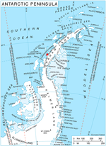
Cape Bellue is a headland on the north side of the entrance to Darbel Bay, which forms the west extremity of Stresher Peninsula on the west coast of Graham...
2 KB (157 words) - 17:13, 5 May 2024
(13 km) wide, indenting the coast for 3 miles (5 km) between Cape Evensen and Cape Bellue, along the northwest coast of Stresher Peninsula, Graham Land...
681 bytes (89 words) - 16:04, 20 August 2024
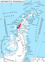
coast of Graham Land in Antarctic Peninsula, extending 158 km between Cape Bellue to the northeast and Bourgeois Fjord to the southwest. South of Loubet...
1 KB (167 words) - 13:16, 1 May 2024
817°W / -66.317; -65.817) is a peak 1.5 nautical miles (2.8 km) east of Cape Bellue on Stresher Peninsula on the west coast of Graham Land. Photographed...
2 KB (137 words) - 15:10, 19 July 2024
to the northwest and Darbel Bay to the southwest. Its west extremity Cape Bellue separates Graham Coast to the northeast from Loubet Coast to the southwest...
2 KB (205 words) - 18:26, 20 September 2021

Graham Land in Antarctic Peninsula, extending 172 km between Cape Bellue to the southwest and Cape Renard to the northeast. The coast is named after Sir James...
1 KB (151 words) - 13:16, 1 May 2024
383; -65.967) are a group of islands and rocks extending southwest from Cape Bellue for 5 nautical miles (9 km) across the entrance to Darbel Bay, off the...
980 bytes (136 words) - 03:56, 19 December 2022
Stresher Peninsula and Pernik Peninsula. Entered southwest of Cape Bellue and northeast of Cape Rey. The glaciers Widmark Ice Piedmont, Cardell, Erskine,...
2 KB (178 words) - 22:08, 30 January 2023
50278°W / -66.34333; -65.50278, which is 17.7 km east-southeast of Cape Bellue, 6.3 km west-southwest of Rugg Peak and 7.78 km northwest of Mount Lyttleton...
2 KB (212 words) - 15:19, 6 June 2024
Rubner Peak, 29.35 km east-southeast of Madell Point, 43.4 km south of Cape Bellue, 9.65 km south of Gostilya Point and 9.4 km west-southwest of Voit Peak...
2 KB (226 words) - 04:33, 12 July 2019