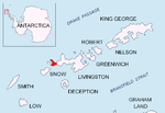
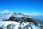
Clark Nunatak is a rocky peak rising to 147 m at the southwest edge of the ice cap of Rotch Dome in western Livingston Island, South Shetland Islands...
3 KB (223 words) - 15:07, 14 April 2020
Alexandra Mountains (redirect from Sneddon Nunataks)
to southeast, include Scott Nunataks, Mount Youngman, Sneddon Nunataks and Mount Swadener. Southern features include Clark Peak, La Gorce Peak, Bowman...
7 KB (1,133 words) - 01:44, 7 July 2024
which is 12.1 km east-southeast of Nikopol Point, 3.95 km southeast of Clark Nunatak, 3.08 km southwest of Bond Point and 13.2 km west-southwest of Hannah...
3 KB (277 words) - 20:53, 12 October 2024
Snow Hill Island (redirect from Day Nunatak)
project up through the sedimentary rocks near the station Nunatak. Day Nunatak and Dingle Nunatak appear within the main ice cap of the island. Both were...
10 KB (1,280 words) - 15:28, 2 October 2024
with Byers Peninsula also all ice-free ground and ice sheet west of Clark Nunatak and Rowe Point, increasing the overall surface area of that protected...
74 KB (7,603 words) - 01:57, 5 October 2024
-60.91833, which is 700 m east of Rish Point and 600 m southwest of Clark Nunatak (Spanish mapping in 1993). Península Byers, Isla Livingston. Mapa topográfico...
2 KB (195 words) - 20:55, 1 November 2024
Island with Robbery Beaches and Tsamblak Hill in the middle, and left to right Rowe Point, Ivanov Beach, Urvich Wall and Clark Nunatak in the background...
4 KB (311 words) - 19:52, 1 November 2024
which is 2 km northwest of Elephant Point and 1.8 km southeast of Clark Nunatak. Livingston Island List of Bulgarian toponyms in Antarctica Antarctic...
3 KB (270 words) - 06:19, 8 July 2019
Island with Robbery Beaches and Tsamblak Hill in the middle, and left to right Rowe Point, Ivanov Beach, Urvich Wall and Clark Nunatak in the background...
6 KB (309 words) - 17:59, 1 November 2024
Island with Robbery Beaches and Tsamblak Hill in the middle, and left to right Rowe Point, Ivanov Beach, Urvich Wall and Clark Nunatak in the background...
6 KB (307 words) - 08:35, 2 November 2024
Byers Peninsula, 2.3 km northwest of Amadok Point, 1.3 km southwest of Clark Nunatak, and 1 km northeast of Stackpole Rocks. Juturna Lake is centred 320...
2 KB (199 words) - 21:19, 28 October 2024
Mount Terror (Antarctica) (redirect from Pōnui Nunatak)
by James Clark Ross. Alberts 1995, p. 740. "Antarctica Ultra-Prominences" Peaklist.org. Retrieved 2012-09-05. Ross Island USGS. Kienle Nunataks USGS. Mount...
14 KB (2,360 words) - 04:46, 29 May 2024
Island with Robbery Beaches and Tsamblak Hill in the middle, and left to right Rowe Point, Ivanov Beach, Urvich Wall and Clark Nunatak in the background...
6 KB (324 words) - 01:10, 2 November 2024
ground; and Rowe Point, Cutler Stack, Ivanov Beach, Nedelya Point, Urvich Wall surmounted by the slopes of Rotch Dome, and Clark Nunatak in the background...
3 KB (287 words) - 03:35, 21 August 2020
from Basalt Lake vicinity on Byers Peninsula, Livingston Island, with Clark Nunatak, Ritli Hill, Elephant Point and Telish Rock in the left background,...
3 KB (298 words) - 10:46, 19 April 2024
Island with Robbery Beaches and Tsamblak Hill in the middle, and left to right Rowe Point, Ivanov Beach, Urvich Wall and Clark Nunatak in the background...
5 KB (310 words) - 10:11, 21 October 2024
Island with Robbery Beaches and Tsamblak Hill in the middle, and left to right Rowe Point, Ivanov Beach, Urvich Wall and Clark Nunatak in the background...
4 KB (329 words) - 03:11, 2 November 2024
ground; and Rowe Point, Cutler Stack, Ivanov Beach, Nedelya Point, Urvich Wall surmounted by the slopes of Rotch Dome, and Clark Nunatak in the background...
3 KB (247 words) - 06:23, 29 October 2024
ground; and Rowe Point, Cutler Stack, Ivanov Beach, Nedelya Point, Urvich Wall surmounted by the slopes of Rotch Dome, and Clark Nunatak in the background...
11 KB (1,108 words) - 02:19, 29 October 2024
Nedelya Point, Urvich Wall surmounted by the slopes of Rotch Dome, and Clark Nunatak in the background. Topographic map of Byers Peninsula featuring Antarctic...
4 KB (442 words) - 22:14, 28 October 2024
Nedelya Point, Urvich Wall surmounted by the slopes of Rotch Dome, and Clark Nunatak in the background Topographic map of Livingston Island and Smith Island...
4 KB (355 words) - 03:40, 29 October 2024
Nedelya Point, Urvich Wall surmounted by the slopes of Rotch Dome, and Clark Nunatak in the background Map of Antarctic Specially Protected Area ASPA 126...
3 KB (326 words) - 17:36, 1 September 2024
Ivanov Beach, Nedelya Point, Urvich Wall surmounted by Rotch Dome, and Clark Nunatak in the background Topographic map of Byers Peninsula featuring Antarctic...
4 KB (413 words) - 14:47, 29 October 2024
Eland Mountains (redirect from Temnikow Nunataks)
include Peters Bastion, Mount Strong, Hall Ridge, Clark Hills, Kelley Massif, Reynolds Bench, Temnikow Nunataks and Daniels Hill. 70°27′S 62°54′W / 70.450°S...
6 KB (983 words) - 05:48, 8 June 2024
671222; -60.91333, which is 965 m east of Rish Point, 440 m south of Clark Nunatak and 1.4 km northwest of Amadok Point. Detailed Spanish mapping in 1992...
6 KB (339 words) - 00:34, 2 November 2024
besides Byers Peninsula also all ice-free ground and ice sheet west of Clark Nunatak and Rowe Point, increasing the overall surface area of the protected...
10 KB (982 words) - 19:40, 9 March 2024
Nedelya Point, Urvich Wall surmounted by the slopes of Rotch Dome, and Clark Nunatak in the background Topographic map of Livingston Island, Greenwich, Robert...
4 KB (331 words) - 13:46, 19 December 2020
from Basalt Lake vicinity on Byers Peninsula, Livingston Island, with Clark Nunatak, Ritli Hill, Elephant Point and Telish Rock in the left background,...
3 KB (208 words) - 17:09, 21 October 2022
Allegheny Mountains (Antarctica) (redirect from Breeding Nunatak)
the Clark Mountains. Features, from west to east, include Mount Darling, Mount Spencer, Mount Tolley, Mount Swartley, Mount Zeigler and Cady Nunatak. Isolated...
6 KB (920 words) - 15:34, 27 March 2024
Beaches from near Basalt Lake on Byers Peninsula, Livingston Island, with Clark Nunatak, Ritli Hill, Elephant Point and Telish Rock in the left background,...
4 KB (270 words) - 14:11, 29 October 2024


