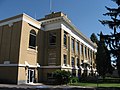
Cold Springs is an unincorporated community in Umatilla County, Oregon, United States, south of the Columbia River in the Hermiston area. Cold Springs...
5 KB (258 words) - 02:55, 21 November 2023

Oregon Route 37 is a state highway in the U.S. state of Oregon that runs between Cold Springs Junction on the Columbia River in north-central Oregon, to...
4 KB (290 words) - 17:49, 22 June 2023

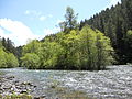
Cold Springs Dam is an earthen dam 7 miles (11 km) northeast of Hermiston and 3 miles (5 km) south of the Columbia River in Umatilla County, Oregon. The...
6 KB (231 words) - 08:41, 24 July 2023

Oregon Route 207 is an Oregon state highway running from U.S. Route 26 in Mitchell to U.S. Route 730 near Cold Springs Junction. OR 207 is 152.30 miles...
6 KB (376 words) - 09:40, 25 October 2023

Tutuilla Umapine Bingham Springs Blakeley (ghost town) Cold Springs Cold Springs Junction Ferndale Gibbon Hinkle Holdman Lehman Springs McNary Myrick Nolin...
21 KB (1,673 words) - 16:42, 24 June 2024
Buckhorn Springs Road connects the community to Oregon Route 66 near Emigrant Lake. The springs at this location are known for their cold, highly carbonated...
5 KB (252 words) - 20:49, 22 July 2023

wet winters with frequent overcast and cloudy skies. Eastern Oregon falls into the cold semi-arid climate (or BSk type), which features drier weather...
16 KB (1,295 words) - 18:59, 11 July 2024

Alvord Desert (category Deserts of Oregon)
western edge as well as cold springs following NE to SW trending normal faults. On the western edge of the desert is Alvord Hot Springs (42°32′38″N 118°32′02″W...
15 KB (1,523 words) - 12:08, 22 April 2024

Little Crater Lake (category Springs of Oregon)
is a spring-fed lake in the Mount Hood National Forest in Clackamas County, Oregon, United States. It is named after Crater Lake, also in Oregon. Little...
4 KB (253 words) - 22:50, 19 February 2023
the 1860s, Soda Springs served as the seat of Oneida County.[citation needed] The city is named for the hundreds of natural springs of carbonated water...
15 KB (1,111 words) - 05:03, 26 May 2024

Oregon (/ˈɒrɪɡən, -ɡɒn/ ORR-ih-ghən, -gon) is a state in the Pacific Northwest region of the United States. Oregon is a part of the Western United States...
196 KB (16,684 words) - 20:12, 21 July 2024

around a spring on his property. The spring, which emerged from a bed of black basalt, was known to pioneer ranchers in the area as Summit Springs. Experiencing...
23 KB (2,015 words) - 18:02, 2 May 2024

U.S. Route 730 (redirect from U.S. Route 730 (Oregon))
terminus of Oregon Route 207 (OR 207) in rural Umatilla County. The highway turns northeastward along Lake Wallula and intersects OR 37 at Cold Springs Junction...
30 KB (2,326 words) - 04:23, 15 June 2024

Cold Springs National Wildlife Refuge is a 3,117-acre (12.61 km2) National Wildlife Refuge located 7 miles (10 km) northeast of Hermiston and 3 miles (5 km)...
4 KB (282 words) - 14:52, 28 May 2023

Wilhoit Springs is a county park located in Clackamas County, Oregon, deep in the foothills of the Cascade Mountains, roughly 8 miles southeast of Molalla...
9 KB (1,141 words) - 16:15, 26 February 2024
The Oregon Trail is a text-based strategy video game developed by Don Rawitsch, Bill Heinemann, and Paul Dillenberger in 1971 and produced by the Minnesota...
28 KB (2,947 words) - 05:53, 18 July 2024

geyser and several hot springs. Geothermal exploration at the 7,200-acre (2,900 ha) Crump Geyser site in 2010 found hot springs with temperatures as high...
15 KB (1,077 words) - 11:39, 2 August 2023

Oregon Route 334 (OR 334) is an Oregon state highway running from OR 37 near Myrick to OR 11 near Athena. OR 334 is known as the Athena-Holdman Highway...
3 KB (208 words) - 09:27, 23 June 2023

with hot carbonated water for laundry and chugging springs for fresh water. Just west of Soda Springs the Bear River turns southwest as it heads for the...
144 KB (19,253 words) - 17:25, 20 July 2024

clearance above a roadbed below. The Cold Springs Bridge was constructed in 1884 at the Snake River Crossing in Ontario, Oregon. In 1917, the bridge was disassembled...
2 KB (172 words) - 04:24, 6 August 2023

Creek - Belknap Springs - Bellevue - Bellfountain - Bend - Bethany - Bethel - Beulah - Beverly Beach - Biggs Junction - Bingham Springs - Birkenfeld -...
41 KB (1,679 words) - 00:03, 20 July 2024

Springs, Colorado" (PDF). GHC Bulletin, Oregon Tech: 13–14. Retrieved July 7, 2022. Town of Hot Sulphur Springs official website Hot Sulphur Springs Chamber...
18 KB (1,093 words) - 18:52, 11 June 2024
beginning in the spring season brings more cold water out of springs under the permeable rock, increasing the McKenzie's flow and maintaining cold water temperatures...
25 KB (2,192 words) - 08:52, 31 October 2023

Clear Lake is a mountain lake 86 mi (138 km) northeast of Eugene, Oregon, United States in Linn County. It has two main bodies connected by a bottleneck...
4 KB (313 words) - 16:50, 7 May 2021
Deer Creek Hot Springs (also known as Bigelow Hot Springs) is a hot spring along the McKenzie River in the Cascade Range of western Oregon, United States...
1 KB (158 words) - 05:42, 21 February 2020

Hot Springs National Park is an American national park in central Garland County, Arkansas, adjacent to the city of Hot Springs, the county seat. Hot...
46 KB (5,826 words) - 08:04, 8 June 2024
"Cooling Business:3 of 5 local Cold Stone Creamery stores have shut down in just over a year". The Gazette. Colorado Springs, Colorado. Archived from the...
25 KB (2,470 words) - 05:47, 2 July 2024
The Warm Fork Spring River is a stream in Oregon County, Missouri and northern Fulton County, Arkansas. The stream begins in western Oregon County at the...
5 KB (182 words) - 10:24, 9 June 2024

records on the West Coast and is still in Oregon City. Around 1900, the spa and resort at Wilthoit Springs was a popular tourist destination. In 1902...
39 KB (2,752 words) - 20:28, 21 July 2024

U.S. Route 395 (redirect from Oregon Route 32)
with I-82, or I-84. US 395 went north from Pendleton to Cold Springs Junction, currently Oregon Route 37. From there, US 395 traveled concurrently with...
31 KB (3,198 words) - 18:48, 26 June 2024