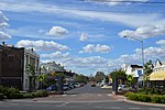
the Castlereagh River. Coonamble Shire includes the towns of Coonamble, Gulargambone and Quambone. The mayor of Coonamble Shire Council is Cr. Daniel Keady...
8 KB (350 words) - 19:40, 5 November 2024
has media related to Coonamble. Coonamble Shire Council Coonamble on the Castlereagh The Sydney Morning Herald Travel: Coonamble (February 8, 2004) ABC...
11 KB (724 words) - 11:58, 17 October 2024
South Wales, Australia, on the banks of the Castlereagh River, in Coonamble Shire. It is 382 km (and 490 km by road) north-west of Sydney. At the 2016...
7 KB (682 words) - 14:51, 19 July 2023
(Shires) Act 1905. The shire office was in Coonamble. Towns and villages in the shire included Gulargambone and Quambone. Wingadee Shire amalgamated with the...
2 KB (183 words) - 16:30, 29 April 2023
July 1936. "Coonamble’s Way" p. 21 See for example the Coonamble Shire flyer at http://www.coonambleshire.nsw.gov.au/VisitingCoonamble/coonamble.html accessed...
48 KB (6,828 words) - 07:13, 11 December 2024
three local government areas: Warrumbungle Shire to the east, Gilgandra Shire to the south and Coonamble Shire to the west. Located within the large area...
10 KB (918 words) - 02:35, 23 December 2024
including Dubbo, with a estimated population of 123,862 people. Cobar Shire Council is composed of 12 councillors elected proportionally to a single...
51 KB (579 words) - 07:42, 31 October 2024
the Coonamble Shire local government area, 591 kilometres (367 mi) north west of the state capital, Sydney and 56 kilometres (35 mi) west of Coonamble. The...
2 KB (171 words) - 20:04, 21 September 2022
Retrieved 7 July 2017. Australian Bureau of Statistics (27 June 2017). "Coonamble (A)". 2016 Census QuickStats. Retrieved 7 July 2017. Australian Bureau...
52 KB (2,825 words) - 08:12, 19 June 2024
Gulargambone Parish, New South Wales is a bounded rural locality of Coonamble Shire and a civil parish of Gowen County, a cadastral division of New South...
3 KB (187 words) - 21:01, 21 November 2020
Wilber Parish, New South Walesis a bounded rural locality of Coonamble Shire and a civil parish of Gowen County, New South Wales. The only town of the...
2 KB (148 words) - 12:56, 24 August 2019
Caraghnan Parish, New South Wales is a bounded rural locality in Coonamble Shire and a civil parish of Gowen County, New South Wales. The parish located...
2 KB (149 words) - 20:59, 21 November 2020
away with "Mudgee Shire" (now a part of Central West Region), and "Coolah" and "Coonabarabran" shires have merged into Warrumbungle Shire. "About us". Regional...
7 KB (478 words) - 08:50, 19 December 2024
Coonamble Shire, City of Randwick, Tenterfield Shire, Inner West Council, Lachlan Shire, Bega Valley Shire, City of Blue Mountains, Surf Coast Shire,...
190 KB (15,499 words) - 15:21, 3 January 2025
about frequent vandalism causing maintenance and safety issues. The Coonamble Shire Council were looking for a possible tenant at that time to secure the...
6 KB (565 words) - 07:11, 9 December 2024
Callangoan, New South Wales is a bounded rural locality of Coonamble Shire, and a civil parish of Gowen County, a county of New South Wales. The parish...
2 KB (173 words) - 20:59, 21 November 2020
Coonamble Airport (IATA: CNB, ICAO: YCNM) is an airport located 2 nautical miles (3.7 km; 2.3 mi) south of Coonamble, New South Wales, Australia. The airport...
2 KB (107 words) - 17:31, 12 January 2024
Bourke Shire, Brewarrina Shire, Narrabri Shire, Walgett Shire, Warrumbungle Shire, Coonamble Shire, Gilgandra Shire, Warren Shire, Bogan Shire, Lachlan...
9 KB (478 words) - 07:36, 27 November 2024
May 2016. Retrieved 13 May 2016. "Wentworth - A Brief History". Wentworth Shire Council. Retrieved 16 February 2020. "Local Government Act, 1919—Proclamation"...
74 KB (2,504 words) - 12:59, 22 December 2024
River and includes land on both sides of the Castlereagh River, including Coonamble. Leichhardt County was named in honour of the Prussian naturalist and...
16 KB (112 words) - 06:56, 6 August 2024
Naman, New South Wales is a bounded rural locality of Coonamble Shire and a civil parish of Gowen County, New South Wales. The Parish is on the Tunderbrine...
2 KB (158 words) - 15:30, 5 February 2022
Council, Narromine Shire and Warrumbungle Shire) North Western Library (Bogan Shire, Gilgandra Shire Coonamble Shire, and Warren Shire) Richmond Tweed Regional...
36 KB (2,721 words) - 06:03, 20 December 2024
"John Rayner leads new Georges River Council". St George & Sutherland Shire Leader. Retrieved 15 May 2016. "PROCLAMATION". New South Wales Government...
152 KB (6,257 words) - 04:25, 13 October 2024
Caraghnan Coonamble Shire 31°17′54″S 149°01′04″E / 31.29833°S 149.01778°E / -31.29833; 149.01778 (Caraghnan) Cobbinbil Coonamble Shire 31°18′54″S...
9 KB (119 words) - 06:55, 6 August 2024
The Hills Shire (known until 2008 as Baulkham Hills Shire) is a local government area in the Greater Sydney region of Sydney, New South Wales, Australia...
27 KB (2,138 words) - 12:10, 28 December 2024
Sutherland Shire is a local government area (LGA) in the southern region of Sydney, in the state of New South Wales, Australia. Sutherland Shire is located...
61 KB (5,317 words) - 07:50, 29 November 2024
(Duffity) Dynong Coonamble Shire 30°37′54″S 147°40′04″E / 30.63167°S 147.66778°E / -30.63167; 147.66778 (Dynong) Embie Coonamble Shire 31°09′54″S 147°58′04″E...
14 KB (91 words) - 06:47, 23 December 2024
during summer.[citation needed] Gilgandra Shire has a number of heritage-listed sites, including: East Coonamble Road, Curban: Corduroy Road Ruin Historic...
7 KB (456 words) - 01:57, 13 September 2024
Evans Walgett Shire 30°19′54″S 148°20′04″E / 30.33167°S 148.33444°E / -30.33167; 148.33444 (Evans Parish) Gidgenbar Coonamble Shire 30°39′54″S 148°46′04″E...
13 KB (119 words) - 06:47, 6 August 2024
Allamurgoola Gilgandra Shire 31°25′54″S 148°30′04″E / 31.43167°S 148.50111°E / -31.43167; 148.50111 (Allamurgoola) Armatree Coonamble Shire 31°23′54″S 148°24′04″E...
9 KB (92 words) - 19:14, 1 June 2024


