
D106 is a state road connecting the mainland to island of Pag and terminating in Žigljen ferry port, from where Jadrolinija ferries fly to the mainland...
7 KB (261 words) - 20:49, 22 August 2023

of the town and continues north-west then west rejoining the N1. The D106 road also goes north from the commune to Vieux Bourg. The Route du Palais Royal...
21 KB (1,786 words) - 02:29, 21 July 2024

44°19′30″N 15°15′29″E / 44.325°N 15.258°E / 44.325; 15.258 Carries D106 road Crosses Ljubačka Vrata Strait Locale Zadar County, Croatia Named for Island...
3 KB (205 words) - 09:42, 22 April 2024
situated some 5 miles (8 km) east of Hesdin on the D105 junction with the D106 road. The eighteenth-century church of Notre-Dame Remains of a 17th-century...
2 KB (116 words) - 06:35, 4 August 2023

port - ferry access to Žigljen, island of Pag (D106). The road is 2.9 km long. As with all other state roads in Croatia, the D406 is also managed and maintained...
4 KB (164 words) - 13:32, 28 February 2024
of particular historical, scenic, architectural or engineering interest. Road and railway bridges, viaducts, aqueducts and footbridges are included. This...
36 KB (1,060 words) - 21:16, 2 January 2024
List of highways numbered 106 (redirect from State Road 106)
106 A106 B106 road Pahang State Route C106 D106 road N106 (Bangladesh) P106 R106 road (Ireland) This article includes a list of roads, streets, highways...
5 KB (374 words) - 15:25, 9 April 2024

D108 is a state road branching off from D106 trunk road on the island of Pag and terminating in Povljane. The road is 7.6 km long. The road, as well as all...
2 KB (80 words) - 20:06, 22 August 2023

Highways in Croatia (redirect from D401 road)
Avenue in Zagreb, designated as Ž1040, a county road. Other than the motorway routes, the national road classification includes the following enumerated...
62 KB (2,675 words) - 14:23, 13 July 2024

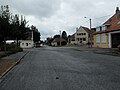
France. The commune is situated 12 miles (19 km) west of Abbeville, on the D106 road. Sitting squarely between the industrial Vimeu region and the tourist...
3 KB (192 words) - 12:20, 22 September 2022

state road branching off from D106 trunk road on the island of Pag and terminating in Stara Novalja ferry port. The road is 8.0 km long. The road, as well...
2 KB (86 words) - 03:14, 3 February 2023
D108 may refer to: D108 road (Croatia), a state road branching off from D106 trunk road on the island of Pag and terminating in Povljane HMS Cardiff (D108)...
346 bytes (90 words) - 00:13, 11 October 2011
31 miles (50 km) northeast of Le Havre, at the junction of the D53 and D106 roads. The church of St.Pierre, dating from the eighteenth century. Communes...
2 KB (101 words) - 01:18, 16 October 2022
southeast of Bourges at the junction of the D2076 with the D46e and on the D106 road. The church of St. Just, dating from the twelfth century. The chateau...
2 KB (148 words) - 16:36, 1 August 2023
miles (42 km) north of Rouen at the junction of the D55, D25 and the D106 roads. The church of St. Henri, dating from the nineteenth century. Two sandstone...
2 KB (121 words) - 12:23, 30 August 2022

The D8 state road is the Croatian section of the Adriatic Highway, running from the Slovenian border at Pasjak via Rijeka, Senj, Zadar, Šibenik, Split...
33 KB (906 words) - 01:10, 3 June 2024

miles (40 km) northwest of Rouen at the junction of the D25, D27 and the D106 roads. The church of St.Pierre, dating from the twelfth century. The chapel...
2 KB (150 words) - 04:23, 3 March 2023
29 miles (47 km) northeast of Le Havre, near the junction of the D106 and D149 roads. The ruins of an 11th-century chapel at the hamlet of Attemesnil...
2 KB (110 words) - 12:35, 3 August 2022

Vaudricourt is situated 10 miles (16 km) west of Abbeville, on the D106 and the D63 roads. Communes of the Somme department "Répertoire national des élus:...
2 KB (93 words) - 08:31, 29 September 2022

lies about 20 miles (32 km) southeast of Montreuil-sur-Mer, on the D106 and D98 road junction. The seventeenth century church of St. Martin. Communes of...
2 KB (112 words) - 06:47, 4 August 2023
miles (51 km) northeast of Le Havre, at the junction of the D105 and D106 roads. The church of St. Firmin, dating from the nineteenth century. A seventeenth-century...
3 KB (300 words) - 09:52, 17 February 2023

A1 (Croatia) (redirect from A1 road (Croatia))
motorway follows a route parallel to the Adriatic coast. As a part of the road network of Croatia, it is a part of two major European routes: E65...
103 KB (6,714 words) - 20:04, 17 May 2024
miles (19 km) southeast of Bourges on the D132 road at its junction with the D106 and the D953 roads. The church of St. Denis, dating from the twelfth...
2 KB (141 words) - 18:46, 15 February 2024

to the south of Bourges at the junction of the D106 with the N142 and with the D31 and the D46 roads. The river has been dammed and has created an 82...
3 KB (174 words) - 16:35, 1 August 2023
written by John B. Keane. 6 "The Funeral " 31 October 2004 (2004-10-31) D106 Killinaskully is in festive mood as it prepares for the funeral of one of...
17 KB (147 words) - 15:08, 27 March 2024
some 26 miles (42 km) northwest of Rouen, at the junction of the D106 and the D142 roads. The church of St.Pierre, dating from the fourteenth century. Communes...
2 KB (115 words) - 12:07, 4 December 2022
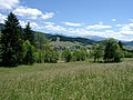
D106C which branches north from the D106 and passes in a loop through the village then back south to Méaudre. A local road goes north from the village along...
16 KB (1,238 words) - 02:42, 1 March 2024
Bhutanatha group of temple on the east margin of the tank Badami Bagalkot N-KA-D106 Group of temples on the north side of the Lake towards east end Badami Bagalkot...
39 KB (126 words) - 12:49, 27 November 2023
Malaysia Federal Route 131 (category Infobox road maps tracking category)
Federal Route 131, or Jalan Raja Perempuan Zainab II, is a federal road in Kelantan, Malaysia. It is also a main route to the Universiti Sains Malaysia...
4 KB (86 words) - 23:20, 31 January 2023
Malaysia Federal Route 57 (category Infobox road maps tracking category)
Jalan Long Yunus and Jalan Pengkalan Chepa (now Jalan Tok Guru) is a federal road in Kelantan, Malaysia. It is a main route to Sultan Ismail Petra Airport...
6 KB (77 words) - 10:26, 2 February 2023