
D76 is a state road in Croatia that connects Makarska Riviera to Imotski and Bosnia and Herzegovina. Furthermore, the road has junctions to major roads...
5 KB (143 words) - 09:37, 3 February 2024

Sveti Ilija Tunnel (category Road tunnels in Croatia)
metres (13,962.0 ft). Roadway is 7.7 m (25 ft) wide. Tunnel is carrying D76 state road. It passes through Biokovo between the Bast in the municipality of Baška...
4 KB (380 words) - 19:28, 25 December 2023

Highways in Croatia (redirect from D401 road)
Avenue in Zagreb, designated as Ž1040, a county road. Other than the motorway routes, the national road classification includes the following enumerated...
62 KB (2,675 words) - 15:37, 19 August 2024

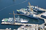
HMS Virago (R75) (redirect from HMS Virago (D76))
the British oil tanker Empire Cross exploded, burned and sank in Haifa Roads, Palestine, killing 25 people. Virago and Venus took part in the rescue...
13 KB (1,161 words) - 21:20, 10 November 2023

of D60 and D76 state roads and 20 km from the Sveti Ilija Tunnel. The A1 motorway is accessed at the Zagvozd Interchange, next to the D76 expressway....
12 KB (1,064 words) - 19:23, 21 August 2024

Mali Prolog. The road provides access to the Mali Prolog border crossing to Bosnia and Herzegovina via the D222 state road. The road generally serves...
8 KB (281 words) - 09:37, 3 February 2024

Hangard village. saint-Martin Hangard Map of the commune Hangard is on the D76 road, some 13 miles (21 km) southeast of Abbeville, and is at an elevation of...
5 KB (591 words) - 12:28, 28 September 2022
four rolls of black and white 35mm film. The developing chemical, Kodak D76, was heated to a temperature far higher than recommended, shortening the...
30 KB (3,087 words) - 19:19, 8 August 2024

the D76 road from Meymac, which continues through the village then south-west to join the D16 north of Égletons. There is also the D123 minor road running...
17 KB (1,598 words) - 23:22, 22 August 2024

The D8 state road is the Croatian section of the Adriatic Highway, running from the Slovenian border at Pasjak via Rijeka, Senj, Zadar, Šibenik, Split...
34 KB (1,069 words) - 11:34, 28 July 2024

D60 is a state road in Dalmatia region of Croatia connecting D1 state road in Brnaze to Vinjani Donji border crossing to Sovići, Bosnia and Herzegovina...
7 KB (241 words) - 01:40, 5 February 2023
Prison, Building D26 Recognized – 1991 Rum / Salt Meats Stores, Building D75-D76 Recognized – 1991 Sail Loft / Oil Stores, Building D109 Recognized – 1991...
22 KB (2,126 words) - 12:59, 10 February 2024

1,522 m. at an average gradient of 8%. Alternatively, the route via the D76 is 19.8 km. long, climbing 1,520 m. at an average of 7.7%. The northern approach...
8 KB (401 words) - 15:55, 25 July 2024

in Hauts-de-France in northern France. The commune is situated on the D76 road, some 25 miles (40 km) southeast of Amiens. Communes of the Somme department...
2 KB (96 words) - 16:00, 30 October 2023

the Muslims of the East Punjab and the affected neighbouring areas.' MB1/D76/1. Mountbatten Papers, University of Southampton. Stein, Burton; Arnold,...
237 KB (24,608 words) - 22:03, 16 August 2024

A1 (Croatia) (redirect from A1 road (Croatia))
motorway follows a route parallel to the Adriatic coast. As a part of the road network of Croatia, it is a part of two major European routes: E65...
104 KB (6,740 words) - 09:09, 8 August 2024

Names. "Department of Education annual report, 1973–74". library.ubc.ca. p. D76. Cal-Eco Consultants 2006, p. 46 (42). Cal-Eco Consultants 2006, p. 25 (21)...
33 KB (3,620 words) - 20:43, 13 July 2024

"Observational constraints on dark energy and cosmic curvature". Physical Review. D76 (10): 103533–63. arXiv:astro-ph/0703780. Bibcode:2007PhRvD..76j3533W. doi:10...
10 KB (1,211 words) - 23:51, 29 April 2024

department in Hauts-de-France in northern France. Ignaucourt is situated on the D76 road, some 15 miles (24 km) southeast of Amiens. Communes of the Somme department...
2 KB (90 words) - 14:49, 17 January 2023

are derived from the New York State Department of Transportation's county road listing for Nassau County, unless otherwise noted. This list of county routes...
78 KB (544 words) - 23:05, 14 August 2024
some 20 miles (32 km) northwest of Guéret, at the junction of the D76 and the D44 roads, where the river Petite Creuse joins the Creuse. The church of St...
2 KB (148 words) - 10:28, 22 May 2024
European route E5 in France (category Road transport in France)
The European route E5 in France is a series of roads, part of the International E-road network, running from the portal city of Le Havre in northwestern...
40 KB (434 words) - 18:39, 7 April 2024
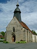
miles (45 km) southeast of Bourges, at the junction of the D91 and the D76 roads. The church of St. Roch, dating from the twelfth century The sixteenth-century...
2 KB (139 words) - 18:43, 15 February 2024

miles (34 km) northeast of Rouen at the junction of the D130 and the D76 roads. The church of Notre-Dame, dating from the eleventh century. An old stone...
2 KB (121 words) - 18:19, 16 February 2023

situated 25 km (16 mi) south of Abbeville, at the junction of the D193 and D76 roads. War Memorial twelfth century church Communes of the Somme department...
2 KB (120 words) - 14:20, 30 August 2022
river Varenne in the Pays de Caux, at the junction of the D15, the D76 and the D154 road, some 16 miles (26 km) south of Dieppe. The church of St. Hellier...
2 KB (150 words) - 01:10, 16 October 2022
It lies by the intersection of the two major state roads. (D60 Split - Lovreć - Imotski and D76 Baška Voda - Sveti Ilija Tunnel - Zagvozd - Grubine)...
8 KB (841 words) - 21:37, 4 August 2024

Vienne river in the Pays de Caux, at the junction of the D23 and the D76 roads, some 14 miles (23 km) south of Dieppe. The church of St.Médard, dating...
2 KB (113 words) - 12:35, 23 September 2022

the river Scie in the Pays de Caux at the junction of the D3 and the D76 roads, some 11 miles (18 km) south of Dieppe . The church of Notre-Dame, dating...
2 KB (117 words) - 12:23, 23 September 2022
20 miles (32 km) south of Dieppe, at the junction of the D100 and the D76 roads. The church of St.Jean, dating from the eighteenth century. The manorhouse...
2 KB (120 words) - 12:22, 4 December 2022