DTED (or Digital Terrain Elevation Data) is a standard of digital datasets which consists of a matrix of terrain elevation values, i.e., a Digital Elevation...
3 KB (280 words) - 00:48, 2 October 2024

unprecedented accuracy according to better than DTED Level 2 specifications. WorldDEM resolution will correspond to DTED Level 3 (post spacing of better than 12...
5 KB (380 words) - 13:58, 25 May 2024
is split into 33 tiles stored in the USGS DEM file format. According to DTED and USGS DEM the absolute vertical accuracy of GTOP30 varies from ±30 meters...
6 KB (128 words) - 21:28, 14 September 2023

Supported GDAL Raster Formats". Gdal.org. 2013-11-18. Retrieved 2014-01-20. "DTED - Military Elevation Data". Gdal.org. Retrieved 2014-01-20. "Various Supported...
15 KB (1,169 words) - 10:52, 16 November 2022
skydio.com/hc/en-us/articles/23710736220699-How-to-use-Crosshair-Coordinates-DTED-on-Skydio-X10D. {{cite web}}: Missing or empty |title= (help) "USAID Delivers...
20 KB (2,048 words) - 08:00, 29 September 2024

and full GIS electronic maps. Automatic operation and high speed AHC using DTED Level II (30 meters between elevation points) to enhance accuracy of weapon...
7 KB (786 words) - 15:46, 25 August 2024
orthonormalized using the National Geospatial-Intelligence Agency (NGA)'s DTED. CIB is RPF and NITF compliant. (Source: FAS) Controlled Image Base (NGA...
1 KB (84 words) - 17:01, 15 February 2024

Terrain cartography Terrain rendering Bathymetric Attributed Grid (BAG) DTED DIMAP Sentinel 1 ESA data base SDTS DEM USGS DEM I. Balenovic, H. Marjanovic...
30 KB (3,235 words) - 10:40, 4 July 2024
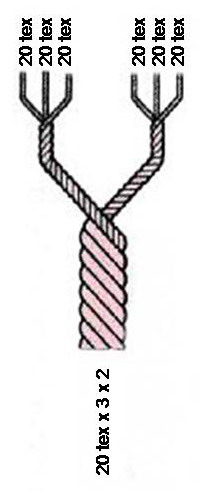
314.9 ÷ NeC 7,972.3 ÷ NeK 17,439 ÷ NeS grams per 9,000 m gr/yd tex ÷ 70.86 dted ÷ 708.6 den ÷ 673.7 gr/yd 23.33 ÷ NeL 14.1 ÷ Nm 8.33 ÷ NeC 12.5 ÷ NeK 27...
30 KB (3,585 words) - 04:07, 26 August 2024
Control System software (with Swiss maps, digital terrain elevation data (DTED), and Geofencing) DJI Mavic 2 Enterprise Advanced China Mini-UAV, Multicopter...
134 KB (3,632 words) - 12:18, 27 September 2024
text file giving corner coordinate, raster cells per unit, and rotation DTED – Digital Terrain Elevation Data KML – Keyhole Markup Language, XML-based...
130 KB (14,128 words) - 15:33, 30 September 2024
Earth elevation model at 30 arc seconds, delivered in the USGS DEM format DTED – National Geospatial-Intelligence Agency (NGA)'s Digital Terrain Elevation...
23 KB (2,986 words) - 22:26, 6 January 2024

Simulations Digital Terrain Elevation Data (DTED) Level - 1 for Aircraft Simulations Digital Terrain Elevation Data (DTED) Level - 2 for Aircraft Simulations...
79 KB (10,037 words) - 08:00, 25 August 2024
the areas of science, technology, engineering, politics, and economics. DTED (Digital Terrain Elevation Data) map collection [from The National Geospatial-Intelligence...
3 KB (360 words) - 04:34, 31 July 2024
(i) Digital Terrain Data DTE – (i) Data Terminal Equipment – Down To Earth DTED – (p) Digital Terrain Elevation Data ("dee-ted") DTG – (i) Date-Time Group...
33 KB (3,312 words) - 07:50, 26 September 2024
? ? ? SketchUp Make Yes Yes ? ? ? ? SKP+KMZ SKP+KMZ SketchUp Pro Yes Yes ? ? ? ? SKP+KMZ SKP+KMZ E-on Vue Yes Yes ? Yes ? ? DTED Wings3D ? ? ? ? ? ?...
67 KB (661 words) - 08:58, 26 September 2024
the merger of the Minnesota Department of Trade and Economic Development (DTED) and the Minnesota Department of Economic Security (MDES). The Business and...
4 KB (316 words) - 17:30, 1 December 2021
Out-of-the-box, Grome has the default plugins to include support for COLLADA, XML, DTED, shape files, 16bit RAW, BT and all major images formats. Grome 3.0 is currently...
8 KB (911 words) - 18:31, 19 March 2022
the year. Taking different resolutions of Digital Terrain Elevation Data – DTED as input, PREDICTion computes the theoretical performance of ATC surveillance...
13 KB (1,177 words) - 21:07, 24 June 2024
for common GIS data formats including: ArcINFO/ArcView, MapInfo, GeoTIFF, DTED/CDED, BIL, SRTM, WMO-GRIB, Surfer The watershed basin and stream delineation...
3 KB (341 words) - 22:32, 28 December 2017
Advanced weapon simulation is augmented by digital terrain elevation data (DTED) and geometric ranging. Data communication and data transmission upgrades...
14 KB (1,645 words) - 09:15, 31 January 2024
primary, secondary and tertiary school teachers. Diploma in Teacher Education (DTEd) Bachelor of Science in Education(BSc.Ed) Bachelor of Art in Education (BA...
2 KB (226 words) - 16:40, 22 June 2024
Synthetic human-made environment Glossary of military modeling and simulation DTED Topographic Engineering Center National Geospatial-Intelligence Agency "MSDO...
9 KB (1,004 words) - 20:41, 30 July 2024
Raster. SOCET SET has the ability to read terrain data formats, including: DTED, USGS DEM, ASCII (user-defined), LIDAR LAS, ArcGrid, SDTS, NED, GSI, GeoTIFF...
7 KB (907 words) - 03:35, 28 July 2024