
The Dreiherrnspitze (Italian: Picco dei Tre Signori), at 3,499 m (11,480 ft) above mean sea level, is a mountain on the tripoint between the Austrian...
4 KB (364 words) - 16:51, 14 July 2024

705 metres, 8,875 ft), the Hochfeiler (3,509 metres, 11,512 ft), the Dreiherrnspitze (3,499 metres, 11,480 ft), the Hochgall (3,436 metres, 11,273 ft),...
74 KB (7,676 words) - 15:00, 4 September 2024

The Dreiherrnspitze from the west in the year 1890...
14 KB (825 words) - 17:15, 14 July 2024
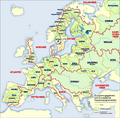
junction. The ca 130 km long Ahr->Rienz->Eisack originating under the Dreiherrnspitze joins the 409 km long Adige/Etch 103 km below the latter's nominal...
261 KB (9,219 words) - 01:56, 3 September 2024

837 ft) Prominence 3,303-2,620 m ↓ Schütttaler Joch Isolation 12.2 km → Dreiherrnspitze Listing Alpine mountains above 3000 m Coordinates 47°08′21″N 12°06′38″E...
3 KB (215 words) - 16:52, 14 July 2024

attains 3,510 metres in the Hochfeiler. But, a little farther, at the Dreiherrnspitze (3,499 m), the chain splits: the main watershed between the Black Sea...
12 KB (1,854 words) - 02:50, 9 August 2024

The Dreiherrnspitze, on the Austrian-Italian border...
4 KB (248 words) - 17:15, 14 July 2024
Dreiherrnspitze 3499 ET/Sb/ST Venediger Group Hohe Tauern 47°04′09″N 12°14′27″E / 47.06917°N 12.24083°E / 47.06917; 12.24083 (20. Dreiherrnspitze...
93 KB (777 words) - 22:15, 28 July 2023

Bern/Uri CH 1841 141 Dreiherrnspitze 3499 581 47°04′09″N 12°14′27″E / 47.06917°N 12.24083°E / 47.06917; 12.24083 (141. Dreiherrnspitze (3499 m)) Venediger...
109 KB (1,721 words) - 23:03, 29 September 2024
Valley 1866 Dreiherrnspitze 3,499 11,480 581 1,906 47°04′09″N 12°14′27″E / 47.06917°N 12.24083°E / 47.06917; 12.24083 (140. Dreiherrnspitze (3499 m))...
127 KB (690 words) - 12:17, 6 September 2024
Cevedale, Monte Cristallo, Nesthorn, Tschingelhorn, Vertainspitze 1866 Dreiherrnspitze, Gross Litzner, Monte Zebrù, Piz Cengalo, Piz Platta, Piz Palü (1868...
4 KB (450 words) - 11:27, 22 May 2022

473 m (AA) (11,394 ft) Prominence 102 m ↓ Umbalscharte Isolation 1.6 km → Dreiherrnspitze Coordinates 47°04′21″N 12°15′36″E / 47.0725°N 12.26°E / 47.0725;...
8 KB (852 words) - 16:53, 14 July 2024
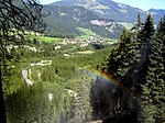
(Krimmler Achental) with its extended mountain pastures leads up to the Dreiherrnspitze peak at 3,499 m (11,480 ft), part of the Venediger Group subrange in...
6 KB (503 words) - 22:13, 2 April 2020

ranges of the Central Eastern and Northern Limestone Alps east of the Dreiherrnspitze peak. The Noric Alps were considered the major northern range of the...
6 KB (618 words) - 16:58, 11 April 2024