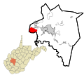
Dry Branch is an unincorporated community in Kanawha County, West Virginia, United States. Dry Branch is 3 miles (4.8 km) southwest of East Bank, along...
3 KB (112 words) - 04:51, 24 July 2023
Dry Branch, West Virginia, an unincorporated community in Kanawha County, West Virginia Dry Branch (Cypress Creek), a stream in Missouri Dry Branch (Indian...
881 bytes (148 words) - 14:32, 9 August 2021
Mountain in Patrick County, Virginia and then flows south-southeast to join Birds Branch about 1 mile west-northwest Ararat. Dry Run drains 0.57 square miles...
5 KB (151 words) - 03:12, 16 May 2023
state of West Virginia. List of West Virginia rivers includes streams formally designated as rivers. There are also smaller streams (i.e., branches, creeks...
27 KB (2,030 words) - 04:05, 9 May 2024
Creek Dry Branch Maggotty Creek North Fork Stinking River West Fork Stinking River Shockoe Creek Whitethorn Creek Dry Branch Georges Creek Dry Branch Mill...
36 KB (2,547 words) - 16:45, 3 May 2024
Pennsylvania Dry Run (West Branch Susquehanna River tributary) in Pennsylvania Dry Fork (Cheat River tributary), or Dry Run, in West Virginia Dark Waters...
2 KB (225 words) - 17:49, 15 March 2021
mouth lies east of Green Spring, Hampshire County, West Virginia, where it meets the North Branch Potomac River to form the Potomac. The Native Americans...
14 KB (1,045 words) - 14:52, 13 January 2024
Shenandoah River (category Rivers of West Virginia)
approximately 100 miles (160 km) long each, in the U.S. states of Virginia and West Virginia. The river and its tributaries drain the central and lower Shenandoah...
18 KB (1,770 words) - 12:03, 25 June 2024
Mile Branch Straight Branch Coon Branch Apple Grove, West Virginia Atwell, West Virginia Avondale, West Virginia Bartley, West Virginia Beartown, West Virginia...
4 KB (312 words) - 04:29, 21 June 2022
S. state of West Virginia. As of the 2020 census, the population was 6,143, making it the second-least populous county in West Virginia. Its county seat...
27 KB (2,209 words) - 02:04, 10 May 2024
Pendleton County, West Virginia, United States. The community lies along U.S. Highway 220 at the confluence of Reeds Creek and the South Branch Potomac River...
6 KB (302 words) - 02:10, 3 June 2024
is a tributary of the Kanawha River, 22.7 miles (36.5 km) long, in West Virginia in the United States. Via the Kanawha and Ohio rivers, it is part of...
6 KB (329 words) - 17:10, 1 April 2024
state of West Virginia is a major north–south Interstate Highway. It extends for 187.21 miles (301.29 km) between Bluefield at the Virginia state line...
55 KB (4,954 words) - 02:18, 31 January 2024
Branch Potomac River flows from Fairfax Stone in West Virginia to its confluence with the South Branch Potomac River near Green Spring, West Virginia...
9 KB (516 words) - 13:12, 29 November 2023
and Western) network and the Dry Branch of the Tug Fork river. U.S. Geological Survey Geographic Names Information System: Garland, West Virginia v t e...
2 KB (66 words) - 05:40, 25 July 2023
in Pendleton County, West Virginia, United States. Circleville was originally named Zirkleville after John Zirkle, who ran a dry goods store in the town...
4 KB (190 words) - 00:36, 8 June 2024
county in the U.S. state of West Virginia. As of the 2020 census, the population was 180,745, making it West Virginia's most populous county. The county...
32 KB (2,413 words) - 22:42, 7 June 2024
Shepherdstown is a town in Jefferson County, West Virginia, United States, located in the lower Shenandoah Valley along the Potomac River. Home to Shepherd...
24 KB (2,349 words) - 20:10, 27 April 2024
Clarksburg is a city in and the county seat of Harrison County, West Virginia, United States, in the north-central region of the state. The population...
63 KB (6,055 words) - 02:32, 10 July 2024
Sand Creek, Dry Branch, Browns Branch, Swift Shoals Branch, Walker Branch, Fowler Branch, Douglas Branch, Green Shoal Creek, and Abbotts Branch. These various...
11 KB (1,174 words) - 03:54, 9 September 2023
River. Dry Branch is also part of Atenville. Captain Henry Farley, a veteran of the Revolutionary War and resident of Montgomery County, Virginia, was the...
5 KB (372 words) - 21:52, 21 July 2023
Virginia, officially the Commonwealth of Virginia, is a state in the Southeastern and Mid-Atlantic regions of the United States between the Atlantic Coast...
299 KB (26,629 words) - 19:02, 12 July 2024
34.3-mile-long (55.2 km) river in the Allegheny Mountains of eastern West Virginia, USA. Via the Black Fork, it is a principal tributary of the Cheat River...
14 KB (1,223 words) - 14:31, 12 January 2024
Smoke Hole Canyon (category Canyons and gorges of West Virginia)
(32 km) long gorge carved by the South Branch Potomac River in the Allegheny Mountains of eastern West Virginia, United States. The area is rather isolated...
45 KB (6,060 words) - 12:23, 9 November 2023
influenced by the dry Sahara to the north and east, which provides dry winds during the Harmattan, as well as the Atlantic Ocean to the south and west, which provides...
98 KB (11,749 words) - 21:54, 12 July 2024
Dolly Sods Wilderness (category Campgrounds in West Virginia)
Sods) is a U.S. Wilderness Area in the Allegheny Mountains of eastern West Virginia and is part of the Monongahela National Forest of the U.S. Forest Service...
35 KB (4,445 words) - 18:53, 11 April 2024
Upper Falls, is a census-designated place (CDP) in Kanawha County, West Virginia, United States. Four agencies of the United States government determine...
28 KB (2,980 words) - 22:19, 10 November 2023
highway in the U.S. state of Virginia. The state highway runs 18.04 miles (29.03 km) from SR 902 and SR 924 near Briery Branch east to Interstate 81 (I-81)...
7 KB (517 words) - 01:11, 17 April 2024
Clarke's Gap (redirect from Clarks Gap, Virginia)
created by the drainage of Dry Mill Branch of Tuscarora Creek to the east and an unnamed tributary of Catoctin Creek to the west. The original road between...
3 KB (241 words) - 19:43, 16 May 2024
Opequon Creek (category Rivers of Berkeley County, West Virginia)
Sylvan Run Three Run Goose Creek Middle Creek Hopewell Run Dry Run Buzzard Run Sulphur Spring Branch Spa Run Cold Spring Run Evens Run Tuscarora Creek Eagle...
5 KB (526 words) - 23:07, 17 April 2024


