The Fort Resolution Highway, officially Northwest Territories Highway 6, is a highway following the shore of Great Slave Lake from the Buffalo River Junction...
2 KB (134 words) - 07:16, 7 January 2024
on the shores of Great Slave Lake, and at the end of the Fort Resolution Highway (Highway 6). It is the headquarters of the Deninu Kųę́ First Nation...
18 KB (1,283 words) - 16:55, 16 August 2024
all-weather highway network are: Behchoko (Rae-Edzo) Dettah Enterprise Fort Liard Fort McPherson Fort Providence Fort Resolution Fort Simpson Fort Smith Hay...
13 KB (216 words) - 19:55, 2 July 2024
The Fort Smith Highway, officially Northwest Territories Highway 5, is a highway in Canada's Northwest Territories. Completed in 1966, the highway travels...
2 KB (135 words) - 21:25, 2 July 2024

highway system through a 1991 resolution. K-242 was a short spur route that served Fort Larned National Historic Site in Pawnee County. The highway began...
203 KB (17,757 words) - 22:09, 4 August 2024

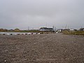
south shore of Great Slave Lake between the towns of Hay River and Fort Resolution in the Northwest Territories of Canada. It was built to serve the work...
13 KB (980 words) - 15:19, 17 March 2024

by Fort Scott and the section from the south end of the US-169 overlap by Osawatomie north to US-59 in Atchison is included in the National Highway System...
39 KB (3,010 words) - 01:04, 5 August 2024
States portal U.S. roads portal 1926 Arkansas state highway numbering Map note: Added by Resolution 4/12/40 86-S-3 7.0 Map note: Number Assigned May 28...
244 KB (1,779 words) - 09:22, 17 August 2024
U.S. Route 421 in North Carolina (redirect from Oscar A. Keller Jr Highway)
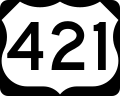
Route 421 (US 421) is part of the United States Numbered Highway System that runs from Fort Fisher, North Carolina to Michigan City, Indiana. In the U...
49 KB (3,479 words) - 19:58, 27 August 2024

U.S. Route 287 (redirect from United States Highway 287)
truck route between Dallas-Fort Worth and Amarillo, Texas, and between Fort Collins, Colorado, and Laramie, Wyoming. The highway is broken into two segments...
24 KB (2,695 words) - 07:09, 23 May 2024

junction with Highway 2 west of Fort Macleod. Briefly concurrent with Highway 2, it becomes a divided highway and part of Alberta's "Export Highway", a segment...
77 KB (7,430 words) - 05:42, 27 August 2024

Dallas Fort Worth International Airport (IATA: DFW, ICAO: KDFW, FAA LID: DFW) is the primary international airport serving the Dallas–Fort Worth metroplex...
116 KB (7,502 words) - 04:06, 20 August 2024
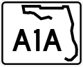
Florida State Road A1A (redirect from Fort Lauderdale Beach Boulevard)
Ormond Scenic Loop and Trail, a Florida Scenic Highway. It is also called the Indian River Lagoon Scenic Highway from State Road 510 at Wabasso Beach to U...
60 KB (2,508 words) - 16:14, 27 August 2024

and included Fort Worth, Fort Graham, Fort Gates, Fort Croghan, Fort Martin Scott, Fort Lincoln, and Fort Duncan. Originally, 10 forts had been proposed...
147 KB (13,174 words) - 18:15, 8 August 2024

areas are located along the highway as far as the Fort Simpson Airport, just beyond which is the Liard River ferry crossing. Fort Simpson was first started...
38 KB (1,863 words) - 02:51, 22 July 2024
Tamiami Trail (redirect from U.S. Highway 94)
Highway. At a subsequent meeting in Orlando, on June 10, 1915, of what became the Central Florida Highway Association, Perry introduced a resolution which...
27 KB (3,036 words) - 03:14, 17 April 2024
U.S. Route 270 (redirect from United States Highway 270)
Oklahoma. After leaving the Panhandle and picking up US 183 near Fort Supply, the highways turn southwest towards Woodward. US 412 splits away in Woodward...
33 KB (1,700 words) - 19:12, 24 August 2024

Interstate 95 (redirect from Interstate Highway 95)
and Fort Lauderdale, SunPass express lanes pass over the highway. Before 1987, a notable gap in the highway existed between West Palm Beach and Fort Pierce;...
58 KB (5,212 words) - 07:03, 29 August 2024

56–57. State Highway Commission of Kansas (October 15, 1957). "Resolution for Redesignation of Road in Linn County". Topeka: State Highway Commission of...
16 KB (1,516 words) - 22:07, 4 August 2024

former Ozark Trails and Kansas City-Fort Scott-Miami-Tulsa Short Line. K-52 was first established as a state highway on January 7, 1937, and went from K-38...
20 KB (1,751 words) - 01:03, 5 August 2024

California State Route 20 (redirect from California State Highway 20)
Legislature. Statutes of California (Resolution). State of California. Ch. 46 p. 1520. Oakland Tribune, Highway Commission Lays Plans for Building Lake...
25 KB (2,222 words) - 05:39, 26 February 2024

State Highway Commission of Kansas (November 12, 1999). "Resolution Designating City Connecting Links in State Highway System". Topeka: State Highway Commission...
17 KB (1,121 words) - 14:43, 8 March 2024

State Highway Commission of Kansas (June 12, 1964). "Resolution for relocation and redesignation of road in Clay County". Topeka: State Highway Commission...
11 KB (955 words) - 01:04, 5 August 2024

council adopted a resolution in 1823 calling for a fort further up the Athabasca River to reduce transport times. Under the new plan, Fort Assiniboine on...
20 KB (1,619 words) - 15:07, 7 October 2023

U.S. Route 81 in Kansas (redirect from K-226 (Kansas highway))
U.S. Route 81 (US-81) is a part of the U.S. Highway System that travels from Fort Worth, Texas to the Pembina–Emerson Border Crossing near Pembina, North...
17 KB (1,292 words) - 01:45, 5 August 2024

United States Bullion Depository (redirect from Fort Knox Bullion Depository)
Bullion Depository, often known as Fort Knox, is a fortified vault building located next to the United States Army post of Fort Knox, Kentucky. It is operated...
46 KB (4,921 words) - 12:08, 13 June 2024

back of the Municipal Hall of Pikit. on a hill facing the National Highway. Fort Pikit was built in 1893 by the Spanish at the time the Spanish colonial...
7 KB (450 words) - 09:24, 9 July 2024

State Highway System Log" (PDF). Phoenix: Arizona Department of Transportation. Retrieved October 18, 2018. Staff. "ADOT Right-of-Way Resolution 1972-P-082"...
49 KB (3,403 words) - 20:01, 2 July 2024

U.S. Route 41 in Michigan (redirect from U.S. Highway 41 (Michigan))
community along the highway is Copper Harbor at the tip of the Keweenaw Peninsula. The trunkline ends at a cul-de-sac east of Fort Wilkins State Park after...
83 KB (8,651 words) - 01:43, 5 August 2024
CANAMEX Corridor (section Highway)
Highway 201 through Calgary Highway 2 – Calgary to Fort Macleod Highway 3 – Fort Macleod to Lethbridge Highway 4 – Lethbridge to the Sweetgrass–Coutts Border...
10 KB (987 words) - 17:20, 8 June 2024