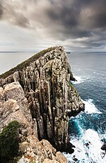
Frederick Henry Bay is a body of water in the southeast of Tasmania, Australia. It is located to the east of the South Arm Peninsula, and west of the...
7 KB (697 words) - 16:52, 22 April 2024
(1918), Frederick Henry (North Bay) and Norfolk Bays, Admiralty, retrieved 8 June 2015 United States. Hydrographic Office, Frederick Henry (North Bay) and...
2 KB (191 words) - 10:30, 28 May 2022
American baseball player and manager, born Frederick Marshall Henry Frederick Henry Bay, in Tasmania This disambiguation page lists articles about people...
1 KB (164 words) - 18:29, 12 January 2025

sea-side locality that lies at the northern channel between Frederick Henry Bay and Norfolk Bay. Though primarily a holiday home community, it has a large...
5 KB (346 words) - 17:57, 25 July 2024
on water activities. With its reputation for beautiful beaches (Frederick Henry Bay,Tiger Head Beach, Red Ochre Beach, Carlton Beach, Okines Beach),...
5 KB (337 words) - 13:31, 2 November 2024
by water; to the north by Norfolk Bay, to the northwest by Frederick Henry Bay, to the west and south by Storm Bay, and to the east by the Tasman Sea...
10 KB (1,112 words) - 17:41, 24 May 2024

reaching into the tidal flatland area of Lauderdale (between Ralphs Bay and Frederick Henry Bay). Hobart has access to a number of beach areas including those...
144 KB (12,996 words) - 05:23, 28 January 2025
Seven Mile Beach was gazetted as a locality in 1966. The waters of Frederick Henry Bay form most of the southern boundary, and Pitt Water the eastern and...
4 KB (233 words) - 18:05, 25 July 2024
Sloping Main. Slopen Mane is a confirmed locality. The waters of Frederick Henry Bay form the western to north-eastern boundaries. Route C341 (Coal Mine...
3 KB (167 words) - 18:06, 25 July 2024
Norfolk Bay is a body of water in the south east of Tasmania, Australia. The north west aspect of Norfolk Bay is continuous with Frederick Henry Bay. The...
7 KB (620 words) - 02:45, 30 December 2024
Carlton. Carlton was gazetted as a locality in 1967. The shore of Frederick Henry Bay, known as Carlton Beach, is the southern boundary. The C334 route...
3 KB (175 words) - 16:45, 25 July 2024

Frederick Bernard Henry (April 11, 1943 – December 3, 2024) was the seventh bishop of the diocese of Roman Catholic Diocese of Calgary, in the province...
10 KB (905 words) - 21:19, 8 December 2024

gummy sharks tend to travel to is Frederick Henry Bay for a brief time. This is beneficial since Frederick Henry Bay has a more stable salinity level compared...
26 KB (3,374 words) - 22:04, 15 November 2024

mainland. It faces Ralphs Bay, and the majority of Lauderdale's population live along Roches Beach, which faces Frederick Henry Bay. Along with nearby Seven...
4 KB (461 words) - 12:41, 12 September 2024
area he named Frederick Henricx Bay (made up of what is now called Blackman Bay, Marion Bay and North Bay). The name Frederick Henry Bay was mistakenly...
7 KB (610 words) - 20:13, 24 December 2024
in 1887 and closed in 1972. The waters of Ralphs Bay form the western boundary, and Frederick Henry Bay most of the southern and eastern. Route B33 (South...
4 KB (273 words) - 12:40, 12 September 2024

the Coal River and connected to the Tasman Sea via Barilla Bay and the Frederick Henry Bay. The area is characterised by tidal flats, saltmarshes, and...
8 KB (757 words) - 16:17, 27 January 2025
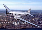
authorised weight. The takeoff was into a light southerly wind towards Frederick Henry Bay and the sea. Observers at the aerodrome reported that the takeoff...
44 KB (5,614 words) - 22:15, 27 January 2025

Contrariety. The beach is 2.1 km long and faces south-southeast into Storm Bay exposing it to all southerly swell. Waves average 1-1.5 m and maintain a...
3 KB (302 words) - 23:01, 27 March 2024
Major General Frederick Henry Baddeley (4 December 1794 – 4 May 1879), born Frederick Henry Clinton-Baddeley, youngest son of Sir Henry Clinton and his...
9 KB (681 words) - 23:40, 20 March 2023
median personal income in Tasmania, at $749 per week. The waters of Frederick Henry Bay form the eastern boundary, while Pipe Clay Lagoon forms most of the...
4 KB (235 words) - 16:51, 25 July 2024

the long-running comic strip Fatty Finn. Syd Nicholls was born in Frederick Henry Bay, Tasmania on 20 December 1896, the son of a watchmaker Hubert George...
10 KB (1,113 words) - 14:56, 30 September 2024
the south bordered by Ralph's Bay, to Seven Mile Beach and the Pitt Water in the east, bordered by Frederick Henry Bay, to the Municitpality of Sorell...
64 KB (7,091 words) - 13:29, 5 October 2024

Chesapeake Bay, both at Baltimore and what became Washington, D.C., and across the Appalachian Mountains to the Ohio River watershed. Frederick is home to...
90 KB (8,516 words) - 07:17, 26 January 2025
locality in 1958. It was named for an early settler. The waters of Frederick Henry Bay form the eastern boundary. Route C330 (Acton Road) passes to the...
3 KB (190 words) - 18:01, 25 July 2024

Frederick Funston Henry (September 23, 1919 – September 1, 1950) was a United States Army officer and a posthumous recipient of the United States military's...
7 KB (749 words) - 15:24, 11 June 2023
defined by the peninsula to the west, while Storm Bay lies to the south of the peninsula, Frederick Henry Bay to the east side that separates from the Tasman...
2 KB (208 words) - 10:08, 16 March 2022

d'Entrecasteaux's choice of the location to investigate. An inset map of Frederick Henry Bay, the place recommended by Peyroux for a settlement, was included...
19 KB (2,500 words) - 14:15, 20 November 2024
hectares (0.86 acres), part of the Sloping Island Group, lying in the Frederick Henry Bay, close to the south-eastern coast of Tasmania, Australia. The island...
4 KB (106 words) - 22:17, 23 September 2022

Frederick Henry Piesse, CMG (6 December 1853 – 29 June 1912) was a farmer, businessman and politician who is credited with much of the early development...
8 KB (834 words) - 03:49, 10 January 2024