Geodetic astronomy or astronomical geodesy (astro-geodesy) is the application of astronomical methods into geodetic networks and other technical projects...
4 KB (425 words) - 23:24, 14 January 2024


orientation to the geographic north is achieved through methods of geodetic astronomy. The principal instruments used are theodolites and tacheometers,...
7 KB (718 words) - 14:11, 14 May 2024
Satellite geodesy (redirect from Space geodetic techniques)
PAGEOS Seasat Starlette and Stella TOPEX/Poseidon TRANSIT WESTPAC Geodetic astronomy Satellite gravimetry Seeber, Gunter (2003). Satellite geodesy. Berlin...
21 KB (2,340 words) - 17:44, 23 August 2024

The United States Coast and Geodetic Survey (abbreviated USC&GS; known as the Survey of the Coast from 1807 to 1836, and as the United States Coast Survey...
103 KB (11,237 words) - 16:16, 11 August 2024

disappearing from the surface and beneath or above the surface of the Earth. Geodetic astronomy is the application of astronomical methods into networks and technical...
33 KB (3,874 words) - 06:56, 30 August 2024

systems of Gauss–Krüger are defined by ED50 and oriented by means of geodetic astronomy. Up to now it has been used in databases of gravity fields, cadastre...
8 KB (927 words) - 23:56, 8 June 2024
Apparent place (section Astronomy)
Astrometry Celestial navigation Coordinated Universal Time dUT1 Geodetic astronomy Meridian circle Solar time Star position Zenith camera Seidelmann...
4 KB (588 words) - 17:43, 16 February 2023

binary Barycentric celestial reference system Ephemeris Equatorium Geodetic astronomy Gaia spacecraft — launched December 2013 Hipparcos Space Astrometry...
18 KB (1,895 words) - 19:52, 17 July 2024
The Struve Geodetic Arc is a chain of survey triangulations stretching from Hammerfest in Norway to the Black Sea, through ten countries and over 2,820...
12 KB (1,365 words) - 20:02, 19 June 2024

Azimuth (redirect from Geodetic bearing)
in the signed range -180° to +180°. The concept is used in navigation, astronomy, engineering, mapping, mining, and ballistics. The word azimuth is used...
14 KB (1,766 words) - 20:53, 24 July 2024

coordinate systems used in spherical astronomy. An example of Earth-centered frame Earth-centered inertial (ECI) Geodetic system International Terrestrial...
9 KB (904 words) - 20:32, 10 September 2024
Glaciology Hydrogeology Marine geology Geodesy Cartography Earth's orbit Geodetic astronomy Geomatics Gravity of Earth Planetary geodesy Remote sensing Geopositioning...
21 KB (2,959 words) - 10:11, 14 March 2024

Geographic coordinate system (section Geodetic datum)
A geographic coordinate system (GCS) is a spherical or geodetic coordinate system for measuring and communicating positions directly on Earth as latitude...
22 KB (2,491 words) - 15:04, 9 September 2024

life Nature Geodesy Cartography Computer cartography Earth's orbit Geodetic astronomy Geomatics Gravity Navigation Remote Sensing Geopositioning Virtual...
57 KB (5,983 words) - 21:00, 12 August 2024

Earth ellipsoid (section Geodetic coordinates)
modern satellite geodesy or the analysis and interconnection of continental geodetic networks. Amongst the different set of data used in national surveys are...
19 KB (2,379 words) - 05:58, 11 September 2024

Practical Navigator Celestial pole Circle of equal altitude Ephemeris Geodetic astronomy GNSS Satellite navigation History of longitude List of proper names...
39 KB (5,086 words) - 02:20, 15 June 2024

coordinates, Ecliptic coordinates annual aberration, improper motion Geodetic astronomy, transit instruments F.W.A. Argelander (1863). Bonner Sternverzeichnis...
4 KB (394 words) - 20:41, 24 September 2023

1867 worked in the United States Coast Survey, where he worked in geodetic astronomy and was in charge of the longitude department. He developed and organized...
10 KB (1,070 words) - 21:43, 1 December 2023

Lunar distance (redirect from Lunar distance (astronomy))
L}} ), or Earth–Moon characteristic distance, is a unit of measure in astronomy. More technically, it is the semi-major axis of the geocentric lunar orbit...
40 KB (4,225 words) - 01:45, 17 August 2024

Longitude (redirect from Ls (astronomy))
from the ground at that location. Longitude is generally given using the geodetic normal or the gravity direction. The astronomical longitude can differ...
35 KB (4,153 words) - 15:34, 20 July 2024

Yrjö Väisälä (category Astronomy-optics society)
contributions were in the field of optics. He was also active in geodetics, astronomy and optical metrology. He had an affectionate nickname of Wizard...
21 KB (1,192 words) - 04:33, 1 September 2024

life Nature Geodesy Cartography Computer cartography Earth's orbit Geodetic astronomy Geomatics Gravity Navigation Remote Sensing Geopositioning Virtual...
48 KB (5,000 words) - 22:03, 14 August 2024
mechanics of heaven. In his work he dealt with issues concerning geodetic astronomy. [citation needed] In 1979, the International Astronomical Union named...
2 KB (275 words) - 11:44, 30 June 2023
important scientists in geodetic astronomy and in electronic navigation. In the 1950s Ramsayer became professor at the Geodetic Institute of the University...
3 KB (399 words) - 22:29, 11 December 2023

Atmospheric refraction (redirect from Geodetic refraction)
optics to reduce this effect. Terrestrial refraction, sometimes called geodetic refraction, deals with the apparent angular position and measured distance...
30 KB (3,728 words) - 06:38, 8 February 2024

The geodetic effect (also known as geodetic precession, de Sitter precession or de Sitter effect) represents the effect of the curvature of spacetime...
9 KB (1,471 words) - 18:37, 17 February 2024

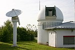
Roble Observatory Manuel Foster Observatory TIGO (Transportable Integrated Geodetic Observatory) Giant Magellan Telescope (GMT) to be located at Las Campanas...
20 KB (1,838 words) - 06:50, 15 June 2024
published on geodesy and photogrammetry, with additional contributions to geodetic astronomy and the development of clocks. He held multiple positions within the...
13 KB (1,368 words) - 17:29, 10 June 2024

body that is roughly spherical. In spatial (3D) geometry, as applied in astronomy, the equator of a rotating spheroid (such as a planet) is the parallel...
32 KB (2,392 words) - 07:39, 30 June 2024