
Honduras is a country in Central America. Honduras borders the Caribbean Sea and the North Pacific Ocean. Guatemala lies to the west, Nicaragua south east...
42 KB (4,017 words) - 08:34, 11 September 2024

Mosquitia is the easternmost part of Honduras along the Mosquito Coast, which extends into northeastern Nicaragua. It is a region of tropical rainforest, pine...
7 KB (770 words) - 06:06, 11 July 2024

Honduras, officially the Republic of Honduras, is a country in Central America. It is bordered to the west by Guatemala, to the southwest by El Salvador...
146 KB (15,172 words) - 22:20, 5 October 2024

Category:Culture of Honduras Category:Economy of Honduras Category:Education in Honduras Category:Environment of Honduras Category:Geography of Honduras Category:Government...
10 KB (1,083 words) - 01:23, 26 June 2024
See ISO 3166-2:HN Internet country code top-level domain: .hn Geography of Honduras Honduras is: a country Location: Northern Hemisphere and Western Hemisphere...
13 KB (775 words) - 18:43, 22 September 2024

Geography of El Salvador Geography of Guatemala Geography of Honduras Geography of Nicaragua Geography of Panama Geography of Greenland Geography of the...
31 KB (3,424 words) - 17:59, 3 August 2024

The economy of Honduras is based mostly on agriculture, which accounts for 14% of its gross domestic product (GDP) in 2013. The country's leading export...
86 KB (11,097 words) - 01:39, 9 October 2024
Hondurans (Spanish: Hondureños; also called catrachos) are the citizens of Honduras. Most Hondurans live in Honduras, although there is also a significant...
24 KB (2,434 words) - 12:01, 1 October 2024
Pacific coast (category Coastal geography)
of Canada Geography of Costa Rica Geography of El Salvador Geography of Guatemala Geography of Honduras Pacific Coast of Mexico Geography of Nicaragua...
4 KB (461 words) - 07:59, 16 January 2024
Honduras observes Central Standard Time (UTC−6) year-round. Daylight saving time was used in 1987, 1988, and 2006. President Manuel Zelaya advanced the...
3 KB (218 words) - 15:54, 2 June 2024
Honduras Geography of Honduras History of Honduras ISO 3166-1 alpha-2 country code for Honduras: HN ISO 3166-1 alpha-3 country code for Honduras: HND ISO...
5 KB (533 words) - 12:11, 30 October 2023

flora and fauna of Honduras reflects the country's geographical location inside the tropics. This has allowed for diverse species of plants and animals...
13 KB (1,183 words) - 03:37, 15 July 2024

Honduras is divided into 18 departments (Spanish: departamentos). Each department is headed by a governor, who is appointed by the President of Honduras...
8 KB (507 words) - 05:57, 13 May 2024
division in Honduras that possess local government. Each municipality has its own elected mayor as opposed to the appointed governors of departments....
71 KB (211 words) - 08:39, 3 June 2024

British Honduras was a Crown colony on the east coast of Central America, south of Mexico, from 1783 to 1964, then a self-governing colony, renamed Belize...
47 KB (6,168 words) - 18:33, 30 September 2024
Honduras was inhabited by many indigenous peoples when the Spanish arrived in the 16th century. The western-central part of Honduras was inhabited by the...
100 KB (12,121 words) - 12:53, 2 October 2024
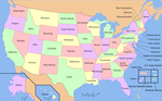
used in the geographical sense, refers to the contiguous United States (sometimes referred to as the Lower 48, including the District of Columbia not...
49 KB (5,624 words) - 16:07, 23 September 2024

Mosquito Coast (redirect from Kingdom of Mosquitia)
Mosquitia or Mosquito Shore) is an area along the eastern coast of present-day Nicaragua and Honduras. It was named after the local Miskito Nation and was long...
63 KB (6,968 words) - 20:57, 27 July 2024

provided as an overview of and topical guide to geography: Geography – study of Earth and its people. an academic discipline – a body of knowledge given to...
86 KB (7,704 words) - 10:03, 27 September 2024
danger of extinction, it has a population of 300 to 594 semi-speakers. Its geographical location is between the western departments of Honduras, as they...
9 KB (689 words) - 14:57, 10 October 2024

Canada has a vast geography that occupies much of the continent of North America, sharing a land border with the contiguous United States to the south...
55 KB (7,024 words) - 11:55, 27 September 2024
municipality in the Honduran department of Atlántida. 2010 Population by Age: "Population Total". Population Department of Honduras. 2010. Archived from...
4 KB (73 words) - 01:37, 19 January 2024

Bay Islands Department (redirect from Bay Islands, Honduras)
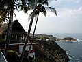
βaˈi.a]) is a group of islands off the Caribbean coast of Honduras. Collectively, the islands form one of the 18 departments of Honduras. The departmental...
35 KB (3,423 words) - 14:27, 26 September 2024

Colón is one of the 18 departments into which Honduras is divided. It was created in 1881. The departmental capital is Trujillo, and the other main city...
7 KB (211 words) - 21:29, 29 July 2024
Caribbean Lowlands (category Geography of Honduras)
Lowlands are region of plains along the eastern coast of several Central American nations along the Caribbean Sea, including Belize, Honduras, Nicaragua, Costa...
3 KB (273 words) - 19:52, 18 May 2024

nation in the Caribbean Sea. It comprises an archipelago of islands centred upon the geographic coordinates 21°3N, 80°00W. Cuba is the principal island...
21 KB (1,823 words) - 10:19, 28 September 2024

Cayman Ridge (category Geography of Honduras)
The Cayman Ridge is an undersea mountain range on the northern margin of the Cayman Trough in the Caribbean Sea. It extends from the Sierra Maestra in...
3 KB (168 words) - 03:05, 26 April 2024

The geography of Mexico describes the geographic features of Mexico, a country in the Americas. Mexico is located at about 23° N and 102° W in the southern...
35 KB (4,562 words) - 14:14, 14 September 2024

west by Mexico, to the east by Belize and by the Gulf of Honduras, to the east by Honduras, to the southeast by El Salvador, and to the south by the...
16 KB (1,224 words) - 01:28, 23 June 2024
between Costa Rica and Honduras. Nicaragua is the largest country in Central America in square kilometers. Nicaragua covers a total area of 130,370 square kilometers...
21 KB (1,777 words) - 23:00, 12 August 2024