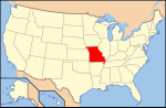
The geology of Missouri includes deep Precambrian basement rocks formed within the last two billion years and overlain by thick sequences of marine sedimentary...
9 KB (1,232 words) - 08:57, 14 July 2024

Ozarks (redirect from Geology of the Ozarks)
Salem, Missouri, makes up the largest geologic area of the Ozarks. The second largest is the Springfield Plateau, named after Springfield, Missouri, nicknamed...
68 KB (6,903 words) - 07:07, 25 August 2024

New Madrid Seismic Zone (category Geology of Missouri)
near Marston, Missouri [U.S. Geological Survey Professional Paper 1538-P]. Washington, DC: U.S. Department of the Interior, U.S. Geological Survey. Potter...
32 KB (3,762 words) - 01:27, 14 July 2024

The Missouri River is a river in the Central and Mountain West regions of the United States. The nation's longest, it rises in the eastern Centennial...
189 KB (18,105 words) - 08:31, 13 August 2024

Laurentide ice sheet (category Geology of Missouri)
as Chicago and St. Louis, Missouri, and then followed the present course of the Missouri River up to the northern slopes of the Cypress Hills, beyond...
14 KB (1,672 words) - 21:19, 11 June 2024

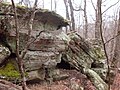
Weaubleau structure (category Geology of Missouri)
Beveridge, T.R., 1949, The Geology of the Weaubleau quadrangle, Missouri [Ph.D. thesis]: Iowa City, State University of Iowa Snyder, F.G., Gerdemann...
8 KB (778 words) - 17:02, 2 October 2023

Vineyard, Jerry D. (1992). Missouri Geology: Three Billion Years of Volcanoes, Seas, Sediments, and Erosion. University of Missouri Press. ISBN 978-0-8262-0836-1...
153 KB (14,003 words) - 14:13, 28 August 2024

Crowley's Ridge (category Geology of Missouri)
Ridge (also Crowleys Ridge) is a geological formation that rises 250 to 550 feet (170 m) above the alluvial plain of the Mississippi embayment in a 150-mile...
12 KB (1,235 words) - 03:43, 8 November 2023

Jordan Formation (category Geology of Missouri)
to as Jordan were made by many of the pioneering geologists of the upper Midwest. In an 1852 report on the geology of Wisconsin, Iowa, and Minnesota,...
19 KB (1,816 words) - 07:05, 10 July 2023

St. Francois Mountains (category Mountain ranges of Missouri)
southeast Missouri are a mountain range of Precambrian igneous mountains rising over the Ozark Plateau. This range is one of the oldest exposures of igneous...
14 KB (1,393 words) - 07:23, 8 December 2023

publicly accessible, geologic preserve near Thayer, Missouri, United States, encompassing a forked canyon that is the remnant of an ancient collapsed...
7 KB (442 words) - 05:20, 6 December 2023
was inducted into the Missouri Walk of Fame Jackson is notable as the last living widow of a Civil War Veteran. U.S. Geological Survey Geographic Names...
2 KB (185 words) - 01:58, 25 July 2023

Flood geology (also creation geology or diluvial geology) is a pseudoscientific attempt to interpret and reconcile geological features of the Earth in...
105 KB (13,027 words) - 23:25, 20 August 2024
Geology of Michigan Geology of Minnesota Geology of Mississippi Geology of Missouri Geology of Montana Geology of Nebraska Geology of Nevada Geology of...
7 KB (758 words) - 00:27, 8 December 2020

(geṓdēs) 'earthlike') is a geological secondary formation within sedimentary and volcanic rocks. Geodes are hollow, vaguely spherical rocks, in which masses of mineral matter...
7 KB (812 words) - 22:38, 28 March 2024

The Southeast Missouri Lead District, commonly called the Lead Belt, is a lead mining district in the southeastern part of Missouri. Counties in the Lead...
17 KB (1,538 words) - 02:24, 23 March 2024
Missouri University of Science and Technology (Missouri S&T or S&T) is a public research university in Rolla, Missouri. It is a member institution of...
93 KB (9,918 words) - 18:56, 13 August 2024

(1982) [1974]. Springs of Missouri (PDF). Missouri Department of Natural Resources, Division of Geology and Land Survey. Library of Congress Card Catalog...
6 KB (461 words) - 23:03, 26 November 2023

St. Louis (redirect from City of St. Louis, Missouri)
state of Missouri. It is located near the confluence of the Mississippi and the Missouri rivers. In 2020, the city proper had a population of 301,578...
168 KB (15,642 words) - 22:12, 10 August 2024

Missouri Buttes or Little Missouri Buttes are located in Crook County in northeast Wyoming on the northwest flank of the Black Hills Uplift. The buttes...
4 KB (320 words) - 06:20, 25 August 2024

Davis Formation (category United States geologic formation stubs)
Formation is a geologic formation in Indiana and Missouri. It preserves fossils dating back to the Cambrian period. Paleontology portal List of fossiliferous...
3 KB (124 words) - 11:19, 22 August 2024

Joachim Dolomite (category United States geologic formation stubs)
Ordovician geologic formation in Arkansas, Illinois, and Missouri. The name was first introduced in 1894 by Arthur Winslow in his study of the geology of Missouri...
3 KB (168 words) - 17:11, 30 May 2020

The Great Falls of the Missouri River are a series of waterfalls on the upper Missouri River in north-central Montana in the United States. From upstream...
45 KB (6,048 words) - 08:22, 19 June 2024

first. Missouri Department of Natural Resources, Division of Geology and Land Survey and Ed Clark Museum of Missouri Geology. United States Geological Survey...
31 KB (2,720 words) - 16:30, 25 August 2024
Roubidoux Formation (category Geologic formations of Missouri)
The Roubidoux Formation is a geologic formation in the Ozarks of Missouri. It preserves fossils dating back to the Ordovician period. Kirengella K. oregonensis...
3 KB (178 words) - 15:38, 13 February 2024
commons:Category:Geography of Missouri Geology of Missouri commons:Category:Geology of Missouri Ghost towns in Missouri Category:Ghost towns in Missouri commons:Category:Ghost...
18 KB (1,647 words) - 14:41, 19 August 2024

Current River (Ozarks) (redirect from Current River (Missouri))
Natural Resources, Division of Geology and Land Survey in cooperation with U.S. Geological Survey and Missouri Department of Conservation, 1982 USGS Surface...
10 KB (836 words) - 02:54, 25 July 2023

of Administrative Support Division of Energy Division of Environmental Quality Missouri Geological Survey Missouri State Parks https://dnr.mo.gov/about-us...
2 KB (116 words) - 19:42, 1 August 2024
The Missouri Escarpment is a ridge in North Dakota approximately 100 miles to the west of the Red River Valley, at the edge of the Missouri Plateau. It...
592 bytes (44 words) - 07:26, 19 October 2021

Greene County, Missouri, United States. As of the 2020 census, the city population was 6,344. It is part of the Springfield, Missouri Metropolitan Statistical...
12 KB (1,156 words) - 07:51, 28 July 2024