Gnarwarre is a rural locality in the Surf Coast Shire, Victoria, Australia. In the 1800s, the locality was alternately known as Shankhill. In the 2016...
8 KB (897 words) - 09:53, 7 May 2023
This is a list of government schools in Victoria, Australia. Broadmeadows Secondary College merged into Hume Central Secondary College Croydon Secondary...
387 KB (272 words) - 13:26, 28 August 2024

Duneed, Victoria Durdidwarrah, Victoria Gherang Gherang, Victoria Gherineghap, Victoria Gnarwarre, Victoria Gorong, Victoria Gorrockburkghap, Victoria Jan...
4 KB (307 words) - 22:19, 20 March 2024
and owns Rosemont Stud, over 566 hectares (1,400 acres) in Gnarwarre and Ceres, Victoria. The logo of the stud is a red and white gatecrasher, that originally...
10 KB (874 words) - 08:59, 18 January 2024
lowland." The area stretches roughly through the modern localities of Gnarwarre, Barrabool and Ceres, and straddles the intersection of the City of Greater...
10 KB (1,402 words) - 00:53, 7 April 2023

relieves the heavy traffic loads. The single-lane bridge, located in Gnarwarre, carries Pollocksford Road over the river. The original bridge was constructed...
32 KB (2,771 words) - 07:31, 28 June 2024

Surf Coast Shire (category Local government areas of Victoria (state))
Coast Shire is a local government area in the Barwon South West region of Victoria, Australia, located in the south-western part of the state. It covers an...
16 KB (694 words) - 16:22, 3 March 2024

(1911–1957) • Freshwater Creek (1860–1961) • Gherang (Gherang Military) • Gnarwarre (1857–1963) • Jan Juc • Lorne (Lorne North, Split Point Lighthouse,...
136 KB (12,146 words) - 05:09, 28 June 2024
Buckley is a rural locality in the Surf Coast Shire, Victoria, Australia. It was formerly known as Laketown. In the 2021 census, Buckley had a population...
7 KB (671 words) - 00:11, 11 March 2024

"'Super-rabbits' now!". The Argus. 27 November 1953. p. 7. Retrieved 21 June 2012. "Gnarwarre crew praised". CFA Connect. 2012. Retrieved 21 June 2012. Indigenous Plants:Zone...
6 KB (472 words) - 10:13, 7 May 2023

Inverleigh is a town in Victoria, Australia located 28 kilometres (17 mi) west from the City of Geelong and 87 kilometres (54 mi) from the state capital...
9 KB (667 words) - 03:00, 23 March 2024
Mount Moriac is a rural locality in the Surf Coast Shire, Victoria, Australia. In the 2016 census, Mount Moriac had a population of 240 people. A farming...
7 KB (664 words) - 10:04, 7 May 2023
successful than subsequent 1840s attempts at selling the land in the nearby Gnarwarre and Modewarre parishes. The 1850s saw the development of the Berramongo...
11 KB (1,092 words) - 09:40, 7 May 2023
Wadawurrung language (category Extinct languages of Victoria (state))
language spoken by the Wathaurong people of the Kulin Nation of Central Victoria. It was spoken by 15 clans south of the Werribee River and the Bellarine...
11 KB (635 words) - 03:23, 20 December 2023

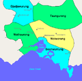
Shire of Barrabool (category Former local government areas of Victoria (state))
Barrabool Bellbrae Buckley Ceres Eastern View Fairhaven Freshwater Creek Gnarwarre Jan Juc Modewarre Moriac Mount Moriac Paraparap Torquay* (shared with...
4 KB (311 words) - 11:32, 12 May 2023

Electoral district of South Barwon (category Electoral districts of Victoria (state))
centre of Torquay and the rural towns of Barrabool, Bellbrae, Connewarre, Gnarwarre, Modewarre, Moriac and Mount Moriac. The electorate had a population of...
6 KB (396 words) - 13:20, 15 August 2024