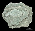
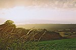
The Greensand Ridge, also known as the Wealden Greensand, is an extensive, prominent, often wooded, mixed greensand/sandstone escarpment in south-east...
15 KB (2,028 words) - 01:07, 22 September 2023
poorer soils. These Greensand Ridges are popular long distance walking routes, for instance the Greensand Way in Kent. The Lower Greensand (known as the Woburn...
12 KB (1,328 words) - 19:25, 4 March 2024
Greensand Ridge Walk Natural England - Bedfordshire Greensand Ridge Defra: JCA 090: Bedfordshire Greensand Ridge Greensand Ridge Path Greensand Ridge...
2 KB (176 words) - 16:28, 28 January 2021
The Greensand Ridge Walk is a long-distance walk of 40 miles (64 km) that traverses the county of Bedfordshire in England, with brief sections in the...
2 KB (169 words) - 14:43, 19 October 2019
of the county and principally covers parts of the North Downs and Greensand Ridge. It was designated as an Area of Outstanding Natural Beauty in May...
8 KB (374 words) - 19:59, 6 August 2024
England, from Haslemere in Surrey to Hamstreet in Kent. It follows the Greensand Ridge along the Surrey Hills and Chart Hills. The route is mostly rural,...
5 KB (403 words) - 15:40, 28 May 2024
Leith Hill in southern England is the highest summit of the Greensand Ridge, approximately 6.7 km (4 mi) southwest of Dorking, Surrey and 40.5 km (30 mi)...
16 KB (1,658 words) - 09:34, 25 August 2023
Holmesdale at a place where there is a natural water-cut gap in the Greensand Ridge, which connects the town with the low-lying land of the Low Weald to...
44 KB (4,771 words) - 02:47, 27 September 2024
on the shadier, northern side of the greensand ridge, for the sunny south side is partially on the Lower Greensand which is an area that early farmers...
19 KB (2,220 words) - 17:41, 30 September 2024
Greensand, or green sand, is a sand or sandstone which has a greenish color. Greensand or green sand may also refer to: Greensand Ridge, an escarpment...
805 bytes (128 words) - 08:56, 11 March 2023
remnant being Winterfold Forest directly north-west on the northern Greensand Ridge. In 2011 it had a population of just over 11,000. Until the mid-1860s...
34 KB (3,956 words) - 18:05, 16 October 2024
"High Weald" in the centre, the clay "Low Weald" periphery and the Greensand Ridge, which stretches around the north and west of the Weald and includes...
30 KB (3,742 words) - 08:56, 18 March 2024
Charleshill, Elstead in its east, a steep northern outcrop of the Greensand Ridge at Crooksbury Hill on Crooksbury Common in the north and Farnham Common...
14 KB (1,565 words) - 12:46, 4 October 2024
Much of the wood was formerly heathland at the western end of the Greensand Ridge that was developed privately during the 20th century as commercial...
18 KB (1,271 words) - 21:38, 1 November 2024
cottages and outhouses on the wooded, upper southern slopes of the Greensand Ridge near Coldharbour in Surrey, England. It was built around 1830 for the...
7 KB (551 words) - 14:26, 7 May 2024
metres (1,066 ft) Salisbury Plain – Walbury Hill at 297 metres (974 ft) Greensand Ridge – Leith Hill at 294 metres (965 ft) South Downs – Butser Hill at 271...
6 KB (346 words) - 14:18, 29 August 2024
are now lakes: at Priory Country Park, Wyboston and Felmersham. The Greensand Ridge is an escarpment across the county from near Leighton Buzzard to near...
30 KB (2,858 words) - 00:32, 19 October 2024
chiefly set in the wooded Vale of Holmesdale between the North Downs and Greensand Ridge. As of 2011 the village had a population of 1,032. The village gives...
23 KB (2,234 words) - 14:32, 18 October 2024
section of the London Borough of Bromley. The AONB also includes the Greensand Ridge, a prominent sandstone escarpment which lies south of the chalk escarpment...
6 KB (447 words) - 10:43, 23 November 2023
village and higher land of the parish lie within the Bedfordshire Greensand Ridge. The western lower lying area is part of the Bedfordshire and Cambridgeshire...
13 KB (1,360 words) - 05:05, 22 March 2024
Farley Green is a small hamlet of Albury in the Greensand Ridge where it forms the south of the Surrey Hills AONB, to the south east of Guildford. On...
5 KB (477 words) - 15:59, 2 October 2024
Hog's Back (category Ridges of England)
The Hog's Back is a hilly ridge, part of the North Downs in Surrey, England. It runs between Farnham in the west and Guildford in the east. Compared with...
15 KB (1,887 words) - 08:46, 28 September 2024
dominated by a buffer zone of fields and woodland, mostly south of the Greensand Ridge escarpment between Witley and Chiddingfold, having no dual carriageways...
10 KB (967 words) - 16:10, 2 October 2024
outskirts of Holmbury St Mary. More than half of the parish lies on the Greensand Ridge, while the remainder is divided between the Vale of Holmesdale and...
14 KB (1,571 words) - 18:24, 18 October 2024
estimated to be around 650 years old. It sits at the crest of the Greensand Ridge, offering views over the surrounding countryside. Its graveyard is...
23 KB (2,674 words) - 21:54, 25 July 2024
51°06′58″N 0°42′58″W / 51.11611°N 0.71611°W / 51.11611; -0.71611 Geography Gibbet Hill Gibbet Hill in Surrey, England Parent range Greensand Ridge...
8 KB (884 words) - 19:14, 20 October 2024
Chichester would have required steep crossings of the North Downs, Greensand Ridge and South Downs. The road was therefore designed to exploit a natural...
59 KB (6,365 words) - 08:52, 1 November 2024
roughly concentric circles towards the centre; these comprise the Greensand Ridge, most prominent on the north side of the Weald, where it includes Leith...
26 KB (2,989 words) - 08:15, 3 May 2024
in Kent. The East Stour, 10.3 miles (16.5 km) long,) rises on the Greensand ridge at Postling north of Hythe as a number of small streams. It then flows...
2 KB (154 words) - 18:04, 16 April 2022
England that falls between the hill ranges of the North Downs and the Greensand Ridge of the Weald, in the counties of Kent and Surrey. It stretches from...
4 KB (435 words) - 14:19, 16 June 2022


