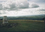
The Howgill Fells are uplands in Northern England between the Lake District and the Yorkshire Dales, lying roughly within a triangle formed by the town...
6 KB (667 words) - 13:07, 10 October 2024
Mountains and hills of England (section Howgill Fells)
into the lowlands of the English Midlands around the Trent Valley. The Howgill Fells are an area of uplands in Cumbria lying between the Lake District and...
12 KB (1,485 words) - 15:28, 28 February 2024
south-west, separated from Swarth Fell by Grisedale. Kelsall, Dennis (2009). The Yorkshire Dales: north and east : Howgill Fells, Mallerstang, Swaledale, Wensleydale...
3 KB (322 words) - 20:33, 5 November 2024
Fell and Snaizeholme is traversed by the Pennine Way. Marsh, Terry (1989). The Pennine mountains: the Cheviots, the Northern Moors, the Howgill fells...
4 KB (346 words) - 22:39, 5 November 2024
Lancashire, comprising the Rossendale Fells, West Pennine Moors, and Bowland Fells. The Howgill Fells and Orton Fells in Cumbria are also sometimes considered...
53 KB (5,349 words) - 00:49, 26 October 2024
in England which covers most of the Yorkshire Dales, the Howgill Fells, and the Orton Fells. The Nidderdale area of the Yorkshire Dales is not within...
14 KB (1,208 words) - 18:00, 21 September 2024
north). Additionally, although the National Park includes the Howgill Fells and Orton Fells, they are not usually considered part of the Dales. Most of...
27 KB (2,493 words) - 09:42, 20 October 2024
Great Langdale (section Other fells)
also the name of a valley in the Howgill Fells, elsewhere in Cumbria. It is a popular location for hikers, climbers, fell-runners and other outdoor enthusiasts...
13 KB (1,566 words) - 07:57, 12 October 2024
com/press. 5 September 2024. Retrieved 9 September 2024. Ordnance Survey: Howgill Fells and Upper Eden Valley: OL19 Explorer Map Owen, Amanda (2016). A Year...
16 KB (1,574 words) - 12:23, 25 October 2024
an elevation of 676 metres (2,218 ft), is the highest point in the Howgill Fells, an area of high ground in north-west England. It is in the north-west...
4 KB (359 words) - 09:41, 20 December 2023
designated a national landscape. South of the vale are the Orton Fells, Howgill Fells, and part of the Yorkshire Dales, which are all within the Yorkshire...
76 KB (6,293 words) - 13:14, 13 November 2024
in Limestone Country (1970) Walks on the Howgill Fells (1972) A Coast to Coast Walk (1973) The Outlying Fells of Lakeland (1974) Walks from Ratty (1978)...
34 KB (3,615 words) - 01:13, 4 November 2024
A Pictorial Guide to the Lakeland Fells is a series of seven books by A. Wainwright, detailing the fells (the local word for hills and mountains) of the...
11 KB (1,347 words) - 04:38, 2 October 2024
Col between Kensgriff and Yarlsidine in the Howgill Fells, England...
11 KB (1,329 words) - 10:45, 10 September 2024
comes down from a high plateau called The Calf. It is located in the Howgill Fells, traditionally in the West Riding of Yorkshire but now in the administrative...
2 KB (154 words) - 07:29, 3 February 2023
area follow those of the historic counties). It stands at the foot of Howgill Fells, on the north bank of the River Rawthey, which joins the River Lune...
12 KB (1,281 words) - 21:36, 9 October 2024
Scafell Pike (redirect from Pikes of Sca Fell)
miles (134 km), 31 degrees Cold Fell, 39 miles (63 km), 39 degrees Howgill Fells, 29 miles (47 km), 103 degrees Bow Fell, 2 miles (3 km), 105 degrees Yorkshire...
22 KB (2,481 words) - 07:06, 9 November 2024
District; the west coast; and to the east, the Yorkshire Dales; and Howgill Fells. Burton in Kendal's local football club, Burton Thistle F.C., currently...
8 KB (747 words) - 15:14, 16 October 2024
List of hills in the Lake District (category Fells of the Lake District)
lowest point between it and the Pennines. This occurs just north of the Howgill Fells and gives the boundaries as, primarily, the River Eden and River Lune...
27 KB (182 words) - 11:14, 11 November 2023
Orton, Westmorland and Furness (section Orton Fells)
Tower on a clear day, the A66 over Stainmore, the Lake District, the Howgill Fells and even down or up the Eden Valley to its source at Mallerstang. The...
7 KB (719 words) - 17:33, 14 April 2023
Pennine Way Companion. Frances Lincoln. p. 65. ISBN 9780711233683. OL19 Howgill Fells & Upper Eden Valley (Map). 1:25000. Explorer. Ordnance Survey. Ordnance...
6 KB (683 words) - 17:42, 7 August 2024
Original Mountain Marathon (category Fell running competitions)
Rations Compass (GPS Not Allowed) Sleeping Bag Footwear With Adequate Grip For Fell Conditions Space Blanket or large heavy gauge polythene bag Rucksack First-Aid...
13 KB (1,096 words) - 05:53, 8 September 2024
group (a sequence of rock strata) in the southern Lake District and the Howgill Fells of northern England. The name is derived from the town of Kendal in...
2 KB (154 words) - 21:27, 22 February 2022
feet (22 m), others have a longer fall: Cautley Spout, in Cumbria's Howgill Fells, is almost 590 feet (180 m) high, and Hardraw Force, in North Yorkshire...
7 KB (771 words) - 15:03, 2 May 2024
Howgill Fells to the south. The area mostly falls within the boundaries of the Yorkshire Dales National Park while a small part of the western fells is...
4 KB (391 words) - 12:58, 17 February 2024
of the Yorkshire Dales National Park, immediately to the east of the Howgill Fells and to the north of Whernside, the highest of the Yorkshire Three Peaks...
5 KB (652 words) - 20:16, 21 February 2023
and its proximity to the Lake District, North Pennines, Swaledale and Howgill Fells. From 1973 Ferguson Industrial Holdings Plc was based at Appleby Castle...
22 KB (1,934 words) - 15:14, 11 November 2024
northern end of the Pennines. Howgill Fells - uplands in Cumbria between the Lake District and Yorkshire Dales. Orton Fells - uplands in Cumbria between...
31 KB (2,447 words) - 20:57, 13 September 2024
2 July 2015. Ordnance Survey 1:25,000 scale Explorer map sheet OL19 Howgill Fells & Upper Eden Valley British Geological Survey 1:50,000 scale geological...
9 KB (796 words) - 11:52, 8 October 2024
Randygill Top is a mountain located in the Howgill Fells, Cumbria (historically Westmorland), England. "Randygill Top". Peakbagger.com. Retrieved 11 January...
1 KB (25 words) - 18:58, 11 April 2022


