
Hurunui District is a territorial local government district within the Canterbury Region on the east coast of New Zealand's South Island, north of Christchurch...
16 KB (663 words) - 13:13, 26 August 2024
Hurunui District Council (Māori: Ko te kaunihera ā rohe o Hurunui) is the territorial authority for the Hurunui District of New Zealand. The council is...
4 KB (221 words) - 13:14, 26 August 2024
Hurunui may refer to: Hurunui District, New Zealand Hurunui (New Zealand electorate) Hurunui River, New Zealand Hurunui Windfarm Hurunui, New Zealand,...
232 bytes (57 words) - 14:54, 27 June 2019

the district's southern boundary, separating it from Christchurch City and the Selwyn District. It is bounded in the north by the Hurunui District and...
22 KB (1,405 words) - 04:44, 2 June 2024
Westland District Hokitika Rural Waitaha Whataroa-Harihari Hokitika Valley-Otira Kaikōura Ranges Kaikōura Hanmer Range Amuri Hanmer Springs Upper Hurunui Parnassus...
62 KB (4,617 words) - 09:01, 19 August 2024
was a further elector-initiated proposal for Kaikoura District to merge with Hurunui District, but the Local Government Commission rejected this in 2009...
16 KB (1,327 words) - 20:15, 27 August 2024
by George Mason University Phoebe, New Zealand, a locality in the Hurunui District "Phoebe", a song by Lazlo Bane from their 2006 album, Back Sides Phebe...
1 KB (186 words) - 22:49, 26 April 2024
schools in Christchurch. Schools in the Waitaki District which are located in the Canterbury part of the district are listed at List of schools in Otago. In...
45 KB (926 words) - 21:18, 22 July 2024

District Grey District Westland District Ashburton District Hurunui District Kaikōura District Mackenzie District Selwyn District Timaru District Waimakariri...
6 KB (501 words) - 08:06, 22 July 2024

Cheviot, New Zealand (category Hurunui District)
Cheviot (/ˈtʃɪviət/) is a town in the Hurunui District of north Canterbury, on the east coast of the South Island of New Zealand. It is located on State...
19 KB (1,635 words) - 04:59, 29 July 2024

Amberley, New Zealand (category Hurunui District)
Amberley is a town located in the Hurunui District in north Canterbury, on the east coast of the South Island of New Zealand. It is located on State Highway...
19 KB (2,180 words) - 20:54, 22 July 2024

The mayor of Hurunui officiates over the Hurunui District of New Zealand's South Island. The district is administered by a district council. The current...
3 KB (223 words) - 07:13, 6 August 2024
Horseshoe Lake (New Zealand) (redirect from Horseshoe Lake (Hurunui District))
small lake approximately 27 km south west of Hanmer Springs in the Hurunui District of the Canterbury region of the South Island of New Zealand. 42°35′52...
1 KB (236 words) - 20:36, 22 July 2024

Hanmer Springs (category Hurunui District)
65 km (40 mi) south-west of Kaikōura (135 km (84 mi) by road), in the Hurunui District. The town lies on a minor road 9 km (5.6 mi) north of State Highway...
46 KB (4,777 words) - 08:28, 18 August 2024

Marlborough, and Tasman districts, along with Nelson City, Grey District north of the Grey River, and the Hurunui District north of the Hurunui River. It was reduced...
22 KB (1,290 words) - 06:02, 30 July 2024

Their northern extremes are at the foot of the Hundalee Hills in the Hurunui District, and in the south they merge into the plains of North Otago beyond...
4 KB (420 words) - 20:37, 22 July 2024

Charles Upham (category Hurunui District)
1995, and decommissioned in 2001. A bronze statue stands outside the Hurunui District Council buildings in Amberley, North Canterbury, depicting Charles...
42 KB (5,584 words) - 08:41, 27 August 2024
municipal district in San Cristóbal (province) Medina, Hungary, a village in Tolna County Mdina, Malta, a city Medina, New Zealand, a locality in Hurunui District...
5 KB (615 words) - 11:13, 2 May 2024

Waipara (category Hurunui District)
2014. Retrieved 8 October 2020. Silverstripe. "Waipara · Hurunui District Council". Hurunui.govt.nz. Archived from the original on 4 March 2016. Retrieved...
19 KB (1,514 words) - 03:48, 25 August 2024

"Huntly Domain and Lake Hakanoa Reserve Management Plan" (PDF). Waikato District Council. 28 August 2012. "Environment Waikato Technical Report 2008/36...
165 KB (1,030 words) - 08:28, 8 August 2024

become less realistic, as Greater Christchurch area (including the Selwyn District) has recently experienced rapid population growth. The island has been...
106 KB (9,664 words) - 01:45, 24 August 2024

The Hurunui River is the fourth largest of the four principal rivers in north Canterbury, New Zealand, with a catchment area of 2,670 square kilometres...
12 KB (1,082 words) - 13:14, 26 August 2024

Weka Pass (category Hurunui District)
Weka Pass is a locality in the northern Canterbury region of New Zealand's South Island between the towns of Waipara and Waikari. The Waipara River cut...
5 KB (443 words) - 21:04, 22 July 2024
(Environment Canterbury), nine territorial authority (city and district) councils, two district health boards, and various local boards and licensing trusts...
10 KB (548 words) - 20:52, 22 July 2024

northern Canterbury: the Kaikōura district had the lowest concentration at 1.0%, with the neighbouring Hurunui district having the second-lowest concentration...
18 KB (1,659 words) - 03:55, 3 July 2024

Hawarden, New Zealand (redirect from Hurunui College)
population density of 343 people per km2. Hawarden is part of the larger Upper Hurunui statistical area. Before the 2023 census, the settlement had a larger boundary...
11 KB (1,050 words) - 20:57, 22 July 2024

Culverden (category Hurunui District)
government reforms, and since then, Culverden has belonged to the Hurunui District. Culverden is described by Statistics New Zealand as a rural settlement...
16 KB (1,480 words) - 20:55, 22 July 2024

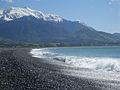
Gore Bay, New Zealand (category Hurunui District)
Gore Bay is a coastal settlement about 8 kilometres (5 mi) from Cheviot, New Zealand. It has a surfing beach with summer beach houses and 14 permanent...
3 KB (261 words) - 20:56, 22 July 2024
Glencoe River (category Hurunui District)
The Glencoe River is a river in the Canterbury region of New Zealand. It arises in the Organ Range near Shale Peak and flows south into the Mandamus River...
1 KB (82 words) - 21:10, 22 July 2024
Kaikoura District and its inclusion in Hurunui District" (PDF). Local Government Commission. May 2009. p. 5. Retrieved 12 February 2022. "Tasman District Council...
7 KB (437 words) - 15:47, 6 June 2024