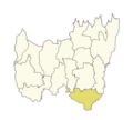
Kachan Kawal (Nepali: कचन कवल) is a place located in Kachan kawal Rural Municipality (previously, Kechana VDC) of Koshi Province of Nepal. At an elevation...
5 KB (181 words) - 11:31, 13 November 2024
connecting India in the south and China in the north. It starts from Kechana Kawal in the Terai region, crosses the Shivalik Hills, passes through the...
4 KB (233 words) - 06:21, 21 October 2024
Kangchenjunga (8598 m) also lie in this province. Nepal's lowest point, Kechana Kawal at 70 m, is located in Jhapa District of this province. There are many...
62 KB (4,427 words) - 07:27, 23 November 2024
544 sq mi) Coastline 0 km (landlocked) Elevation extremes Lowest point: Kechana Kawal, jhapa district 59 m Highest point: Sagarmatha (Mount Everest) 8,848...
64 KB (6,221 words) - 03:03, 15 August 2024
Highest elevation (Mount Kanchenjunga) 8,586 m (28,169 ft) Lowest elevation (Kechana Kawal) 59 m (194 ft) Population (2011) • Total 1,422,182 • Rank 11th • Density...
6 KB (387 words) - 00:30, 21 October 2024
municipality was established merging former VDCs: Gherabari, Pathariya, Kechana, Pathamari, Baniyani and Balubadi. Mr.Kalendra prasad singh Rajbanshi of...
10 KB (600 words) - 04:51, 23 October 2024


