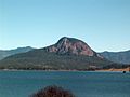
The Kroombit Dam is a roller compacted concrete dam, built to replenish the groundwater supply to the Callide Irrigation area. The dam has a maximum height...
2 KB (103 words) - 13:10, 21 October 2020

(primary coordinates) GPX (secondary coordinates) Dams and reservoirs in Australia is a link page for any dam or reservoir in Australia. There are three key...
76 KB (509 words) - 20:29, 25 September 2023

Callide Dam, and the Kroombit Dam. In the Mackenzie River sub-catchment, the major reservoirs are the Comet Weir, the Fairbairn Dam, the Theresa Creek Dam, the...
20 KB (1,896 words) - 10:27, 4 October 2024

Burnett River (section Dam construction)
Three Moon Creek rises near Kroombit Tops National Park north of Monto and flows south through Monto and Mulgildie, it is dammed near Cania Gorge to form...
10 KB (800 words) - 20:33, 19 May 2024

Lake Awoonga (redirect from Lake Awoonga/Awoonga Dam)
Awoonga Queensland portal Boyne Valley, Queensland Calliope, Queensland Kroombit Tops National Park Ubobo, Queensland Nagoorin, Queensland Builyan, Queensland...
13 KB (1,425 words) - 16:42, 21 July 2024

Biloela (section Callide Dam)
later described how as a child he and his family were chased over the Kroombit Mountains to avoid "being shot down." Aboriginal people were employed on...
45 KB (3,768 words) - 13:00, 26 September 2024

Nine shires in Central Queensland were declared disaster areas. At the Kroombit Dam, the water level increased from 0.5% to 81% due to Beni. Water reserves...
28 KB (2,882 words) - 23:01, 25 May 2024

Callide, the impoundment of Callide Creek by the Callide Dam. It is bounded to the south-west by Kroombit Creek. While the name Valentine Plains might suggest...
15 KB (1,269 words) - 01:47, 31 May 2024
protected areas which surround volcanic peaks and rocky cliffs near Moogerah Dam. Because the peaks are relatively inaccessible the natural vegetation of...
4 KB (370 words) - 13:18, 16 December 2020

animal species and many walking tracks. Kroombit Tops National Park provides habitat for the endemic Kroombit tinker frog. Deepwater National Park is...
19 KB (1,750 words) - 13:48, 22 August 2024
requires a permit and is available at three locations; Wadlow Yards, Kings Dam and The Palms, although none of the three have any facilities. The average...
3 KB (178 words) - 06:36, 13 June 2024
Queensland bioregions. At the southern extent of the park is the Paradise Dam. Goodnight Scrub National Park protects dry rainforest predominated by hoop...
3 KB (202 words) - 08:31, 13 June 2024

cockatoo Yellow-tailed black cockatoo Wedge-tailed eagle Other Species Kroombit tinker frog Rainbow lorikeet (wild roaming) In 2008, a dedicated frog-breeding...
57 KB (8,339 words) - 05:22, 10 August 2024

Queensland portal Gladstone road network Beautiful Betsy The Boyne Valley Kroombit Tops National Park Australian Bureau of Statistics (28 June 2022). "Gladstone...
51 KB (4,597 words) - 03:47, 1 September 2024

elevated lookout over the old weir. There is no drinking water available. Kroombit Tops National Park Monto Gladstone Calliope Lake Awoonga Beautiful Betsy...
9 KB (811 words) - 16:50, 21 July 2024

Cania: Cania Gorge National Park in the south of the locality part of Kroombit Tops National Park in the north of the locality part of Grevillea State...
9 KB (926 words) - 16:44, 25 July 2024
Another walk leads visitors to a former mine site. Queensland portal Cania Dam Protected areas of Queensland Boyne Valley, Queensland "Cania Gorge National...
4 KB (366 words) - 06:34, 15 February 2022
transformation of land, reaping its bounties. Rainwater harvesting with the help of dams was done by pastoralists in the area. Camping facilities are available at...
3 KB (233 words) - 00:14, 14 August 2022
2023. "Queensland Globe". State of Queensland. Retrieved 25 August 2023. "Kroombit – parish in Shire of Banana (entry 18545)". Queensland Place Names. Queensland...
128 KB (3,742 words) - 09:18, 9 October 2024

projects such as the Upper Nepean Scheme, Snowy Mountains Scheme and Warragamba Dam. The Bradfield Scheme has been mooted as a way to transport water from the...
37 KB (3,142 words) - 05:09, 10 September 2024
Allow 1.5 hours Queensland portal Protected areas of Queensland Auburn River Dam "Auburn River National Park (entry 992)". Queensland Place Names. Queensland...
4 KB (301 words) - 06:07, 27 January 2022

in 2008 it became part of Gladstone Region. It is in close proximity to Kroombit Tops National Park. The Gladstone–Monto Road runs through from north to...
18 KB (1,550 words) - 16:39, 25 July 2024

Mingoola School, along the Bruxner Highway. Then turn right into Glenyon Dam Road and then another right into Permanents Road, which promptly enters the...
5 KB (446 words) - 15:54, 31 July 2024

Distance: 58.8 km Time: At least four days It leaves from Baroon Pocket Dam and passes through Kondalilla National park on Day 1. Queensland portal Protected...
8 KB (795 words) - 22:59, 12 September 2024
Eucalyptus spp. Water-bodies present within the park boundaries consist of 15 dams and a small number of creeks. The region in which Taunton National Park is...
29 KB (3,244 words) - 21:26, 18 December 2023
Creek Beelbi Bowling Green Bay Broad Sound Burrum Cape Palmerston - Rocky Dam Cawarral Creek Cleveland Bay Colosseum Inlet Corio Bay Dallachy Creek Deception...
125 KB (3,695 words) - 01:44, 31 May 2024