
that leads to the summit. Retrieved from the Swisstopo topographic maps. The key col is the Glas Pass (1,846 m). "Lüschgrat". Lüschgrat on Hikr v t e...
2 KB (73 words) - 18:15, 20 August 2023

Highest point Elevation 2,163 m (7,096 ft) Prominence 164 m (538 ft) Parent peak Lüschgrat Coordinates 46°43′07.6″N 9°21′21.6″E / 46.718778°N 9.356000°E / 46...
1 KB (57 words) - 18:05, 16 April 2022

Highest point Elevation 2,124 m (6,969 ft) Prominence 135 m (443 ft) Parent peak Lüschgrat Coordinates 46°41′9.96″N 9°20′17.16″E / 46.6861000°N 9.3381000°E /...
1 KB (69 words) - 13:15, 5 May 2022

Highest point Elevation 2,016 m (6,614 ft) Prominence 61 m (200 ft) Parent peak Lüschgrat Coordinates 46°45′56.28″N 9°22′56.28″E / 46.7656333°N 9.3823000°E /...
1 KB (81 words) - 11:03, 2 May 2022
/ Slovenia AT/SI 1376 Lüschgrat 2178 332 46°42′06″N 09°20′41″E / 46.70167°N 9.34472°E / 46.70167; 9.34472 (1376. Lüschgrat (2178 m)) Adula Alps I/B-10...
89 KB (462 words) - 21:49, 19 January 2024
central Graubünden. It is the deepest point on the ridge between the Lüschgrat (key col: 332 m) and Piz Beverin. The pass is overlooked by the Glaser...
2 KB (156 words) - 06:47, 26 March 2024

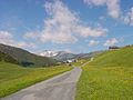
provides nice views of the valley. The highest points along the trail are Lüschgrat (2179 m), Tguma (2163 m) and Präzerhöhi (2120 m). To the west, the ridge...
4 KB (565 words) - 14:18, 6 March 2024