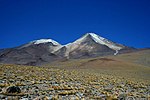
Laguna Vilama is a salt lake in northwestern Argentina, within the Vilama caldera. It is shallow and covers a surface area of 4,590 hectares (11,300 acres)...
15 KB (1,526 words) - 06:32, 29 April 2024
Vilama is a Miocene caldera in Bolivia and Argentina. Straddling the border between the two countries, it is part of the Central Volcanic Zone, one of...
30 KB (3,761 words) - 08:10, 2 January 2024
Desaguadero y del Bebedero Lagunas de Vilama Lagunas y Esteros del Iberá Parque Provincial El Tromen Reserva Costa Atlantica de Tierra del Fuego Reserva...
44 KB (4,820 words) - 02:32, 26 June 2024
Mendoza San Juan San Luis 1012 1999-12-14 Lagunas de Vilama 157,000 390,000 Jujuy 1040 2000-09-20 Lagunas y Esteros del Iberá 24,550 60,700 Corrientes...
244 KB (220 words) - 16:36, 14 November 2024
Gutiérrez Lake Huechulafquen Lake Lácar Lake Laguna Mar Chiquita Mascardi Lake Laguna Melincué Laguna Negra Laguna Vilama Lake Menéndez Moquehue Lake Nahuel Huapi...
985 bytes (75 words) - 19:09, 8 October 2023
Cordillera Domeyko separates the Salar de Atacama basin from arheic areas. Its main tributaries are the San Pedro and Vilama rivers, which originate to the north...
17 KB (1,848 words) - 09:38, 6 November 2024
about ten million years ago, producing the large volcanic calderas Panizos, Vilama, Cerro Guacha and the volcano Uturuncu. The formation of the APVC has been...
42 KB (5,084 words) - 23:41, 8 November 2024
Nevada de Lagunas Bravas Lava Dome Complex 6,127 20,101 26°28.8′S 68°34.8′W / 26.4800°S 68.5800°W / -26.4800; -68.5800 (Sierra Nevada de Lagunas Bravas)...
14 KB (63 words) - 17:15, 10 June 2023
Guacha, Cerro Panizos, Coranzulí, Kapina, La Pacana, Pastos Grandes and Vilama, as well as as-yet undiscovered but presumed buried calderas. The volcanoes...
30 KB (3,470 words) - 05:09, 15 January 2024
Licancabur (category CS1 German-language sources (de))
is Laguna Verde. The mountain is part of the drainage divide between the Altiplano and the Salar de Atacama. Southwest of Licancabur are the Vilama and...
61 KB (6,359 words) - 23:03, 15 November 2024
Uturuncu (category CS1 German-language sources (de))
Pacana, Pastos Grandes and Vilama. Over 50 volcanoes in the region are potentially active. Within the last two mya, the Laguna Colorada, Tatio and Puripica...
75 KB (7,888 words) - 19:56, 29 July 2024
Survey of Japan, AIST. 2020. Retrieved 2021-01-03. start from 1950 CE Bouvet de Maisonneuve, C.; Forni, F.; Bachmann, O. (2021). "Magma reservoir evolution...
68 KB (1,155 words) - 10:55, 6 October 2024
El Tatio (category CS1 German-language sources (de))
middle Miocene. Among these, Cerro Guacha, La Pacana, Pastos Grandes and Vilama produced supereruptions. The Tatio ignimbrite was emplaced 710,000 ± 10...
106 KB (12,355 words) - 22:20, 20 March 2024
Altiplano–Puna volcanic complex (category Puna de Atacama)
least three volcanic centres (Guacha caldera, La Pacana, Pastos Grandes, Vilama) had eruptions of a Volcanic Exposivity Index (VEI) of 8, as well as smaller...
45 KB (5,806 words) - 03:00, 28 October 2024
Purico complex (redirect from Llano de Chajnantor)
the Cerro Guacha, Cerro Panizos, Coranzulí, La Pacana, Pastos Grandes and Vilama centres that cluster around the tripoint between Argentina, Bolivia and...
51 KB (6,165 words) - 09:50, 22 June 2024


