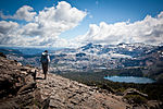
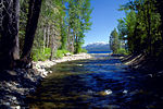
Lake Tahoe Basin Management Unit is a United States National Forest that manages and protects public land surrounding Lake Tahoe and the Lake Tahoe Basin...
5 KB (553 words) - 01:03, 8 October 2024
national forest land, covered by the Lake Tahoe Basin Management Unit of the United States Forest Service. Lake Tahoe is a major tourist attraction in both...
150 KB (16,561 words) - 00:44, 15 November 2024
Desolation Wilderness (category Lakes of the Desolation Wilderness)
Forest and Lake Tahoe Basin Management Unit, in El Dorado County, California. The crest of the Sierra Nevada runs through it, just west of Lake Tahoe. Before...
10 KB (930 words) - 02:04, 9 January 2024
proposed in 1978 by Glenn Hampton, a recreation officer of the Lake Tahoe Basin Management Unit (LTBMU) of the U.S. Forest Service. The trail was completed...
5 KB (397 words) - 20:14, 23 March 2023
northeast edge. Fallen Leaf Lake is located within the National Forest System lands managed by the Lake Tahoe Basin Management Unit, adjacent to El Dorado...
16 KB (2,064 words) - 21:24, 27 September 2024
Rubicon Trail (category Lake Tahoe)
the Lake Tahoe Basin Management Unit. The eastern maintained portion of the trail is called the McKinney Rubicon Springs Road, and leads to Lake Tahoe. There...
12 KB (1,583 words) - 16:25, 10 July 2024
238 m) in Douglas County, Nevada, on the border between the Lake Tahoe Basin Management Unit to the west and the Humboldt-Toiyabe National Forest to the...
5 KB (167 words) - 03:23, 12 November 2024
may be obtained at the Forest Service's Lake Tahoe Basin Management Unit Headquarters in South Lake Tahoe, or reserved online. Venturing into the Wilderness...
9 KB (954 words) - 03:58, 9 January 2024
website. E The Lake Tahoe Basin Management Unit (LTBMU) consists of 154,830 acres (62,660 ha) of U.S. Forest Service land in the Lake Tahoe watershed. The...
116 KB (2,722 words) - 01:13, 8 October 2024
Trailhead". Lake Tahoe Basin Management Unit, USDA Forest Service. Retrieved 2021-05-24. "Hiking Trails: West Shore" (PDF). Lake Tahoe Basin Management Unit, USDA...
9 KB (886 words) - 05:21, 28 March 2024
Dardanelles and Freel Roadless Areas (category Lake Tahoe)
(4.8 km), respectively, south of Lake Tahoe, California, and both are managed by the Lake Tahoe Basin Management Unit of the US Forest Service.These areas...
10 KB (1,273 words) - 00:22, 1 November 2021
States. Tamarack Peak is set six miles north of Lake Tahoe on the boundary that Lake Tahoe Basin Management Unit shares with Humboldt-Toiyabe National Forest...
6 KB (466 words) - 01:47, 16 August 2023
Dianne Feinstein (section Lake Tahoe)
authored the landmark Lake Tahoe Restoration Act of 2000. This act of Congress formally created the Lake Tahoe Basin Management Unit within the National...
201 KB (15,714 words) - 04:46, 17 November 2024
List of Sierra Nevada topics (section Prominent Lakes)
Forest Lake Tahoe Basin Management Unit Plumas National Forest Sequoia National Forest Sierra National Forest Stanislaus National Forest Tahoe National...
11 KB (856 words) - 22:24, 20 July 2024
Angora Lakes are two small freshwater lakes in the Sierra Nevada and Lake Tahoe Watershed ~1,200 ft (370 m) in elevation above Fallen Leaf Lake and Lake Tahoe...
5 KB (418 words) - 21:23, 13 March 2024
Lake Tahoe–Nevada State Park is a state park comprising multiple management units and public recreation areas on the northeast shores of Lake Tahoe in...
7 KB (563 words) - 13:00, 6 November 2024
South Lake Tahoe is the most populous incorporated city in El Dorado County, California, United States, in the Sierra Nevada mountains. The city's population...
27 KB (2,354 words) - 10:23, 19 September 2024
Interior. "Frequently Asked Questions about Lake Tahoe and the Basin". Lake Tahoe Basin Management Unit, U.S. Forest Service. Retrieved 20 June 2007...
3 KB (143 words) - 22:39, 29 October 2023
basin to manage the body or bodies of water into which it drains. Examples of such interstate compacts are the Great Lakes Commission and the Tahoe Regional...
24 KB (2,798 words) - 11:49, 13 November 2024
(by area and discharge) of the 63 Tahoe Basin watersheds contributes 6% of the stream runoff flowing into Lake Tahoe. The creek was a major source of sediment...
7 KB (592 words) - 15:47, 29 March 2024
El Dorado County, California (redirect from Lake Hills Estates)
the county's land area, primarily on the western slope. The Lake Tahoe Basin Management Unit, formerly part of the Eldorado and two other National Forests...
63 KB (3,519 words) - 06:11, 20 November 2024
8:00 AM" (PDF). www.fs.usda.gov. Eldorado National Forest & Lake Tahoe Basin Management Unit. September 20, 2021. Archived (PDF) from the original on January...
72 KB (3,798 words) - 14:54, 30 October 2024
California National Historic Trail Great Basin National Park Humboldt-Toiyabe National Forest Lake Tahoe Basin Management Unit Pony Express National Historic Trail...
161 KB (13,603 words) - 19:30, 17 November 2024
The Palisades Tahoe resort is the largest skiing complex in the Lake Tahoe region, and is known for its challenging terrain. Palisades Tahoe (not including...
33 KB (2,465 words) - 01:07, 11 October 2024
sinks. Lake Tahoe, North America's largest alpine lake, is part of the Great Basin's central Lahontan subregion. The hydrographic Great Basin contains...
34 KB (3,615 words) - 11:52, 1 November 2024
Twin Peaks (Placer County, California) (category Tahoe National Forest)
Peaks is located four miles west of Tahoe Pines and Lake Tahoe, along the boundary that Lake Tahoe Basin Management Unit shares with Granite Chief Wilderness...
5 KB (419 words) - 01:01, 1 January 2024
borders Eldorado National Forest at Carson Pass, and the Lake Tahoe Basin Management Unit, a special unit of the U.S. Forest Service, at Luther Pass. In 1989...
12 KB (1,138 words) - 02:44, 10 November 2023
Cleveland National Forest at 460,000 acres (1,900 km2). The Lake Tahoe Basin Management Unit is not precisely a national forest in the conventional sense...
33 KB (1,312 words) - 19:16, 9 July 2024
Tahoe National Forest is a United States National Forest located in California, northwest of Lake Tahoe. It includes the 8,587-foot (2,617 m) peak of...
13 KB (1,311 words) - 20:59, 8 November 2024
forest is bordered on the north by the Tahoe National Forest, on the east by the Lake Tahoe Basin Management Unit, on the southeast by the Humboldt–Toiyabe...
9 KB (834 words) - 01:03, 8 October 2024


