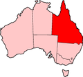
The Leichhardt Highway is a major transport route in Queensland, Australia. It is a continuation northward from Goondiwindi of the Newell Highway, via...
9 KB (266 words) - 22:59, 27 May 2024
formerly 85) from Toowoomba to the Leichhardt Highway, and the southern 19 km (12 mi) section of the Leichhardt Highway (also National Route A39) to Goondiwindi...
7 KB (380 words) - 09:50, 20 October 2024
Legacy Way Western Freeway, Brisbane Leichhardt Highway David Low Way Carnarvon Highway Dawson Highway Gregory Highway Ipswich Road Fitzroy Developmental...
5 KB (381 words) - 02:22, 30 July 2024
Leichhardt may refer to: Division of Leichhardt, electoral District for the Australian House of Representatives Leichhardt Highway, a highway of Queensland...
710 bytes (104 words) - 15:27, 23 October 2024
National Highway 42 shield to its south-western terminus with the Leichhardt Highway at Goondiwindi. The majority of the Cunningham Highway is a single...
20 KB (1,363 words) - 22:27, 27 January 2024
Wilhelm Ludwig Leichhardt (German pronunciation: [ˈfʁiːdʁɪç 'vɪlhɛlm 'lu:tvɪç 'laɪçhaːʁt]; 23 October 1813 – c. 1848), known as Ludwig Leichhardt, was a German...
38 KB (4,071 words) - 23:20, 21 November 2024
Isis, Dawson and Leichhardt Highways, the following state-controlled roads, from south to north, intersect with the Burnett Highway: Kingaroy–Barkers...
15 KB (910 words) - 06:03, 27 April 2024
State Forest and more farmland before reaching the Leichhardt Highway at Moonie. From Moonie the highway passes through more farmland, passing the timbered...
7 KB (549 words) - 10:30, 27 October 2024
airport is located along the Leichhardt Highway approximately 19 km (12 mi) south of the Leichhardt and Warrego Highway intersection, Miles, Queensland...
3 KB (197 words) - 08:26, 30 April 2024
Leichhardt within the Inner West Council area Leichhardt is a suburb in the Inner West of Sydney, in the state of New South Wales, Australia. Leichhardt...
21 KB (2,358 words) - 05:32, 11 December 2024
completion in late 2022. In addition to the Bruce, Leichhardt, Gregory and Landsborough Highways, and the Fitzroy Developmental Road, the following state-controlled...
18 KB (1,298 words) - 01:22, 9 December 2024
endpoint of the highway. The entire highway is part of the National Highway system linking Darwin and Brisbane: formerly National Highway 54, Queensland...
30 KB (2,105 words) - 12:42, 9 March 2024
Route A39) from Toowoomba to the Leichhardt Highway, and the southern 19 km (12 mi) section of the Leichhardt Highway (National Route A39/State Route A5)...
22 KB (1,103 words) - 00:39, 1 December 2024
Rolleston Springsure In addition to the Bruce, Burnett, Leichhardt, Carnarvon and Gregory Highways, and the Fitzroy and Dawson Developmental Roads, the following...
20 KB (1,285 words) - 20:52, 28 July 2024
WLE) which is located along the Leichhardt Highway approximately 19 km (12 mi) south of the Leichhardt and Warrego Highway intersection, Miles, Queensland...
20 KB (1,525 words) - 06:14, 5 August 2024
Chinchilla–Tara Road Chinchilla–Wondai Road Auburn Road (Queensland) Leichhardt Highway Details of above roads not described in another article are shown...
23 KB (1,837 words) - 00:40, 22 January 2024
Gore Highway is a highway running between Toowoomba and Goondiwindi in Queensland, Australia. Together with Goulburn Valley Highway and Newell Highway, it...
12 KB (954 words) - 05:22, 14 June 2024
Queensland, where it meets the Cunningham and Leichhardt Highways, and forms the southward extension of Cunningham Highway from Warwick and Brisbane, the Newell...
30 KB (2,352 words) - 23:07, 7 November 2024
contains a rest area with toilets and a camping area, situated along the Leichhardt Highway just south of Theodore. The national park is upon the traditional...
2 KB (121 words) - 02:28, 11 June 2017
Highway 1 along either coast. Roads that make up the highway are: Great Central Road Gunbarrel Highway Lasseter Highway Stuart Highway Plenty Highway...
9 KB (310 words) - 05:03, 11 February 2024
Landsborough Highway is a highway in western Queensland, Australia, running in the northwest–southeast direction from Morven to Cloncurry. The Landsborough...
10 KB (542 words) - 11:07, 27 July 2023
Mount Lindesay Highway is an Australian national highway located in Queensland. The highway runs southwest from Brisbane, where it leaves Ipswich Road...
26 KB (1,537 words) - 06:49, 13 August 2024
population of 885 people. The town is located on the Dawson River and the Leichhardt Highway, 380 kilometres (240 mi) north-west of the state capital, Brisbane...
56 KB (5,239 words) - 00:05, 22 November 2024
Surat Developmental Road (category Highways in Queensland)
road passes the exit to Chinchilla–Tara Road at Tara, crosses the Leichhardt Highway (A5) at The Gums, passes exits to Meandarra–Talwood Road (to the south-west)...
12 KB (873 words) - 23:11, 15 August 2024
(PDF). Royal Automobile Club of Queensland. Retrieved 17 July 2017. "Leichhardt Highway Melbourne to Rockhampton". Royal Automobile Club of Queensland. Retrieved...
40 KB (873 words) - 09:22, 2 June 2024
Fitzroy Developmental Road (category Highways in Queensland)
section leaves the Leichhardt Highway at a point 17 kilometres (11 mi) north of Taroom as State Route 7. This section meets the Dawson Highway in the locality...
8 KB (435 words) - 03:26, 10 June 2024
The Barkly Highway is a national highway in Queensland and the Northern Territory in Australia. It is the only sealed road between Queensland and the...
13 KB (829 words) - 12:40, 24 June 2024
New England Highway is an 883-kilometre (549 mi) long highway in Australia running from Yarraman, north of Toowoomba, Queensland, at its northern end...
41 KB (2,871 words) - 23:58, 1 November 2024
The National Highway (part of the National Land Transport Network) is a system of roads connecting all mainland states and territories of Australia, and...
37 KB (2,681 words) - 06:45, 7 October 2024
The Balonne Highway, a state highway of Queensland, is the continuation westward of State Route 49 (Moonie Highway) from the town of St George to its termination...
7 KB (344 words) - 10:44, 20 December 2023


