
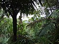
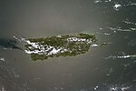
Luquillo barrio-pueblo is a barrio and the administrative center (seat) of Luquillo, a municipality of Puerto Rico. Its population in 2010 was 1,028....
10 KB (749 words) - 12:12, 14 January 2024

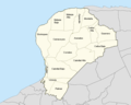
northwest of Fajardo; and east of Rio Grande. Luquillo is spread over 5 barrios and Luquillo Pueblo (the downtown area and the administrative center...
26 KB (1,955 words) - 00:57, 13 August 2024
Pueblo is a term primarily used in Puerto Rico to refer to the municipal district (barrio) that serves as the administrative, historic and cultural center...
24 KB (1,525 words) - 21:25, 28 August 2024

Luquillo, and Sector Tamarindo. The following sectors are in Barrio Pueblo (Sur y Centro): Avenida San Carlos, Barriada Visbal, Barrio Higuey, Barrio...
15 KB (1,344 words) - 14:58, 1 January 2024
up of 827 barrios and 75 barrios-pueblo. There are also a number of subbarrios and communities. The following is a list of the 902 barrios, some of the...
76 KB (3,116 words) - 10:42, 8 April 2024
Río Grande, Puerto Rico (section Barrios)
east of Loíza and Canóvanas and west of Luquillo. Río Grande is spread over eight barrios and Río Grande Pueblo (the downtown area and the administrative...
28 KB (2,167 words) - 00:58, 13 August 2024

Quintas Puerto Rico portal List of communities in Puerto Rico "US Census Barrio-Pueblo definition". factfinder.com. US Census. Archived from the original on...
6 KB (517 words) - 20:04, 9 June 2023
(Norte) Sector Llanos Jiménez Sector Luquillo Sector Tamarindo Avenida San Carlos Barriada Visbal Barrio Higuey Barrio Iglesias Calle Mercado Calle Mercedes...
13 KB (1,249 words) - 00:21, 6 October 2023

San Lorenzo, Puerto Rico (section Barrios)
of Juncos and Las Piedras. San Lorenzo is spread over twelve barrios and San Lorenzo Pueblo (the downtown area and the administrative center of the city)...
25 KB (1,792 words) - 23:23, 12 August 2024

Puerto Rico Highway 193 (category Luquillo, Puerto Rico)
a road located in Luquillo, Puerto Rico, passing through its downtown. This highway begins at PR-3 southeast of downtown Luquillo and returns again to...
3 KB (132 words) - 03:06, 1 August 2023

Trujillo Alto, Puerto Rico (section Barrios)
Guaynabo, Cataño, and Toa Baja. The city is spread over 6 barrios and Trujillo Alto Pueblo (the downtown area and the administrative center of the city)...
50 KB (4,164 words) - 00:58, 13 August 2024

Naguabo, Puerto Rico (section Barrios)
and Ceiba; and east of Las Piedras. Naguabo is spread over 8 barrios and Naguabo Pueblo (the downtown area and the administrative center of the city)...
24 KB (1,686 words) - 00:57, 13 August 2024

Canóvanas, Puerto Rico (section Barrios)
Carolina; and west of Río Grande. Canóvanas is spread over 6 barrios and Canóvanas Pueblo (the downtown area and administrative center). It is part of...
40 KB (3,436 words) - 00:07, 13 August 2024

Ceiba, Puerto Rico (section Barrios)
the Sierra de Luquillo at 3,346 feet (1,020 m) of elevation. Like all municipalities of Puerto Rico, Ceiba is subdivided into barrios. The municipal...
33 KB (2,474 words) - 23:12, 21 August 2024

Las Piedras, Puerto Rico (section Barrios)
and west of Naguabo and Humacao. Las Piedras is spread over 7 barrios and Las Piedras Pueblo (the downtown area and the administrative center of the city)...
24 KB (1,762 words) - 00:57, 13 August 2024
more barrios. When the urban area is made up of only one barrio, it is called "Barrio Pueblo". Some urban areas are made up of multiple barrios: Ponce's...
122 KB (1,772 words) - 10:01, 18 July 2024
Caguas, Puerto Rico (section Barrios)
into barrios: Caguas barrio-pueblo Bairoa Beatriz Borinquen Cañabón Cañaboncito Río Cañas San Antonio San Salvador Tomás de Castro Turabo Barrios (which...
56 KB (4,814 words) - 15:52, 31 August 2024

Rico, the municipality has a barrio called pueblo until it was called barrio-pueblo in 1990 by the US census. The barrio-pueblo of a municipio contains a...
22 KB (1,799 words) - 08:52, 7 September 2023

of Nicanor Vázquez Boulevard. The entire route is located in Humacao barrio-pueblo, Humacao. Interstate Highways in Puerto Rico "PR-3 north" (Map). Google...
21 KB (770 words) - 22:22, 4 August 2024

written that the "limits of the Loisa River are: On the east, the sierra of Luquillo (situated near the northeast corner of the island); on the south, the sierra...
8 KB (712 words) - 16:19, 20 February 2024

Caguas Valley (section Settlements and barrios)
a large valley lying between the Central Mountain Range and the Sierra Luquillo in the eastern part of Puerto Rico, immediately south of San Juan. In a...
7 KB (667 words) - 22:20, 30 March 2024
Cayey, Puerto Rico (section Barrios)
and Salinas; and west of San Lorenzo. Cayey is spread over 21 barrios plus Cayey Pueblo (the downtown area and the administrative center). It is part...
49 KB (4,710 words) - 23:20, 12 August 2024
mountainous, it has three mountain ranges: Sierra Cayey in the southeast, Sierra Luquillo in the northeast, and Cordillera Central in the central and western region...
35 KB (3,309 words) - 20:43, 27 August 2024

popularly known as the Playa Húcares, to distinguish it from the rest of the barrio of Húcares. The malecón is a popular tourist attraction due to its panoramic...
4 KB (315 words) - 21:55, 11 January 2023

San Juan, Puerto Rico (section Barrios)
El Yunque National Forest recreational areas in the municipalities of Luquillo and Río Grande. An April 2019 report indicated that, by that time, repairs...
162 KB (15,542 words) - 12:14, 31 August 2024

Cordillera Central and the highest point in Puerto Rico. The Sierra de Luquillo, where El Yunque is located, is sometimes included as a subrange or eastward...
48 KB (3,346 words) - 22:18, 30 March 2024
Tourism in Puerto Rico (section Playas P’al Pueblo)
Región Este (Spanish for eastern region), corresponds to the Sierra de Luquillo, the eastern coast of Puerto Rico and the island municipalities of Culebra...
48 KB (5,332 words) - 00:10, 18 August 2024

National Register of Historic Places listings in eastern Puerto Rico (redirect from National Register of Historic Places listings in Luquillo, Puerto Rico)
Location Barrio Description 1 Faro de Punta de las Figuras More images October 22, 1981 (#81000687) Punta de las Figuras, southeast of Arroyo Pueblo 17°57′18″N...
36 KB (617 words) - 17:45, 3 June 2024

Another important peak is El Yunque, one of the highest in the Sierra de Luquillo at the El Yunque National Forest, with an elevation of 3,494 ft (1,065 m)...
261 KB (26,135 words) - 21:03, 24 August 2024
junctions South end PR-3 / PR-9188 in Canóvanas North end PR-187 in Loíza barrio-pueblo Location Country United States Territory Puerto Rico Municipalities...
6 KB (218 words) - 03:04, 1 August 2023