The MacArthur Highway, officially the Manila North Road (MNR or MaNor), is a 685-kilometer (426 mi), two-to-six lane, national primary highway and tertiary...
20 KB (1,285 words) - 05:14, 10 November 2024
NLEX Harbor Link (redirect from NLEX MacArthur Highway Link)
42-kilometer (1.50 mi) expressway from Harbor Link Interchange to MacArthur Highway in Karuhatan, Valenzuela. It is the first segment of the NLEX Harbor...
31 KB (2,806 words) - 03:07, 11 November 2024
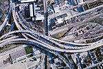
separating traffic between MacArthur and the Bay Bridge from the north–south traffic between Cypress and the Eastshore Highway. The enlargement to the Maze...
26 KB (2,715 words) - 02:57, 1 October 2024
The MacArthur Leyte Landing Memorial National Park (also known as the Leyte Landing Memorial Park and MacArthur Park) is a protected area of the Philippines...
13 KB (1,162 words) - 18:49, 1 July 2024
that links SCTEX with North Luzon Expressway (NLEX) and crosses over MacArthur Highway (N2). Past the Clark Logistics interchange, its main destination changes...
27 KB (2,189 words) - 18:15, 10 October 2024
companies' rest stops can be found along MacArthur Highway including Siesta and Motorway. The MacArthur Highway goes from the southern to the northern end...
22 KB (1,738 words) - 08:29, 1 November 2024
Interstate 580 (California) (redirect from Macarthur freeway)
1960). "US 50 Freeway: State Begins Construction on MacArthur Freeway in Oakland". California Highways and Public Works. Vol. 39, no. 3–4. p. 8. ISSN 0008-1159...
48 KB (3,671 words) - 09:17, 10 November 2024
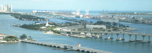
Douglas MacArthur Causeway is a six-lane causeway that connects Downtown Miami to South Beach via Biscayne Bay in Miami-Dade County. The highway is the...
5 KB (374 words) - 06:02, 29 April 2024
Luzon. It currently ends in Mabalacat. The NLEX runs parallel to the MacArthur Highway, which is officially known as the Manila North Road. From Balintawak...
65 KB (4,434 words) - 07:02, 15 November 2024
Valenzuela, until a permanent town hall was built near the intersection of MacArthur Highway and the old Polo-Novaliches Road. The division soon proved to be detrimental...
145 KB (12,589 words) - 16:07, 26 October 2024
and MacArthur Highway, or alight at Capas-Angeles Transport Terminal which is also walking distance from Fields Avenue and the MacArthur Highway. The...
9 KB (1,112 words) - 09:16, 1 November 2024
According to the 2020 census, it has a population of 94,485 people. The MacArthur Highway goes through the center of the town. Gerona is one of the 17 towns...
17 KB (938 words) - 07:00, 1 November 2024
vehicular accident along a highway in Pampanga, now known as the MacArthur Highway. The accident which occurred on November 4, 1954, which killed House...
13 KB (708 words) - 06:54, 28 September 2024
long, 9.42 meters (30.9 ft) wide, and connects the Maharlika Highway and the MacArthur Highway from the Ilocos Region to Cagayan Valley. The viaduct was...
3 KB (182 words) - 11:26, 11 October 2024
along MacArthur Highway. A part of the MacArthur Highway cutting across Barangay Lolomboy, Bocaue leading to Marilao. View from MacArthur Highway's Bocaue...
33 KB (2,382 words) - 05:11, 20 November 2024
Entering Metro Manila, the highway follows MacArthur Highway over Valenzuela, which runs on a four to six-lane highway up to the Bonifacio Monument...
53 KB (4,448 words) - 02:36, 16 November 2024
Long Island MacArthur Airport (IATA: ISP, ICAO: KISP, FAA LID: ISP), formerly known as Islip Airport, is a public airport in Ronkonkoma, New York, within...
73 KB (6,636 words) - 02:46, 13 November 2024
Consunji Street in the downtown; and SM City Telabastagan, along MacArthur Highway in barangay Telabastagan. Robinsons Starmills Pampanga or Robinsons...
44 KB (4,214 words) - 08:39, 9 November 2024
2604194; 120.5597806 Banban Bridge is a highway bridge in Central Luzon, Philippines which is part of the MacArthur Highway (N2). The bridge was constructed...
2 KB (130 words) - 18:29, 13 March 2024
along Macabulos Drive, San Roque, and the annex campus, located along MacArthur Highway in San Miguel. The annex campus has been officially known as Jose...
6 KB (485 words) - 00:51, 11 November 2024
accessible via Tarlac–Pangasinan–La Union Expressway (TPLEX), or via the MacArthur Highway. The town itself is dotted with ancestral houses and heritage structures...
19 KB (1,297 words) - 06:58, 1 November 2024
starts from this town and ends in Baguio. It is accessible via the MacArthur Highway, or via the NLEX (North Luzon Expressway), SCTEX (Subic–Clark–Tarlac...
21 KB (1,544 words) - 10:44, 1 November 2024
Medical Center, Inc. 329 MacArthur Highway, Brgy. Tapuac, Dagupan City Dagupan Doctors Villaflor Memorial Hospital, Inc. McArthur Highway, Mayombo District,...
104 KB (61 words) - 16:59, 10 November 2024
District. MacArthur High School in Lawton, Oklahoma. MacArthur Middle School on Fort George G. Meade army base in Fort Meade, Maryland. Macarthur High School...
23 KB (3,026 words) - 12:48, 20 May 2024
Urdaneta–Dagupan Road (redirect from N57 highway (Philippines))
or city of Urdaneta and vice versa. It starts at the junction with MacArthur Highway and Asingan–Urdaneta Road in Urdaneta City. The road continue westward...
3 KB (211 words) - 12:59, 19 May 2024
Metro Manila. It runs for approximately 4.5 kilometers (2.8 mi) from MacArthur Highway in barangay Malinta, past the North Luzon Expressway intersection...
6 KB (409 words) - 17:41, 10 November 2024
Radial Road 9 (section MacArthur Highway)
Rizal Avenue. It runs underneath the LRT Line 1. R-9 becomes the MacArthur Highway after crossing the intersection of EDSA and Samson Road at the Monumento...
3 KB (231 words) - 15:39, 31 October 2024
Street Fatima Medical Center – MacArthur Highway F and P Hernandez Maternity and Lying–in Clinic – MacArthur Highway, Marulas Pasolo Maternity and Medical...
18 KB (1,958 words) - 17:58, 24 August 2024
intersection with MacArthur Highway and Carmen–Alcala Road at Barangay Carmen, Rosales. "Pangasinan 3rd". Department of Public Works and Highways. Retrieved...
4 KB (252 words) - 09:06, 23 July 2024
MacArthur Thruway (Chinese: 麥克阿瑟公路; pinyin: Màikèāsè Gōnglù; shortened to 麥帥公路; Mài Shuài Gōnglù), was the first controlled-access highway in Taiwan, linking...
5 KB (607 words) - 22:57, 28 April 2024


