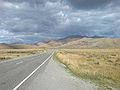
The Mackenzie Highway is a Canadian highway in northern Alberta and the Northwest Territories. It begins as Alberta Highway 2 at Mile Zero in Grimshaw...
12 KB (666 words) - 02:02, 1 February 2024
Canada's Northwest Territories Alberta Mackenzie County, a specialized municipality in northwestern Alberta Mackenzie Highway, in Alberta McKenzie Lake, Calgary...
5 KB (564 words) - 11:38, 29 July 2024
border on the Hay River. Enterprise is at an important junction of the Mackenzie Highway and the road to Yellowknife and was established when two service stations...
12 KB (1,296 words) - 12:56, 27 July 2024
the Mackenzie Highway, from a junction 188 km (117 mi) north of the Alberta border. First completed in 1960 as a gravel and dirt road, the highway is now...
5 KB (323 words) - 20:11, 2 July 2024
Lake northwest to the town of Mackenzie, near the southern arm of Williston Lake. Highway 39 and the town of Mackenzie were both built in the 1960s as...
2 KB (124 words) - 18:16, 30 July 2023

to Inuvik, Northwest Territories on the Mackenzie River delta. The highway crosses the Peel and the Mackenzie rivers using a combination of seasonal ferry...
13 KB (1,099 words) - 09:11, 7 July 2024

Yellowknife Highway branches out from Mackenzie Highway and connects it to Yellowknife. Dempster Highway is the continuation of Klondike Highway. It starts...
79 KB (6,163 words) - 17:29, 10 August 2024

Provincial Highway No. 35, commonly referred to as Highway 35, is a north–south highway in northwest Alberta, Canada that forms a portion of the Mackenzie Highway...
6 KB (196 words) - 04:53, 24 July 2022

Alberta, Canada. It is located at the intersection of the Mackenzie Highway (Highway 35) and Highway 58, approximately 733 kilometres (455 mi) north of Edmonton...
22 KB (1,800 words) - 19:41, 7 August 2024
Zama City (category Mackenzie County)
Canada within Mackenzie County. It is located north of Zama Lake along Zama Road, which branches off the Mackenzie Highway (Highway 35) approximately...
7 KB (309 words) - 14:23, 5 January 2024

Mackenzie County is a specialized municipality in northern Alberta, Canada. It is located in Census Division 17, along the Mackenzie Highway. The municipal...
16 KB (795 words) - 15:52, 8 December 2022
highways in the Northwest Territories of Canada. They are divided amongst Arterial Class Highways, of which there are six; Collector Class Highways,...
13 KB (216 words) - 19:55, 2 July 2024

the junction of Highway 2 and Highway 2A and along Mackenzie Northern Railway. By virtue of being the original starting point of Highway 35, which leads...
18 KB (1,379 words) - 21:23, 23 July 2024
19th Avenue 16th Avenue Elgin Mills Road Highway 7 Highway 407 14th Avenue Steeles Avenue "Major MacKenzie Drive. route". Google Maps. Retrieved July...
9 KB (538 words) - 22:38, 12 August 2024
Jean Marie River (section Mackenzie River Flooding)
year and by the all-season JMR Access Road 27 km (17 mi) from the Mackenzie Highway. In the 2021 Census of Population conducted by Statistics Canada,...
13 KB (786 words) - 19:39, 29 December 2023

Fort Providence (category Populated places on the Mackenzie River)
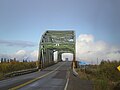
road connections by way of the Yellowknife Highway (Great Slave Highway) branch off the Mackenzie Highway, and the Deh Cho Bridge opened November 30,...
16 KB (868 words) - 09:51, 11 August 2024
junction with Highway 5. The highway was originally a portion of the Mackenzie Highway; this status ended with the extension of the highway northwest from...
2 KB (140 words) - 17:10, 22 December 2022
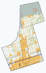
King's Highway 48, also known as Highway 48, is a provincially maintained highway in southern Ontario that extends from Major Mackenzie Drive in Markham...
23 KB (1,938 words) - 15:08, 8 August 2024
The Mackenzie River (French: Fleuve (de) Mackenzie; Slavey: Deh-Cho [tèh tʃʰò], literally big river; Inuvialuktun: Kuukpak [kuːkpɑk], literally great river)...
72 KB (6,655 words) - 23:02, 17 August 2024
Alps constitute its western edge. The Mackenzie Basin is located entirely within South Canterbury. Using State Highway 8, it can be accessed via Burkes Pass...
14 KB (1,507 words) - 20:38, 22 July 2024

Great Slave Lake (category Tributaries of the Mackenzie River)
highway was built around the west side of the lake, originally an extension of the Mackenzie Highway but now known as Yellowknife Highway or Highway 3...
20 KB (2,065 words) - 20:55, 19 June 2024
1 mi) east Cardinal Lake, Highway 2 meets Highway 35, the Mackenzie Highway. Highway 2 turns south to Grimshaw, while Highway 35 turns north, following...
111 KB (7,512 words) - 19:24, 16 August 2024

Falls (15 m drop), the second of the Twin Falls. Situated on the Mackenzie Highway the falls are about 10 km (6.2 mi) southwest of Enterprise and 43 km...
4 KB (251 words) - 05:00, 7 July 2024

The Canadian province of Alberta has a provincial highway network consisting of over 31,400 kilometres (19,500 mi) of roads as of 2021-2022, of which...
158 KB (1,097 words) - 19:02, 21 August 2024

community in northern Alberta, Canada. It is west of Highway 35 (also known as the Mackenzie Highway) approximately midway between Manning to the south...
8 KB (180 words) - 22:19, 15 January 2024

routes are the Mackenzie Highway and Bicentennial Highway in the northwest, the Northern Woods and Water Route in the southeast and Highway 63 in the east...
12 KB (860 words) - 02:15, 18 November 2023

to the southern Canadian city of Edmonton via the Yellowknife and Mackenzie Highways. This list ranks buildings in Yellowknife that stand at least 30 m...
17 KB (1,218 words) - 16:20, 16 August 2024
National Highway System (French: Réseau routier national) in Canada is a federal designation for a strategic transport network of highways and freeways...
74 KB (1,269 words) - 09:58, 21 August 2024

SS Distributor and SS Mackenzie, were retired around the same time. In later years, with the construction of the Mackenzie Highway from Alberta to Great...
134 KB (2,331 words) - 03:47, 22 August 2024

all-weather highway, the Tuktoyaktuk Winter Road, an ice road, connected Inuvik with Tuktoyaktuk during the winter months across the frozen Mackenzie River...
9 KB (908 words) - 12:12, 3 November 2023