
State Route 189 (SR 189) is a numbered state highway in Maine, running from U.S. Route 1 (US 1) in Whiting in the west to the Canada–US border at Lubec...
3 KB (183 words) - 05:33, 6 April 2023

Franklin Delano Roosevelt Bridge (redirect from Franklin Delano Roosevelt Bridge, Maine-New Brunswick)
Canada–United States border. The bridge, connecting New Brunswick Route 774 to Maine State Route 189, is Campobello Island's only fixed connection to the mainland...
6 KB (380 words) - 05:04, 1 May 2024

distinctive red-and-white stripes was built in 1858. Lubec is crossed by Maine State Route 189. The Franklin Delano Roosevelt Bridge connects the town to Campobello...
19 KB (1,496 words) - 22:12, 6 August 2023
Connecticut Route 189 Florida State Road 189 Georgia State Route 189 K-189 (Kansas highway) Kentucky Route 189 Maine State Route 189 Maryland Route 189 Massachusetts...
2 KB (151 words) - 23:29, 4 April 2024

State routes in Maine are highways within the Maine State Highway System that are signed and maintained by the Maine Department of Transportation, and...
91 KB (221 words) - 11:10, 11 April 2024

State Route 11 (SR 11) is a state highway in the U.S. state of Maine. It is a major interregional route which runs nearly the entire length of the state...
33 KB (1,652 words) - 09:12, 2 June 2024

State Route 191 (SR 191) is a 61.24-mile-long (98.56 km) state highway in the US state of Maine. Its southern terminus at SR 189 in Lubec to U.S. Route...
4 KB (338 words) - 06:21, 6 April 2023

U.S. Route 1 (US 1) in the U.S. state of Maine is a major north–south section of the United States Numbered Highway System, serving the eastern part of...
35 KB (1,059 words) - 21:16, 2 December 2023

New England road marking system (redirect from New England Multi-state Route 8)
Portland. Route 25 was replaced by U.S. Route 302, most of New Hampshire Route 25, and Maine State Route 25. Route 25A was replaced by Vermont Route 25 and...
158 KB (6,445 words) - 17:10, 1 February 2024

State Route 16 (SR 16) is a numbered state highway in Maine, United States. SR 16 runs from the New Hampshire state line (signed as NH-16) at Wentworth...
9 KB (290 words) - 18:21, 16 June 2024
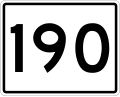
center. The entire route is in Washington County. "Maine DOT Map Viewer". Maine Office of GIS. Retrieved July 2, 2017. "Maine State Route 190" (Map). Google...
3 KB (298 words) - 06:20, 6 April 2023

U.S. Route 2 (US 2) in the U.S. state of Maine is a principal east–west route through the central portion of the state, extending from the New Hampshire...
17 KB (468 words) - 01:50, 11 June 2024

State Route 188 (SR 188) is part of Maine's system of numbered state highways, located in Penobscot County. It runs through three towns for the entire...
2 KB (124 words) - 05:32, 6 April 2023
Delano Roosevelt Bridge, Maine State Route 189 in the community of Lubec, Maine in the United States with New Brunswick Route 774 on Campobello Island...
7 KB (702 words) - 11:03, 16 July 2024

north–south from Miami, Florida to Houlton, Maine. The highway enters Maine from the New Hampshire state line in Kittery and runs for 303 miles (488 km)...
37 KB (2,566 words) - 10:39, 11 September 2024
Delano Roosevelt Bridge at the Canada–US border continuing on as Maine State Route 189. Roads portal Canada portal New Brunswick Department of Transportation:...
2 KB (181 words) - 08:58, 4 February 2024

U.S. Route 431 (US 431) in Kentucky runs 86.93 miles (139.90 km) from the Tennessee state line south of Adairville to US 60 at Owensboro. It crosses the...
16 KB (849 words) - 23:44, 1 June 2024

New Hampshire Route 101 (NH 101) is a state-maintained highway in southern New Hampshire extending from Keene to Hampton Beach. It is the major east–west...
37 KB (3,355 words) - 13:01, 24 May 2024
Montreal, Maine & Atlantic Railway (reporting mark MMA). Approximately 233 mi (375 km) of MNRY's route is owned by the government of the state of Maine while...
11 KB (1,255 words) - 02:36, 18 April 2024
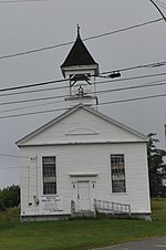
Whiting, on the north side of the three-way junction of US 1 and Maine State Route 189. It is a single story wood frame structure, with a gabled roof,...
3 KB (383 words) - 01:57, 26 May 2022

is at the Vermont state line in Charlestown, where it continues west as Vermont Route 11. The eastern terminus is at the Maine state line in Rochester...
24 KB (1,613 words) - 16:42, 20 February 2024

Yarmouth is a town in Cumberland County, Maine, United States, twelve miles north of the state's largest city, Portland. When originally settled in 1636...
58 KB (6,194 words) - 10:28, 8 September 2024

county seat of Penobscot County, Maine, United States. The city proper has a population of 31,753, making it the state's third-most populous city, behind...
67 KB (7,282 words) - 14:48, 23 August 2024

U.S. state of Maine, with the city's population at 37,121 as of the 2020 United States Census. The city lies halfway between Augusta, the state's capital...
88 KB (8,767 words) - 23:36, 7 September 2024

of the town of Limestone. U.S. Route 1A runs north-south through the center of the CDP, intersecting Maine State Routes 229 and 89. According to the United...
7 KB (515 words) - 16:46, 13 May 2023
district of the state capital of Augusta, a city in Kennebec County, Maine, United States. The airport is owned by the state of Maine, but managed and...
9 KB (847 words) - 03:18, 27 August 2024
Traffic Control Devices-standard yellow-on-blue pentagon route marker. Even numbered routes are east–west roads that increase by multiples of four from...
30 KB (139 words) - 16:35, 9 February 2024
Eric E. Soderholtz Cottage (category Houses on the National Register of Historic Places in Maine)
Eric E. Soderholtz Cottage is a historic house on Maine State Route 186 in West Gouldsboro, Maine. Built in 1902, it is a fine local example of rustic...
4 KB (477 words) - 17:22, 30 May 2022
New Brunswick Southern Railway (redirect from Eastern Maine Railroad)
Together with its sister company Eastern Maine Railway (reporting mark EMRY), NBSR and EMRY form a continuous 189.5 mi (305.0 km) main line connecting Saint...
9 KB (1,131 words) - 15:38, 11 April 2024

Vermont (redirect from State of Vermont)
St. Albans en route to the Canada–U.S. border. I-89 intersects I-91 in White River Junction and has a short spur route, Interstate 189, just outside of...
219 KB (21,844 words) - 06:26, 14 September 2024