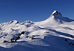
The Mohnenfluh is a 2,544-metre (8,346 ft) high mountain in the Austrian state of Vorarlberg. The Mohnenfluh is the second-highest summit in the region...
3 KB (135 words) - 23:53, 19 November 2024
Austria State Vorarlberg Physical characteristics Source • location Mohnenfluh in the Bregenz Forest Mountains near Schröcken • elevation 2,400 m (7...
3 KB (161 words) - 22:42, 10 November 2024
533 m (AA) (8,310 ft) Prominence 845 m ↓ Schrofen Pass Isolation 6.0 km → Mohnenfluh Coordinates 47°17′06″N 10°07′45″E / 47.285°N 10.12917°E / 47.285; 10...
6 KB (654 words) - 14:11, 5 April 2023
I/B-14.II-A Bern CH 1013 Mohnenfluh 2542 387 47°13′56″N 10°06′08″E / 47.23222°N 10.10222°E / 47.23222; 10.10222 (1013. Mohnenfluh (2542 m)) Lechquellen...
94 KB (827 words) - 18:10, 4 August 2024
Alberschwende. Between the trees, there are the Juppenspitze and the Mohnenfluh in Schröcken on the left and the northern flank of the Kanisfluh on the...
31 KB (3,658 words) - 23:56, 26 October 2024
2,649 m above sea level (AA) Hochlicht, 2,600 m above sea level (AA) Mohnenfluh, 2,542 m above sea level (AA) Karhorn, 2,416 m above sea level (AA) Zitterklapfen...
15 KB (1,573 words) - 11:12, 27 October 2024
current to the villa for 47 years. The veranda of Villa Maund with the Mohnenfluh seen in the distance (2009) Another view of the veranda of Villa Maund...
7 KB (766 words) - 06:54, 30 May 2024
Widderstein 2,533 Southeastern Walsertal Mountains Austria 845 Schrofen Pass 60 Mohnenfluh Hornbachspitze 2,533 Hornbach chain Austria 90 Hermannskarscharte 3 Großer...
148 KB (714 words) - 11:00, 1 November 2022


