
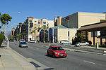
Monterey Road is a major Silicon Valley thoroughfare that runs from Gilroy north to San Jose, California, in Santa Clara County. It follows the historic...
15 KB (1,410 words) - 04:42, 3 June 2024
California county routes in zone G (redirect from Monterey County Route G13)
county highways in Monterey, San Benito, San Luis Obispo, Santa Clara, and Santa Cruz counties. County Route G1 (CR G1) is a road in San Benito County...
82 KB (6,527 words) - 17:52, 3 September 2024

17-Mile Drive (category Roads in Monterey County, California)
17-Mile Drive is a scenic road through Pebble Beach and Pacific Grove on the Monterey Peninsula in California, much of which hugs the Pacific coastline...
15 KB (1,621 words) - 21:51, 4 August 2024

Monterey Bay is a bay of the Pacific Ocean located on the coast of the U.S. state of California, south of the San Francisco Bay Area. San Francisco itself...
10 KB (914 words) - 20:47, 31 August 2024

Monterey County (/ˌmɒntəˈreɪ/ MON-tə-RAY), officially the County of Monterey, is a county located on the Pacific coast in the U.S. state of California...
89 KB (4,427 words) - 18:34, 21 August 2024
Monterey Park is a city in the western San Gabriel Valley region of Los Angeles County, California, United States, approximately seven miles (11 km) east...
66 KB (6,262 words) - 03:05, 4 September 2024

Blossom Hill station is a Caltrain station located off Monterey Road near the Blossom Hill Road expressway in San Jose, California. The station is only...
4 KB (259 words) - 19:12, 1 October 2024
that operated from 1961 to September 1980. It was located at 4885 Monterey Road, at the intersection with Branham Lane. The site is now Edenvale Garden...
40 KB (3,396 words) - 17:13, 23 August 2023

Isuzu Trooper (redirect from Opel Monterey)
SsangYong Korando Family, Honda Horizon, Opel Monterey, Vauxhall Monterey, Holden Jackaroo, and Holden Monterey. In total, there were two generations of this...
47 KB (4,639 words) - 17:09, 2 October 2024

California State Route 1 (category Roads in Monterey County, California)
Creek just south of the Monterey County line. For about 72 miles (116 km) from San Carpóforo Creek to Malpaso Creek, the road winds and hugs the cliffs...
137 KB (9,304 words) - 05:27, 5 October 2024

Monterey Regional Airport (IATA: MRY, ICAO: KMRY, FAA LID: MRY) is three miles (5 km) southeast of Monterey, in Monterey County, California, United States...
26 KB (2,880 words) - 05:00, 19 September 2024

connecting San José, Coyote, and Gilroy. The station depot was located along Monterey Road near the two-story Twelve-Mile House, built in 1858, and the Coyote...
14 KB (1,315 words) - 03:59, 5 September 2024
The Monterey International Pop Festival was a three-day music festival held June 16 to 18, 1967, at the Monterey County Fairgrounds in Monterey, California...
52 KB (6,310 words) - 02:20, 2 August 2024
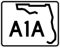
State Road A1A (SR A1A) is a major north–south Florida State Road consisting of seven separate sections running a total of 338.752 miles (545.168 km)...
60 KB (2,538 words) - 02:42, 7 September 2024

Capitol station is a Caltrain station located off Monterey Road near the Capitol Expressway, after which the station is named, in southern San Jose, California...
4 KB (242 words) - 19:12, 1 October 2024

construction of a bridge across the Arroyo Seco at Avenue 60 in 1926, the Monterey Road pass to the south in 1930, and the Hermon Avenue bridge (renamed Via...
12 KB (894 words) - 03:51, 15 August 2024
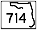
County Road A1A or CR A1A) in Stuart. The route is known locally as Martin Highway, Martin Downs Boulevard, and Southeast Monterey Road. State Road 714 begins...
6 KB (318 words) - 19:27, 25 August 2024
following locations: Monterey Road at the Monterey Road Pass, Huntington Drive North and Collis Avenue, Soto Street and Mission Road, before the Soto Street...
8 KB (635 words) - 21:46, 4 January 2024

destinations. Sargent Station was a key site for shipping oil along Monterey Road to San Jose. Around the turn of the century, the Watsonville Oil Company...
9 KB (813 words) - 06:45, 31 August 2024
Mosport were broadcast live on ESPN2, while the ALMS at Monterey, Road Race Showcase at Road America and ALMS at VIR had delayed highlights on the same...
15 KB (1,549 words) - 14:10, 1 April 2024
annually on the 20-acre (8 ha), oak-studded Monterey County Fairgrounds, located at 2004 Fairground Road in Monterey, on the third full weekend in September...
51 KB (5,959 words) - 20:17, 25 September 2024
Slaughter alley (redirect from Dangerous road)
fatalities, including a Greyhound bus and a fuel tanker. "Blood Alley": Monterey Road, the old U.S. 101 surface routing between Gilroy and San Jose, was known...
8 KB (889 words) - 21:27, 3 August 2024
Monterey Bay Football Club (Monterey Bay FC) is an American professional soccer team based in Monterey County, California. The club was established on...
36 KB (3,039 words) - 00:00, 6 September 2024

in 1869 marked the beginning of the town's prominence. Located off Monterey Road next to Sargent Ranch, the station quickly became a stop on the Southern...
11 KB (1,055 words) - 13:24, 13 June 2024

Big Sur (category Tourist attractions in Monterey County, California)
30 mi (48 km) trip from Monterey to the Pfeiffer Ranch in the Big Sur valley could take three days by wagon. It was a rough road that ended in present-day...
193 KB (20,229 words) - 19:20, 29 September 2024

San Martin Census-designated place Clockwise: Sign on Monterey Road; Lion's Peak; Old San Martin Winery. Location in Santa Clara County and the state...
13 KB (1,365 words) - 02:28, 24 July 2024

south, Huntington Drive to the southeast, and Monterey Road to the east. Neighboring districts include Monterey Hills on the northeast, El Sereno on the southeast...
6 KB (307 words) - 02:45, 26 June 2023
Intel high-end server". Computerworld. May 13, 2002. "Sequent "Project Monterey" Road Map". Computerworld. February 1, 1999. p. 28. "Caldera loads Linux apps...
5 KB (237 words) - 20:08, 25 August 2024
Big Sur Coast Highway (category Roads in Monterey County, California)
north of the San Luis Obispo/Monterey county border and as of August 2024 remains closed. The Nacimiento-Fergusson Road also remains closed. Governor...
98 KB (10,617 words) - 23:44, 6 September 2024

September 9, 1913, the first San Marino school was opened at the corner of Monterey Road, then called Calle de Lopez, and Oak Knoll, in what was known as the...
56 KB (5,475 words) - 00:00, 15 September 2024