
Motajica is a mountain of Bosnia and Herzegovina. It is a mountain island, because a few thousand years ago, when it was the Pannonian Sea, it and several...
2 KB (53 words) - 10:23, 2 February 2024

Klekovača Konjuh Kozara Lebršnik Lelija Orjen Osječenica Ozren Majevica Motajica Manjača Prenj Plješivica Raduša Romanija Trebević Treskavica Šator Velež...
24 KB (1,825 words) - 19:27, 23 August 2024

areas and flat farmlands. The mountain ranges to the south-east are called Motajica and the highest peak is called Gradina at 652m above sea level. The lowest...
12 KB (666 words) - 17:54, 1 March 2024

plans began with firstly liberating the villages of Kozara; Prosara and Motajica, then attacking the communications and blocking the cities of the Sava...
27 KB (2,878 words) - 17:07, 2 June 2024

In service with the River Flotilla of the Serbian Armed Forces. RML-332 Motajica - In service with the River Flotilla of the Serbian Armed Forces. RML-333...
29 KB (3,078 words) - 12:54, 7 July 2024
Jančić. The rebels retreated to their villages, except those in Kozara and Motajica who continued, and offered strong resistance until their defeat in mid-October...
22 KB (1,135 words) - 16:00, 28 July 2024

attempt by creating a "buffer zone" in the area around River Bosna-Kalinovik-Motajica-Travnik. The Partisans were ultimately victorious, inflicting heavy losses...
8 KB (929 words) - 13:53, 6 July 2024
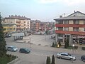
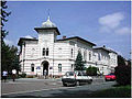
Prnjavor is shielded on all sides by low mountains such as Ljubić (south) and Motajica (north). The town of Prnjavor is located at an altitude of 185m. Other...
27 KB (2,285 words) - 20:53, 31 July 2024
16°58′39″E / 44.97095556°N 16.97743944°E / 44.97095556; 16.97743944 Motajica Gradina 652 m 2,139 ft Srbac 45°05′34″N 17°39′46″E / 45.09288361°N 17...
8 KB (66 words) - 09:12, 27 August 2024
Dalmatian Channels, November 1991. Neštin class Minesweeper Neštin (M-331) Motajiča (M-332) Belegis (M-333) Bosut (M-334) Vučedol (M-335) Panonsko More (M-337)...
37 KB (1,734 words) - 21:58, 26 April 2024
retreated to their villages. Only the rebels on the mountains of Kozara and Motajica continued, and offered strong resistance, which the Ottomans finally crushed...
8 KB (640 words) - 20:15, 30 June 2024

the beginning of Vrbas, between Sava in the north, Prosara in the west, Motajica in the east, and Kozara in the southwest. The western border of the plain...
13 KB (1,292 words) - 07:41, 10 December 2023

subsurface, within the metamorphic rock. Strontium-argon dating of the Motajica granitoid returned an age of 48 million years ago. After the formation...
6 KB (804 words) - 09:01, 14 July 2024
Instead, Đurišić kept moving on a route south of the river, towards the Motajica mountain and the Lijevče field, a large plain between the Bosna, Vrbas...
32 KB (4,081 words) - 23:09, 2 August 2024

March 1944 Konjic district 230 2 battalions — 25 May 1944 — Motajica 11 November 1943 Motajica — 1 company 3 companies (April 1944) 11th Division (11 November...
47 KB (1,746 words) - 08:20, 12 January 2023

the war in the central Bosnian regions of Banja Luka, Uzlomac Mountain, Motajica Mountain, Prnjavor, Vlašić Mountain, Srbac, Teslić/Tešanj and others. Nevenka...
12 KB (1,498 words) - 02:57, 11 June 2023