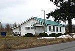
the communities of Mount Hood and Parkdale in the U.S. state of Oregon. Its ZIP code is 97041. "MOUNT HOOD PARKDALE — Post Office". tools.usps.com. Retrieved...
1 KB (70 words) - 21:11, 29 August 2023
Parkdale is an unincorporated community and census-designated place (CDP) in Hood River County, Oregon, United States. As of the 2010 census, the population...
11 KB (682 words) - 17:48, 12 November 2024
northeast of Parkdale on Oregon Route 35. As of the 2010 census it had a population of 286. Mount Hood is the terminus of Oregon Route 281, the Hood River Highway...
8 KB (376 words) - 05:53, 28 September 2024
mountain Mount Hood Parkdale, Oregon, the name of the post office that serves Mount Hood, Oregon List of ships called HMS Hood Hood Steamer, an early (1900–01)...
4 KB (487 words) - 13:48, 12 November 2024
year. The peak is home to 12 named glaciers and snowfields. Mount Hood is considered the Oregon volcano most likely to erupt. The odds of an eruption in...
56 KB (4,716 words) - 18:20, 30 October 2024
The Mount Hood Railroad (reporting mark MHRR) is a heritage and shortline freight railroad located in Hood River, Oregon, 60 miles (97 km) east of Portland...
8 KB (733 words) - 05:33, 25 June 2024
Clackamas River (Sandy), Hood River (Mount Hood-Parkdale), and Zigzag (Zigzag). In descending order of land area, the Mount Hood National Forest is located...
12 KB (1,014 words) - 05:39, 27 October 2024
Hood River County is one of the 36 counties in the U.S. state of Oregon. As of the 2020 census, the population was 23,977. The county seat is Hood River...
26 KB (2,609 words) - 01:48, 9 August 2024
The Mount Hood Highway No. 26 (see Oregon highways and routes) is the Oregon Department of Transportation's designation for a 96.74-mile-long (155.69 km)...
14 KB (1,322 words) - 03:36, 15 June 2024
Oregon Route 281 is an Oregon state highway running from Hood River to the community of Mount Hood. OR 281 is known as the Hood River Highway No. 281...
3 KB (260 words) - 09:26, 23 June 2023
Hood River Valley is the river basin of Hood River in northern Oregon, U.S. It is bounded by the Columbia River to the north, Mount Hood to the south,...
4 KB (467 words) - 12:36, 20 March 2021
Oregon Route 35 is a state highway in the U.S. state of Oregon, running between Government Camp on the slopes of Mount Hood and the city of Hood River...
12 KB (908 words) - 06:38, 3 October 2024
the Hood River, just north of the city's historic train depot on the Mount Hood Railroad, where excursion trains depart for Parkdale near Mount Hood. Across...
71 KB (5,596 words) - 09:07, 11 September 2024
- Monroe - Monument - Morgan - Moro - Mosier - Mount Angel - Mount Hood - Mount Hood Village - Mount Vernon - Mountain Air Park - Mountain View - Mountaindale...
41 KB (1,679 words) - 14:25, 29 September 2024
The Hood River station is a historic train station in Hood River, Oregon, currently serving the heritage Mount Hood Railroad. The station was listed on...
12 KB (926 words) - 21:31, 7 October 2024
districts designated on the National Register of Historic Places in Hood River County, Oregon, United States, and offers brief descriptive information about...
21 KB (742 words) - 23:16, 18 August 2022
(also designated the Cascade Locks Highway) Mount Hood Highway No. 26 for three miles (4.8 km) through Hood River Historic Columbia River Highway No. 100...
36 KB (2,200 words) - 20:14, 16 July 2024
branch line in Central Oregon, connecting Gilchrist to the UP mainline. Mount Hood Railroad (MH). Connects Hood River with Parkdale. Primarily an excursion...
27 KB (2,783 words) - 18:49, 28 January 2024
Cloud Cap Inn (category Buildings and structures in Hood River County, Oregon)
The Cloud Cap Inn is a historic building located high on Mount Hood, Oregon, United States. It was a luxury inn for mountain climbers that included telephones...
4 KB (266 words) - 04:21, 6 August 2023
(see Oregon highways and routes). It is 3.45 miles (5.55 km) long and runs northwest to southeast (signed west and east), entirely within Hood River...
2 KB (226 words) - 14:01, 1 May 2023
Columbia Gorge AVA (category Geography of Hood River County, Oregon)
north; Lyle, Washington, on the east; Parkdale, Oregon, on the south; and Vinzenz Lausmann State Park, Oregon, on the west. The area lies due west with...
18 KB (1,999 words) - 23:34, 18 October 2024
NRHP-listed Oregon State Forester's Office Building, 2600 State Street, Salem, Oregon (Linn A. Forrest Sr.) Parkdale Ranger Station, Mt. Hood National Forest...
20 KB (2,308 words) - 12:52, 1 October 2024
site". Hutson Museum. Retrieved January 15, 2015. "Hutson Museum". Mount Hood, Oregon. Retrieved January 15, 2015. "I.O.N. Heritage Museum". City of Joran...
90 KB (1,892 words) - 06:49, 15 August 2024
List of ski areas and resorts in the United States (redirect from Skiing in Oregon)
Canyon) – Las Vegas Mount Rose – Reno Sky Tavern Ski Area – Reno 1 2 3 4 5 6 a 11 12 Anthony Lakes – North Powder Cooper Spur – Parkdale Ferguson Ridge –...
103 KB (2,707 words) - 20:32, 1 November 2024
based on the 2010 census. Oregon portal List of counties in Oregon List of cities and unincorporated communities in Oregon "Oregon: 2010 - Census Bureau"...
25 KB (52 words) - 05:33, 12 July 2023
Area codes 541 and 458 (category Area codes in Oregon)
the North American Numbering Plan (NANP) for most of the U.S. state of Oregon, excluding only the northwestern corner of the state. The service area includes...
88 KB (505 words) - 03:46, 4 October 2024
(secondary coordinates) List of canals in Oregon contains all canals identified by the USGS in the U.S. state of Oregon. The USGS defines a canal as a manmade...
154 KB (79 words) - 09:53, 24 December 2023
Sports in Maryland (section Hood College)
Northwestern High School, Hyattsville Oxon Hill High School, Oxon Hill Parkdale High School, Riverdale Potomac High School, Oxon Hill Eleanor Roosevelt...
62 KB (3,433 words) - 21:57, 27 September 2024
names Manapouri Pl 1967 Parkdale Development Lake Oban Avenue 1965 M.T. McDonald Oregon Crescent Parkdale Place 1964-66c Parkdale Development Co eponymous...
124 KB (725 words) - 19:22, 13 October 2024
pages: 23 "Negro taken by mob and hanged". Capital Journal. Salem, Marion, Oregon: G. Putnam. August 30, 1922. pp. 1–8. ISSN 2470-6779. OCLC 21019600. Retrieved...
362 KB (12,053 words) - 23:14, 18 November 2024


