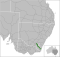
Mountain Highway (also known as Wantirna–Sassafras Road) is an 18 km west–east highway located in the eastern suburbs of Melbourne, linking the outer fringes...
8 KB (462 words) - 05:02, 3 March 2024
The Cheyenne Mountain Highway, also called Cheyenne Mountain Zoo Road,: 1, 7:1 is a road in Colorado Springs, Colorado that begins at the intersection...
16 KB (1,587 words) - 16:53, 7 November 2023
Snowy Mountains Highway is a 333-kilometre-long (207 mi) state highway located in New South Wales, Australia. Its two sections connect the New South Wales...
25 KB (2,176 words) - 05:44, 26 August 2024
The Mountain Loop Highway is a scenic byway in the U.S. state of Washington. It traverses the western section of the Cascade Range within Snohomish County...
11 KB (1,023 words) - 14:43, 25 September 2024
360. Highway 360 is a narrow, winding, and low speed mountain highway. Its initial junction is marked as Mile Zero at Route 36, and the highway runs in...
15 KB (1,178 words) - 16:01, 25 July 2024
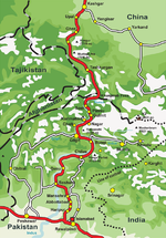
Region. The highway is a popular tourist attraction and is one of the highest paved roads in the world, passing through the Karakoram mountain range, at...
33 KB (3,205 words) - 00:50, 23 December 2024
Colorado Springs and Cripple Creek District Railway (section Colorado Springs and Cripple Creek District Railway--Corley Mountain Highway)
Corley Mountain Highway at that time. Corley removed all the tracks, installed toll booths at both ends and opened the Corley mountain highway in 1926...
7 KB (880 words) - 16:08, 2 December 2023
portion of Stone Mountain Freeway from I-285 to the Dekalb/Gwinnett county line is alternatively designated as Bill Evans Highway. Stone Mountain Freeway begins...
11 KB (917 words) - 02:14, 12 December 2024
on the mountain and built the Cheyenne Mountain Zoo, Cheyenne Mountain Highway, Will Rogers Shrine of the Sun, a lodge on one of the mountain peaks, and...
38 KB (4,069 words) - 19:36, 17 December 2024
Bayswater library is located inside the Mountain High Shopping Centre. Bayswater Station is located near the Mountain Highway, and is on the Belgrave line. Bayswater...
11 KB (1,059 words) - 17:38, 21 December 2024
Highway 99 is a provincial highway in British Columbia that runs 377 kilometres (234 mi) from the U.S. border to near Cache Creek, serving Greater Vancouver...
100 KB (8,919 words) - 00:23, 16 September 2024
State highways cross the forest, including US 3, US 302, NH 16 (White Mountain Highway), NH 112 (Kancamagus Highway), and NH 118 (Sawyer Highway). It is...
11 KB (933 words) - 01:10, 8 October 2024
The Transcaucasian Highway (Russian: Транскавказская автомагистраль) or TransKAM (ТрансКАМ) is a mountain highway in the South Caucasus region, connecting...
2 KB (154 words) - 07:20, 3 November 2024
Saskatchewan Rivers, and at the crossroads of Highway 22 (Cowboy Trail) and Highway 11 (David Thompson Highway). The surrounding Clearwater County's administration...
27 KB (2,051 words) - 17:53, 28 August 2024
Pan-American Highway continues on B.C. Highway 97 as it passes through Toad River Post, and then Summit Lake, which is nested between Stone Mountain and Mount...
71 KB (8,796 words) - 08:32, 23 December 2024
The Canadian province of Alberta has a provincial highway network consisting of over 31,400 kilometres (19,500 mi) of roads as of 2021-2022, of which...
157 KB (1,036 words) - 15:50, 30 August 2024
the mountain plum-pine, a low-lying type of conifer. The Alpine Way and Snowy Mountains Highway are the major roads through the Snowy Mountains region...
24 KB (2,464 words) - 11:13, 30 August 2024
Espinazo del Diablo (section Highway)
including rare cloud forests, and for a stretch tortuous mountain highway (part of Mexican Federal Highway 40) also called the Espinazo del Diablo. The Espinazo...
5 KB (615 words) - 16:13, 10 February 2023
completely disappears and the mountain slopes on the leeward side become brown and arid. Most of the mountain peaks and highway Pass north of Darcha remain...
19 KB (1,631 words) - 21:34, 17 October 2024
U.S. Route 15 in Maryland (redirect from Catoctin Mountain Highway)
most of its length as Catoctin Mountain Highway, US 15 is the primary north–south highway of Frederick County. The highway connects the county seat of Frederick...
55 KB (6,294 words) - 13:46, 24 August 2024
Mountain High, is called the Big Pines Highway to the Route 138 junction. Another key county route through, the mountains is Angeles Forest Highway....
29 KB (3,420 words) - 04:44, 17 November 2024
Oregon Route 245 (redirect from Dooley Mountain Highway No. 415)
an Oregon state highway running from Salisbury to Unity. OR 245 is known as the Dooley Mountain Highway No. 415 (see Oregon highways and routes). It is...
3 KB (322 words) - 09:26, 23 June 2023
Cut chairlift, where some of them are still in use. The Old Grouse Mountain Highway, a gravel road that was constructed to provide access to the base,...
36 KB (3,639 words) - 04:29, 19 December 2024
U.S. Route 36 (redirect from United States Highway 36)
Numbered Highway that travels approximately 1,414 miles (2,276 km) from Rocky Mountain National Park, Colorado to Uhrichsville, Ohio. The highway's western...
15 KB (1,380 words) - 22:03, 30 September 2024
under Maynard Mountain, part of the Chugach Mountain Range. Parts of the route were first constructed in the early 1900s, and the entire highway was completed...
60 KB (6,590 words) - 03:13, 30 August 2024
The Pikes Peak Highway ends on the summit of Pikes Peak. Pikes Peak is the most visited mountain summit in North America. The highway remains open all...
53 KB (720 words) - 01:11, 28 October 2024
Utah State Route 12 (redirect from Highway 12 - A Journey Through Time Scenic Byway)
long portion of the highway that ascends and descends Boulder Mountain on the Aquarius Plateau is known as Boulder Mountain Highway. The segment of SR-12...
11 KB (1,015 words) - 07:24, 2 May 2024
Halsema Highway (also known as the Benguet–Mountain Province Road, the Baguio–Bontoc Road, and the Mountain Trail) is a national secondary highway in the...
8 KB (554 words) - 07:09, 7 July 2024
U.S. Route 491 (redirect from United States Highway 666)
Navajo Nation and Ute Mountain Ute Tribe. The highway passes by two mountains considered sacred by Native Americans: Ute Mountain and an extinct volcanic...
36 KB (3,508 words) - 13:41, 12 October 2024
Veterans Memorial Highway to the summit, while another is used by the Wilmington Trail. A long rock slide on the Southern face of the mountain, known as the...
29 KB (2,537 words) - 17:45, 14 December 2024


