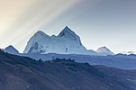
Mururaju, Murrorajo or Pongos Sur is a mountain in the Cordillera Blanca in the Andes of Peru, about 5,688 metres (18,661 ft) high. It is situated in the...
2 KB (163 words) - 22:12, 15 April 2022
Ancash Region, Recuay Province, Catac District. Tantash lies southeast of Mururaju and east of Pukarahu. Peru 1:100 000, Recuay (20-i). IGN (Instituto Geográfico...
1 KB (71 words) - 01:56, 16 April 2022
Bolivia – Chile 5,688 Mururaju Cordillera Blanca 9°48′27″S 77°14′38″W / 9.80750°S 77.24389°W / -9.80750; -77.24389 (Mururaju) Peru 5,686 Vallunaraju...
61 KB (174 words) - 21:34, 18 April 2024
753 ft) Shacsha, 5,703 metres (18,711 ft) Rúrec, 5,700 metres (18,701 ft) Mururaju, 5,688 metres (18,661 ft) Vallunaraju, 5,686 metres (18,655 ft) Caullaraju...
18 KB (1,780 words) - 12:32, 29 April 2024
Ancash Region, Recuay Province, Catac District. Cuncush lies southwest of Mururaju and northwest of Pukarahu. escale.minedu.gob.pe - UGEL map of the Recuay...
2 KB (110 words) - 05:35, 15 April 2022
District. The peaks of Pucarajo lies southeast, south and southwest of Mururaju. escale.minedu.gob.pe - UGEL map of the Recuay Province (Ancash Region)...
2 KB (109 words) - 22:17, 15 April 2022
the Cordillera Blanca, southwest of Yanamarey and Pucaraju, northwest of Mururaju and Queshque and east of Recuay. Queshquecocha List of lakes in Peru Alpenvereinskarte...
5 KB (238 words) - 07:31, 14 June 2024


