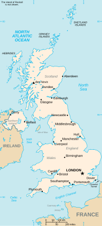
Nerston is a village situated on the northern green-belt boundary of the new town of East Kilbride in South Lanarkshire, Scotland. Nerston is Scots for...
9 KB (810 words) - 16:51, 6 April 2024
Nerston on the R65 road in Mpumalanga is a border post between South Africa and Eswatini. The Eswatini side of the border is known as Sandlane, and the...
1 KB (68 words) - 19:46, 29 July 2024
Zanzibar Bothashoop Emahlathini Golela Jeppe's Reef Josefsdal Mahamba Mananga Nerston Onverwacht, KZN Oshoek Waverley Boesmansnek Caledonspoort Ficksburg Bridge...
3 KB (195 words) - 07:46, 15 July 2024
Amsterdam. The R65 continues east-north-east for 17 kilometres to reach the Nerston Border Post, where it crosses into Eswatini and becomes the MR19 route...
2 KB (134 words) - 19:17, 10 September 2024
Blackwood, Caldermill, Chapelton, Drumclog, Glassford, Kirkmuirhill, Jackton, Nerston, Stonehouse and Thorntonhall. The following electoral wards formed the...
15 KB (438 words) - 19:23, 17 October 2024
National Cycle Route 756 (section Cathkin to Nerston)
Cathkin, the route runs alongside the A749 dual carriageway to Nerston. From Nerston, the route skirts Kingsgate Retail Park then heads down Mavor Avenue...
3 KB (248 words) - 13:45, 4 February 2023
Mossend Mossneuk Motherwell Mount Vernon Muirhead The Murray Nemphlar Nerston Netherburn New Lanark New Stevenston Newarthill Newbank Newbigging Newhouse...
27 KB (2,122 words) - 05:39, 8 November 2024
outskirts of the town in northern, western and south-eastern directions (Nerston, College Milton and Kelvin respectively). The Calderglen gorge bordering...
56 KB (5,730 words) - 23:12, 7 November 2024
of the 2023–24 season. The 90-acre Playsport site, location between the Nerston and Stewartfield areas on the northern edge of the town, was first opened...
5 KB (362 words) - 02:17, 23 May 2024
also crosses here R65 Nerston MR19 Sandlane 08:00–18:00 26°34′11″S 30°47′30″E / 26.5697°S 30.7918°E / -26.5697; 30.7918 (Nerston / Sandlane border crossing)...
5 KB (133 words) - 03:31, 1 November 2022
a consequence of the 1939–45 war, after which the line was cut back to Nerston where it serviced some local industries such as Mavor and Coulson Mining...
9 KB (1,090 words) - 07:09, 8 November 2024
Mains and Lymekilns in East Kilbride between East Mains, Calderwood and Nerston in East Kilbride B784 east of Camphill Water Treatment Works, west of Kilbirnie...
19 KB (72 words) - 16:09, 8 July 2024
A726 on the western side of the town), and for the Kingsgate Retail Park (Nerston). After a traffic light junction the road becomes National Speed Limit...
8 KB (971 words) - 16:29, 15 February 2023
Village Leadhills Lesmahagow Lindsayfield Little Sparta Mossneuk Murrayhill Nerston Netherburn New Lanark Newlandsmuir Newton New Trows Newbigging Peel Park...
5 KB (249 words) - 00:48, 24 April 2024
as a result of WWII war shortages, after which the line was cut back to Nerston where it serviced local industries. The Calderwood Estate, was taken over...
5 KB (555 words) - 17:48, 18 September 2024
information on packaging; titles encoded on disc using CD Text) NFR16 - Nerston Surface/First Voice To Earth CDR (limited to 50 copies in hand-painted...
31 KB (4,314 words) - 20:59, 23 October 2024
Burnbank), Hamilton, and the University of the West of Scotland campus) on to Nerston in the north of East Kilbride. There, it links with the A749 (which runs...
6 KB (611 words) - 07:49, 8 December 2023
town, including the neighbourhoods of Gardenhall, Hairmyres, Mossneuk, Nerston (the brownfield residential developments, but not the older separate hamlet)...
7 KB (652 words) - 15:13, 25 June 2024
as well as Brancumhall, part of St Leonards (east of High Common Road), Nerston (the separate hamlet, but not the brownfield residential developments south...
6 KB (553 words) - 15:14, 25 June 2024
Flintshire 53°08′N 3°09′W / 53.14°N 03.15°W / 53.14; -03.15 SJ2361 Nerston South Lanarkshire 55°46′N 4°10′W / 55.77°N 04.17°W / 55.77; -04.17 NS6456...
73 KB (26 words) - 20:38, 4 June 2022


