Route 1 is a highway in the Canada province of Newfoundland and Labrador, and is the easternmost stretch of the Trans-Canada Highway. Route 1 is the primary...
31 KB (1,150 words) - 22:56, 19 August 2024
The Trans-Labrador Highway (TLH) is the primary public road in Labrador, the mainland portion of the province of Newfoundland and Labrador, Canada. The...
26 KB (1,552 words) - 01:55, 11 October 2024
Canadian province of Newfoundland and Labrador. The route begins at the intersection of Route 1 (The Trans Canada Highway) in Deer Lake and ends in St. Anthony...
14 KB (825 words) - 18:21, 5 April 2024
primary entry point onto the island of Newfoundland and the western terminus of the Newfoundland and Labrador Route 1 (Trans-Canada Highway) in the province...
29 KB (2,055 words) - 14:33, 1 October 2024
Grand Falls-Windsor (redirect from Windsor, Newfoundland and Labrador)
located in the central region of the island of Newfoundland in the province of Newfoundland and Labrador, Canada, with a population of 13,853 at the 2021...
30 KB (2,595 words) - 15:27, 29 August 2024
northernmost permanent settlement in the Canadian province of Newfoundland and Labrador, within the Nunatsiavut region, located about 370 km (230 mi)...
33 KB (1,946 words) - 06:01, 3 September 2024
in the Canadian province of Newfoundland and Labrador. It connects the town of Burgeo with the Trans-Canada Highway (Route 1). The highway is a winding...
4 KB (286 words) - 16:35, 18 April 2023
Canadian province of Newfoundland and Labrador. St. Anthony serves as a main service centre for northern Newfoundland and southern Labrador. St. Anthony had...
22 KB (1,576 words) - 16:22, 28 April 2024
is a town on the Avalon Peninsula in Newfoundland and Labrador, Canada in Division 1. Whitbourne, Newfoundland's first inland town, is named after Sir...
8 KB (498 words) - 02:35, 28 January 2023
Labrador (/ˈlæbrədɔːr/ LAB-rə-dor) is a geographic and cultural region within the Canadian province of Newfoundland and Labrador. It is the primarily continental...
64 KB (5,854 words) - 03:55, 18 October 2024
Current Swift Current is a community and designated place in the Canadian province of Newfoundland and Labrador. Swift Current is located approximately...
4 KB (372 words) - 11:30, 20 April 2024
Route 346, also known as Toogood Arm, is a highway in the province of Newfoundland and Labrador, Canada and leads from Route 340 (Road to the Isles) near...
4 KB (174 words) - 01:44, 16 July 2024
Isle, connecting the province of Newfoundland and Labrador's mainland Labrador region with the island of Newfoundland. This strait has a minimum width...
10 KB (1,096 words) - 01:42, 19 September 2024
Grey River is a local service district and designated place in the Canadian province of Newfoundland and Labrador. Grey River was first settled in the early...
12 KB (994 words) - 05:05, 19 May 2023
Route 80, also known as Trinity Road, is a 105-kilometre-long (65 mi) north–south highway along the Avalon Peninsula of Newfoundland. It connects the communities...
5 KB (274 words) - 23:30, 14 February 2024
local service district and designated place in the Canadian province of Newfoundland and Labrador on the island of Newfoundland. It is located on the southeastern...
12 KB (1,050 words) - 00:54, 11 July 2024
island of Newfoundland in the Canadian province of Newfoundland and Labrador. It is a relatively short highway with no other towns on the route other than...
2 KB (100 words) - 01:44, 16 July 2024
Route 201 (known as the Osprey Trail) is a provincial road in the Canadian province of Newfoundland and Labrador. It is one of only three loop roads designated...
4 KB (288 words) - 01:44, 16 July 2024
on the Bonavista Peninsula, Newfoundland in the Canadian province of Newfoundland and Labrador. Unlike many Newfoundland coastal settlements, Bonavista...
20 KB (1,075 words) - 04:56, 12 July 2024
Labrador City is a town in western Labrador (part of the Canadian province of Newfoundland and Labrador), near the Quebec border. With a population of...
22 KB (1,115 words) - 18:56, 5 November 2024
Route 422, also known as Cormack Road, is a relatively short highway on western Newfoundland in the Canadian province of Newfoundland and Labrador. The...
3 KB (199 words) - 18:21, 5 April 2024
Route 402, also known as Gallants Road, is a minor highway in the Canadian province of Newfoundland and Labrador. The highway is located about 40 kilometres...
2 KB (121 words) - 01:45, 16 July 2024
the Canadian province of Newfoundland and Labrador. The highway begins at a junction with the Trans-Canada Highway (Route 1) and continues to its southern...
2 KB (102 words) - 01:45, 16 July 2024
Bell Island is an island that is part of Newfoundland and Labrador, Canada's easternmost province. With an area of 34 square kilometres (13 sq mi), it...
127 KB (15,374 words) - 23:12, 10 October 2024
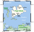
of Newfoundland and Labrador, Canada. The Town of Fogo Island encompasses Fogo, Joe Batt's Arm-Barr'd Islands-Shoal Bay, Seldom-Little Seldom and Tilting...
32 KB (2,294 words) - 20:15, 12 October 2024
The province of Newfoundland and Labrador covers the period from habitation by Archaic peoples thousands of years ago to the present day. Prior to European...
78 KB (10,124 words) - 03:59, 15 August 2024
Highway 1 Manitoba Highway 1A Newfoundland and Labrador Route 1 Prince Edward Island Route 1 Route 1A (Prince Edward Island) Saskatchewan Highway 1 Other...
20 KB (1,282 words) - 08:59, 27 August 2024
Division No. 1, Subdivision A is an unorganized subdivision on the Avalon Peninsula in Newfoundland and Labrador, Canada. It is in Division No. 1, and lies between...
12 KB (1,156 words) - 11:53, 2 September 2024
in the northeastern part of the island of Newfoundland in the Canadian province of Newfoundland and Labrador, approximately 40 km (25 mi) south of Gander...
36 KB (2,669 words) - 18:22, 25 October 2024
St. John's is the capital and largest city of the Canadian province of Newfoundland and Labrador. It is located on the eastern tip of the Avalon Peninsula...
151 KB (12,589 words) - 04:53, 1 November 2024


