[citation needed] Enterprise for more information on the descendants of Nonpareil. "2012 Population by Village". Statistics Guyana. Retrieved 16 August 2020....
6 KB (194 words) - 20:03, 14 September 2022
Look up nonpareil in Wiktionary, the free dictionary. Nonpareil(s) from the French meaning 'without equal', it may also refer to: Nonpareil, Guyana, a village...
1 KB (202 words) - 11:51, 30 September 2023
The Railways of Guyana comprised two public railways, the Demerara-Berbice Railway and the Demerara-Essequibo Railway. There are also several industrial...
12 KB (1,094 words) - 17:32, 15 March 2024

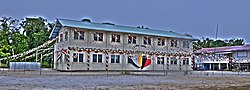
(Dutch: Nieuw Amsterdam) is the regional capital of East Berbice-Corentyne, Guyana and one of the country's largest towns. It is 100 kilometres (62 mi) from...
16 KB (1,258 words) - 01:43, 1 April 2024

Mabaruma (redirect from Mabaruma, Guyana)
administrative centre and regional capital for Region One (Barima-Waini) of Guyana. It is located close to the Aruka River (the Venezuelan border) on a narrow...
11 KB (395 words) - 02:11, 30 January 2024

Lethem is a town in Guyana, located in the Upper Takutu-Upper Essequibo region. It is the regional capital of Upper Takutu-Upper Essequibo. It is named...
15 KB (905 words) - 17:37, 29 January 2024

Demerara-Mahaica (category Regions of Guyana)
Demerara-Mahaica (Region 4) is a region of Guyana, bordering the Atlantic Ocean to the north, the region of Mahaica-Berbice to the east, the region of...
10 KB (442 words) - 01:07, 18 December 2023
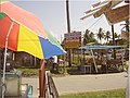
descendant of that small hut village Nonpareil, housing the many branches of its offspring and new families from all around Guyana. The culture in Enterprise still...
16 KB (1,772 words) - 19:58, 14 September 2022
Vreed en Hoop (redirect from Vreed en Hoop, Guyana)
River on its west bank, in the Essequibo Islands-West Demerara region of Guyana, located at sea level. It is the location of the Regional Democratic Council...
11 KB (568 words) - 01:55, 27 November 2023
Enmore is a village in the Demerara-Mahaica region along the coastal belt of Guyana. It is about two square miles (5.1 km2) in size and has a multi-ethnic population...
10 KB (486 words) - 16:38, 23 June 2023

Kato is an indigenous village in the Potaro-Siparuni Region of Guyana. The village is mainly inhabited by Patamona people. The village is located in the...
8 KB (291 words) - 23:19, 11 May 2024

Mahdia is a town in Guyana, located near the centre of the country at an altitude of 415 m (1,362 ft). Commerce is centred on the area's gold and diamond...
11 KB (734 words) - 15:12, 20 February 2024

(also Wandike) is an indigenous village in the Potaro-Siparuni Region of Guyana. The village is inhabited by the Patamona and Macushi tribes. Monkey Mountain...
8 KB (350 words) - 06:46, 24 June 2024
Islands-West Demerara of Guyana. It is located along the Atlantic Ocean coast. It was the first Chinese settlement in Guyana, however few Chinese remain...
9 KB (404 words) - 09:02, 23 August 2023

Jacklow (category Indian diaspora in Guyana)
Jacklow is a village in the Pomeroon-Supenaam Region of Guyana. The village is mainly inhabited by Indo-Guyanese and Amerindian people. Jacklow is situated...
9 KB (432 words) - 19:59, 14 September 2022
Lima Sands (category Guyana geography stubs)
Lima Sands is a village in the Pomeroon-Supenaam Region of Guyana. It is located to the west of Anna Regina. The Cheddi Jagan Bio Diversity Park is in...
7 KB (324 words) - 19:59, 14 September 2022

Tuschen is a village in the Essequibo Islands-West Demerara Region of Guyana. It is located along the Atlantic Ocean coast. The original name of the village...
8 KB (328 words) - 20:00, 14 September 2022
Assakata (category Indigenous villages in Guyana)
Assakata or Asakata is a village in Barima-Waini region, in the north of Guyana. Assakata is an Amerindian village inhabited by Warao and Arawak people...
7 KB (254 words) - 20:28, 12 September 2023

Tumatumari Landing (category Guyana geography stubs)
Tumatumari Landing is a small community in the Potaro-Siparuni Region of Guyana, across the Potaro River from Tumatumari, near the Konawaruk Road, and to...
6 KB (206 words) - 18:49, 4 October 2021