1913, he was placed aboard the survey vessels HNLMS van Doorn and HNLMS Lombok and was mainly tasked with mapping the coastal waters of New Guinea. Early...
14 KB (1,530 words) - 12:36, 12 December 2024
Zuilen – Centraal Station (circular, both directions) 16 Leidsche Rijn – Lombok – Centraal Station – Vredenburg 18 De Meern Oost > Langerak > Centraal Station...
39 KB (2,675 words) - 14:46, 9 October 2024
Dutch Guianas (1616–1975) Dutch Formosa (1624–1662), and Keelung (Fort Noord-Holland; 1663–1668) Dutch Virgin Islands (1625–1680) Dutch Bengal (1627–1825)...
102 KB (11,770 words) - 14:13, 28 December 2024
East Indies located in the Eastern half of Lesser Sunda Islands east of Lombok, it was separated in 1819 from the Governorate of Moluccas (Gouvernement...
7 KB (824 words) - 04:55, 1 November 2024
connecting Utrecht Centraal railway station with the residential areas of Lombok and Kanaleneiland and the suburbs Nieuwegein and IJsselstein to the southwest...
47 KB (4,593 words) - 21:44, 11 December 2024
Kadali (Buru island). Gurun island, and Lombok Merah. Together with prosperous Sasak (central, north and east Lombok) are already ruled. Bantayan with Luwu...
215 KB (24,285 words) - 09:22, 1 January 2025
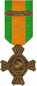
Operations NEDERLAND MEI 1940 NEDERLANDSCH-INDIË 1941-1942 JAVA-ZEE 1941-1942 NOORD-AFRIKA-ITALIË 1942-1944 In 1947, a revised royal decree was promulgated...
4 KB (327 words) - 07:03, 7 November 2024
Amsterdam and Mannheim. On 10 May 1895 the NSM launched the steel deck barge Lomboks Glorie. On 8 June 1895 the Van Outhoorn was laid down for the KPM. She...
46 KB (6,047 words) - 13:11, 7 June 2024
52.983; 5.767 (Broek) Broek-Noord De Fryske Marren 52°59′N 5°47′E / 52.983°N 5.783°E / 52.983; 5.783 (Broek-Noord) Broeksterwoude Dantumadiel 53°16′N...
74 KB (21 words) - 21:21, 27 September 2023


