
North Carolina Highway 711 (NC 711) is a primary state highway in the U.S. state of North Carolina. It connects the town of Pembroke with Interstate 95...
4 KB (358 words) - 00:12, 26 February 2022

U.S. Route 74 (redirect from U.S. Highway 74 (North Carolina))
States highway that runs for 515 miles (829 km) from Chattanooga, Tennessee to Wrightsville Beach, North Carolina. Primarily in North Carolina, it serves...
79 KB (5,546 words) - 17:56, 1 September 2024

of the state. The highway is a major east–west route through the central and eastern portion of the state. US 64 enters North Carolina in Cherokee County...
64 KB (3,966 words) - 00:44, 16 September 2024

North Carolina Highway 72 (NC 72) is a primary state highway in the U.S. state of North Carolina that serves the communities of Red Springs and Lumberton...
5 KB (338 words) - 22:28, 29 January 2022
State highways in North Carolina are owned and maintained by the U.S. state of North Carolina, through the North Carolina Department of Transportation...
198 KB (988 words) - 19:36, 24 September 2024

Bridge carrying North Carolina Highway 58. NC 58 leads north 15 miles (24 km) to U.S. Route 17 at Maysville. North Carolina Highway 24 leads east 20...
9 KB (649 words) - 14:38, 7 May 2024
Calabash is a small fishing town in Brunswick County, North Carolina, United States. As of the 2020 census, the population of the town was 2,011. It is...
12 KB (1,030 words) - 21:39, 14 September 2024

North Carolina Highway 710 (NC 710) is a primary state highway in the U.S. state of North Carolina. It connects the town of Pembroke to Interstate 74 (I-74)...
4 KB (304 words) - 00:12, 26 February 2022

U.S. Route 220 (redirect from U.S. Highway 711)
route are part of the Appalachian Development Highway System's Corridor O as well as I-73 in North Carolina. US 220 is designated as a spur route of US 20...
36 KB (3,842 words) - 21:01, 10 September 2024

Blue Star Memorial Highway for its entire length in North Carolina. It enters the state at the South Carolina state line, just north of the South of the...
32 KB (2,251 words) - 03:33, 18 September 2024
University of North Carolina at Pembroke. The university's campus is situated just north of Pembroke, located directly behind N.C. Highway 711. Interstate...
23 KB (2,105 words) - 16:57, 18 August 2024

North Carolina Highway 731 (NC 731) is a primary state highway in the U.S. state of North Carolina. The highway serves as the main thoroughfare in southern...
6 KB (395 words) - 00:12, 26 February 2022

small rural unincorporated community in southeastern Chatham County, North Carolina, United States. Moncure and the neighboring community of Haywood form...
8 KB (621 words) - 03:08, 18 July 2024

unincorporated community and census-designated place (CDP) in Henderson County, North Carolina, United States. The population was 1,187 at the 2010 census. It is part...
8 KB (608 words) - 00:44, 6 August 2023

Belmont is a small suburban city in Gaston County, North Carolina, United States, located about 9 miles (14 km) east of Gastonia. The population was 10...
30 KB (3,318 words) - 02:17, 5 April 2024

Wrightsville Beach is a town in New Hanover County, North Carolina, United States. Wrightsville Beach is just east of Wilmington and is part of the Wilmington...
20 KB (2,083 words) - 02:43, 6 May 2024

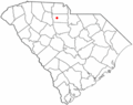
South Carolina Highway 252 (SC 252) is a 35.711-mile-long (57.471 km) state highway in the U.S. state of South Carolina. The highway connects the Anderson...
15 KB (871 words) - 05:54, 29 March 2023

Route 301 (US 301) is a north–south United States highway that runs for 194 miles (312 km) in North Carolina from the South Carolina state line near Rowland...
25 KB (1,109 words) - 06:43, 17 January 2024

Halifax County is a county located in the U.S. state of North Carolina. As of the 2020 census, the population was 48,622. Its county seat is Halifax. Halifax...
24 KB (2,045 words) - 05:01, 28 May 2024

Rock is a town in Watauga and Caldwell counties in the U.S. state of North Carolina. The population was 1,397 at the 2021 census. The Caldwell County portion...
26 KB (2,524 words) - 04:47, 22 September 2024
which bypasses Chester, passes from north to southeast through the center of Gayle Mill, crossing South Carolina Highway 9, which leads east into the center...
8 KB (583 words) - 05:41, 10 July 2023

South Carolina Highway 283 (SC 283) is a 17.840-mile-long (28.711 km) state highway in the U.S. state of South Carolina. The highway connects Plum Branch...
4 KB (270 words) - 02:24, 16 February 2024
County, New York) North Carolina Highway 66 North Dakota Highway 66 Ohio State Route 66 Oklahoma State Highway 66* Oklahoma State Highway 66B* Oregon Route...
7 KB (539 words) - 22:51, 7 August 2024

1942 by a state law that also added SR 161 north of SR 356. State Route 44 followed what is now State Route 711 (Huguenot Trail and Robious Road) from US...
37 KB (5,022 words) - 16:26, 9 February 2024
York) North Carolina Highway 400 Pennsylvania Route 400 (official designation for Pennsylvania Route 380) Puerto Rico Highway 400 South Carolina Highway 400...
3 KB (203 words) - 01:05, 5 August 2024

207-mile (228.860 km) U.S. highway that travels from Cash, Arkansas to Charleston, South Carolina. In the U.S. state of South Carolina, it travels from the...
20 KB (722 words) - 01:45, 18 September 2024

Virginia, and Charlotte and Winston-Salem in North Carolina.[citation needed] The only municipalities on the highway are Vanceburg and Maysville and suburban...
22 KB (1,247 words) - 15:47, 17 May 2024

length in North Carolina is 4 miles (6.4 km). Weingroff, Richard F. (April 7, 2011). "From Names to Numbers: The Origins of the US Numbered Highway System"...
97 KB (595 words) - 22:10, 4 August 2024

(Bus.), US 301, US 501, and North Carolina Highways 20, 41, 71, 72, 83, 130 (Bus.), 211, 295 (to become I-295), 710, 711, and 904. County government supports...
111 KB (11,407 words) - 05:52, 27 September 2024

state highways in South Carolina. These state highways are owned and maintained by the U.S. state of South Carolina, through the South Carolina Department...
340 KB (242 words) - 19:16, 18 September 2024