
State Route 132 (SR 132) is a north–south state highway in the southwestern portion of the U.S. state of Ohio. Its southern terminus is at its interchange...
5 KB (444 words) - 02:23, 18 April 2023

crossing most of northern Ohio. Its western terminus is at the Indiana state line near Hicksville where the route becomes Indiana State Road 37 which continues...
44 KB (1,826 words) - 17:35, 3 December 2023

State Routes in Ohio are owned by the state, and maintained by the state except in cities. They are signed with a white silhouette of Ohio against a black...
191 KB (38 words) - 02:16, 1 July 2024
Highway 132 Ohio State Route 132 Oklahoma State Highway 132 Pennsylvania Route 132 Tennessee State Route 132 (former) Texas State Highway 132 Texas State Highway...
4 KB (320 words) - 20:43, 26 September 2024
the Cincinnati area to the rural counties of Southern Ohio. State Routes Ohio State Route 132 and 222 also pass through Batavia's downtown area. The...
16 KB (1,399 words) - 09:31, 19 October 2024

of the U.S. state of Ohio. It is the eighth longest state route in Ohio, spanning southern Ohio from Cincinnati to Belpre, across the Ohio River from Parkersburg...
33 KB (2,258 words) - 20:14, 22 September 2024

State Route 48 (SR 48) is a north–south highway in Ohio that runs from SR 132 near Goshen to SR 66 near Houston, passing through Dayton. On February 15...
31 KB (2,263 words) - 14:03, 18 September 2024

State Route 28 (SR 28) is an east–west state highway in the U.S. state of Ohio. Both of the route's termini are on U.S. Route 50 (US 50). Its western...
10 KB (612 words) - 17:47, 27 May 2024

State Route 37 (SR 37) is a northwest-southeast highway (signed east–west) in Ohio. It is the ninth longest state route in Ohio. Its western terminus...
14 KB (155 words) - 19:38, 15 May 2024

State Route 13 is a north–south state highway in the northern and southeastern portion of the U.S. state of Ohio. It is the tenth longest state route...
14 KB (369 words) - 02:20, 19 May 2024
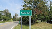
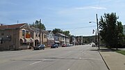
Ohio, United States. The population was 715 at the 2020 census. It is centered on State Route 28 (especially where it overlaps with State Routes 132 and...
6 KB (269 words) - 13:27, 14 June 2024

State Route 749 (SR 749) is an east–west state highway in the southwestern portion of the U.S. state of Ohio. Its western terminus is at a signalized intersection...
3 KB (195 words) - 22:20, 4 August 2024

State Route 276 (SR 276) is a 6.46-mile (10.40 km) long state highway located entirely in Clermont County, Ohio. The route runs from an intersection with...
7 KB (549 words) - 01:22, 5 August 2024

before they both leave Ohio on a pair of bridges across the Ohio River at Bridgeport. The now-decommissioned Ohio State Route 440 ran along old US 40...
77 KB (8,335 words) - 22:57, 25 September 2024

State Route 39 (SR 39) is a primarily east–west running state highway in north-central and northeastern portion of the U.S. state of Ohio. The route runs...
14 KB (519 words) - 21:34, 14 May 2024

State Route 500 (SR 500) is a 13.32-mile-long (21.44 km) Ohio State Route that runs between the Indiana state line and Paulding in the US state of Ohio...
13 KB (1,209 words) - 01:23, 5 August 2024

Louisville, Kentucky to Cleveland, Ohio. The route has several names including Pearl Road from Cleveland to Medina in Northeast Ohio, Reading Road in Cincinnati...
51 KB (2,236 words) - 16:34, 31 August 2024

State Route 60 (SR 60) is a north–south state highway that runs the entire length of the U.S. state of Ohio, from the Williamstown Bridge over the Ohio...
14 KB (262 words) - 00:41, 16 May 2024

State Route 18 (SR 18) is an east–west highway in northern Ohio. It is the sixth longest state route in the state. Its western terminus is at the Indiana...
19 KB (723 words) - 06:04, 15 May 2024

State Route 125 (SR 125) is an east–west state highway in the southwestern portion of the U.S. state of Ohio. Its western terminus is within the Cincinnati...
10 KB (515 words) - 06:15, 18 May 2024

State Route 73 (SR 73) is an east–west state highway in the southern portion of the U.S. state of Ohio. Its western terminus is on U.S. Route 27 in Oxford...
15 KB (677 words) - 17:12, 30 May 2024

State Route 235 (SR 235) is a 133.2-mile-long (214.4 km) north–south state highway in the western portion of the U.S. state of Ohio. Its southern terminus...
21 KB (1,192 words) - 14:07, 27 July 2024

State Route 29 (SR 29) is an east–west state highway in the west-central portion of the U.S. state of Ohio. Its western terminus is at the Indiana state...
12 KB (445 words) - 19:27, 15 May 2024

U.S. Route 30 (US 30) is a United States Numbered Highway that runs from Astoria, Oregon, to Atlantic City, New Jersey. In the state of Ohio, it is a...
53 KB (4,186 words) - 01:42, 5 August 2024

State Route 55 (SR 55) is an east–west state route in western Ohio. Its western terminus is near the town of Laura at SR 571, and its eastern terminus...
16 KB (1,824 words) - 03:12, 10 April 2023

it crosses the Ohio River into Ohio. The Ohio portion has been upgraded to a four-lane highway/freeway between the West Virginia state line and Trotwood...
75 KB (5,753 words) - 01:09, 8 September 2024

Newspapers.com. Ohio Department of Highways and Public Works (August 1, 1926). Map of Ohio Showing State Routes (PDF) (Map). 1:760,320. Columbus: Ohio Department...
25 KB (766 words) - 14:41, 30 October 2023

U.S. Route 224 (US 224) is a spur of US 24 that runs through the states of Indiana, Ohio and Pennsylvania. It currently runs for 289 miles (465 km) from...
37 KB (2,053 words) - 13:36, 7 August 2024

State Route 123 (SR 123) is a state highway in southwestern Ohio. The route runs from SR 251 about seven miles (11 km) southeast of Blanchester to Germantown...
8 KB (343 words) - 06:14, 18 May 2024

Route 20 (US 20) is a United States Numbered Highway that runs from Newport, Oregon, to Boston, Massachusetts. Within the state of Ohio, the route runs...
29 KB (658 words) - 23:04, 27 November 2023