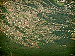
Otford is a village in the Otford Valley located 55 km south of the Sydney and 30 km north of the Wollongong CBD in New South Wales, Australia. Otford...
7 KB (905 words) - 15:14, 29 July 2024
The Otford railway tunnel is a heritage-listed former railway tunnel on the Illawarra railway line at Otford, City of Wollongong, New South Wales, Australia...
13 KB (1,414 words) - 00:37, 12 September 2023
local government areas that comprise the Wollongong Metropolitan Area, New South Wales, Australia. Although it is surrounded by a 'green belt' of farms, Albion...
8 KB (849 words) - 09:47, 20 July 2024
Bomaderry in New South Wales, Australia. Beginning at the Illawarra Junction, the line services the Illawarra and South Coast regions of New South Wales. Opening...
50 KB (5,379 words) - 15:56, 11 October 2024
YOU-nən-derr-ə) is a suburb of Wollongong in New South Wales, Australia. It is located approximately 6 km south-west of the Wollongong CBD. It is bordered...
4 KB (400 words) - 14:47, 30 July 2024
Dapto is a suburb of Wollongong in the Illawarra region of New South Wales, Australia, located on the western side of Lake Illawarra and covering 7.15...
16 KB (1,736 words) - 14:02, 21 November 2024
BULL-eye) is a northern suburb of Wollongong situated on the south coast of New South Wales, Australia. Bulli is possibly derived from an Aboriginal word...
12 KB (1,523 words) - 23:56, 26 August 2024
Warrawong is a suburb of Wollongong in the Illawarra region of New South Wales, Australia. It is situated on the northeast corner of Lake Illawarra. Warrawong...
4 KB (262 words) - 23:37, 12 October 2024
Shellharbour Village) is a suburb located in the Illawarra region of New South Wales, Australia. It also gives its name to the local government area, City...
8 KB (644 words) - 07:24, 30 July 2024
Otford railway station is located on the South Coast railway line in New South Wales, Australia. It serves the village of Otford opening on 3 October 1888...
4 KB (141 words) - 04:04, 28 September 2024
New South Wales State Heritage Register. Department of Planning & Environment. H01269. Retrieved 18 May 2018. Text is licensed by State of New South Wales...
32 KB (4,116 words) - 06:16, 21 October 2024
is separated from Otford in the Hacking River valley below by a high ridge but linked to it by the South Coast Railway and Otford Road. It is separated...
13 KB (1,389 words) - 11:23, 29 October 2024
beach-side suburb approximately 5 km (3.1 mi) north of Wollongong, New South Wales, Australia. Towradgi is derived from the Dharawal word Kow-radgi, meaning...
7 KB (764 words) - 14:43, 30 July 2024
Balgownie (/bælɡaʊni/) is a small suburb of Wollongong, New South Wales, Australia. Balgownie lies to the north-west of the Wollongong CBD. It stretches...
4 KB (275 words) - 10:26, 20 July 2024
Figtree is an inner western suburb of Wollongong, New South Wales, Australia. It is south-west of West Wollongong and connected to Wollongong by the Princes...
7 KB (771 words) - 01:10, 15 August 2024
northern suburb of Wollongong, New South Wales, Australia. It is the northernmost point of the Illawarra coastal strip and lies south of Sydney's Royal National...
14 KB (1,618 words) - 07:34, 30 July 2024
at Lilyvale railway station (1890 to 1989) on the South Coast railway between Helensburgh and Otford. Aboriginal peoples, the latest being the Wodi Wodi...
5 KB (518 words) - 11:24, 9 November 2024
Wollongong (redirect from Woollongong, New South Wales)
Dharawal: Woolyungah) is a city located in the Illawarra region of New South Wales, Australia. The name is believed to originate from the Dharawal language...
74 KB (7,759 words) - 19:38, 19 November 2024
Illawarra region of New South Wales, Australia, in the Municipality of Kiama. It has a station (opened 1891) on the NSW TrainLink South Coast Line. The Minnamurra...
4 KB (351 words) - 13:58, 29 July 2024
Sydney and Wollongong on the New South Wales, Australia coastline. It lies northwest of Stanwell Park and southwest of Otford. With a population of 517 residents...
13 KB (1,279 words) - 15:37, 6 October 2024
Wollongong, New South Wales, Australia. The suburb is bounded by Berkeley, Unanderra, Lake Heights and Warrawong. The suburb is planned on a north-south residential/commercial...
6 KB (510 words) - 18:06, 7 October 2024
Saddleback Mountain is a mountain near Kiama in the Illawarra region of New South Wales, Australia. The mountain rises to about 600 metres (2,000 ft) above...
5 KB (506 words) - 09:17, 1 April 2022
narrow area separating it from Dapto, and farmland to the north, west and south. West of Horsley is Mount Bong Bong, part of the Illawarra escarpment range...
3 KB (294 words) - 05:47, 25 May 2024
Australia and Broken Hill, an ambitious scheme for treating nickel from New Caledonia came to nothing and in 1905 the works closed. (McDonald, 1976;...
5 KB (666 words) - 12:24, 29 July 2024
2019. "Knights Hill (Hill)". Geographical Names Register (GNR) of NSW. Geographical Names Board of New South Wales. Retrieved 29 December 2013. v t e...
2 KB (170 words) - 13:53, 25 January 2024
are an important feature of the Australian coastline particularly in New South Wales. Ocean pools or ocean baths are defined as public seawater pools sited...
14 KB (618 words) - 10:31, 2 November 2024
Mount Pleasant is a hilly suburb in the city of Wollongong, New South Wales, Australia. It is situated on the northern flank of Mount Keira extending...
3 KB (221 words) - 14:03, 29 July 2024
New South Wales State Heritage Register. Department of Planning & Environment. H01072. Retrieved 18 May 2018. Text is licensed by State of New South Wales...
4 KB (271 words) - 11:00, 18 May 2024
of Mount Warrigal in the west, Barrack Heights and Barrack Point in the south and Lake Illawarra in the north. Warilla was officially granted township...
4 KB (310 words) - 19:53, 9 November 2024
Port Kembla is a suburb of Wollongong 10 km south of the CBD and part of the Illawarra region of New South Wales. The suburb comprises a seaport, industrial...
23 KB (2,408 words) - 07:09, 30 July 2024


