Red Elm is an unincorporated community in Ziebach County, in the U.S. state of South Dakota. Red Elm had its start in 1910 when the railroad was extended...
1 KB (121 words) - 06:33, 18 November 2023
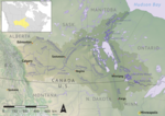
Elm River is a stream in the U.S. states of North Dakota and South Dakota. Elm River was named for the groves of elm trees situated along its course. List...
1 KB (96 words) - 01:18, 11 October 2022

Brule County is a county in the U.S. state of South Dakota. As of the 2020 census, the population was 5,247. Its county seat is Chamberlain. Brule County...
13 KB (1,061 words) - 02:35, 27 April 2024
Des Lacs River Elm River (North Dakota), tributary of Red River of the North Elm River (South Dakota), tributary of James River Forest River Goose River...
4 KB (281 words) - 17:20, 26 December 2022

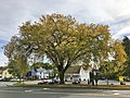
Ulmus rubra (redirect from Red elm)
slippery elm, is a species of elm native to eastern North America. Other common names include red elm, gray elm, soft elm, moose elm, and Indian elm. Ulmus...
21 KB (2,162 words) - 05:25, 27 February 2024

Union Center Viewfield White Owl Postville Dakota Eagle Elm Springs Howard Lakeside Smithville Upper Red Owl Belle Fourche-Cheyenne Valleys North Meade...
14 KB (984 words) - 04:12, 28 September 2024

Ziebach County is a county in the U.S. state of South Dakota. As of the 2020 census, the population was 2,413. Its county seat is Dupree. It is the last...
15 KB (1,293 words) - 14:39, 16 August 2024

into three geographic regions: eastern South Dakota, western South Dakota, and the Black Hills. Eastern South Dakota is lower in elevation and higher in...
66 KB (5,954 words) - 22:49, 25 August 2024
the state of South Dakota in the United States. Little Minnesota River Jorgenson River Whetstone River North Fork Yellow Bank River South Fork Yellow Bank...
5 KB (423 words) - 00:58, 28 August 2024
Minnesota and North Dakota, it flows northward through the Red River Valley, forming most of the border of Minnesota and North Dakota and continuing into...
26 KB (2,366 words) - 00:28, 4 August 2024

Dutch elm disease (DED) is caused by a member of the sac fungi (Ascomycota) affecting elm trees, and is spread by elm bark beetles. Believed to be originally...
64 KB (7,239 words) - 01:18, 29 September 2024
Ulmus americana (redirect from American elm)
Dutch elm disease. The wood was seldom utilized until the advent of mechanical sawing. It is the state tree of Massachusetts and North Dakota. The American...
84 KB (8,687 words) - 01:52, 25 June 2024

Ulmus pumila (redirect from Asiatic Elm)
the Siberian elm, is a tree native to Asia. It is also known as the Asiatic elm and dwarf elm, but sometimes miscalled the 'Chinese elm' (Ulmus parvifolia)...
34 KB (3,893 words) - 20:28, 25 March 2024

the U.S. states of Minnesota to the east, South Dakota to the south, and Montana to the west. North Dakota is part of the Great Plains region, characterized...
152 KB (13,977 words) - 04:59, 22 September 2024

U.S. Route 183 (redirect from U.S. Route 183 (South Dakota))
Holdrege I-80 south of Elm Creek US 30 in Elm Creek US 20 in Bassett. The highways travel concurrently to west-northwest of Long Pine. South Dakota US 18 in...
16 KB (1,607 words) - 14:27, 10 January 2024
(founded May 1878) is an unincorporated community in Pennington County, South Dakota, United States. It is not tracked by the U.S. Census Bureau. Rochford...
18 KB (1,129 words) - 23:21, 9 August 2024
South Dakota. Lake Surveys, Maps, and Fishing Forecasts Northeast South Dakota fish surveys Southeast South Dakota fish surveys Western South Dakota fish...
30 KB (108 words) - 04:25, 30 April 2023

the east side of North Dakota. Its east boundary line abuts the west boundary line of the state of Minnesota (across the Red River). The Goose River...
16 KB (1,033 words) - 03:04, 4 August 2024
This timeline of South Dakota is a list of events in the history of South Dakota by year. Paleo-Indians settle the Americas. List of archaeological periods...
28 KB (3,158 words) - 03:36, 22 September 2024

South Dakota Highway 10 (SD 10) is a 175.945-mile (283.156 km) state highway in the north-central and northeastern portions of South Dakota, United States...
14 KB (988 words) - 02:31, 26 July 2023

Celtis occidentalis (redirect from False elm)
through parts of New England, south to North Carolina-(Appalachia), west to northern Oklahoma, and north to North Dakota. There is a small isolated pocket...
14 KB (1,642 words) - 20:39, 9 September 2024

The North Dakota State Capitol is the house of government of the U.S. state of North Dakota. The capitol, a 21-story Art Deco tower, is located in Bismarck...
26 KB (3,073 words) - 22:29, 7 August 2024
Dakota), a tributary of the Red River of the North in the U.S. state of North Dakota Maple River (North Dakota–South Dakota), a tributary of the Elm River...
902 bytes (171 words) - 03:38, 20 July 2019
This is a list of civil townships in South Dakota and their counties, based on U.S. Geological Survey and U.S. Census data. Contents: A B C D E F G H...
94 KB (84 words) - 18:49, 30 October 2023
These tables are historical listings of state senators who served in the South Dakota Senate from statehood in 1889 until the present. 45 senators elected...
111 KB (1,206 words) - 12:17, 3 August 2024

About 2 miles south of Elmer, Oklahoma, the Salt Fork of the Red River joins from the north. These combined waters receive the North Fork Red River from...
26 KB (2,713 words) - 15:50, 17 August 2024

side of North Dakota. Its eastern boundary line abuts the west boundary line of the state of Minnesota (across the Red River). The Red River flows northward...
25 KB (1,258 words) - 20:37, 4 September 2024

The population of Dakota County was estimated to be 447,440 in 2023. The county seat is Hastings. Dakota County is named for the Dakota Sioux tribal bands...
48 KB (4,192 words) - 02:08, 30 September 2024

Wind Cave National Park (category 1903 establishments in South Dakota)
located 10 miles (16 km) north of the town of Hot Springs in western South Dakota. Established on January 3, 1903 by President Theodore Roosevelt, it was...
27 KB (2,661 words) - 03:34, 3 October 2024

Fox squirrel (category IUCN Red List least concern species)
ash seeds, and eastern red cedar (Juniperus virginiana) berries. In the spring, fox squirrels feed primarily on buds of elm, maple, and oaks but also...
25 KB (2,863 words) - 19:12, 6 August 2024